
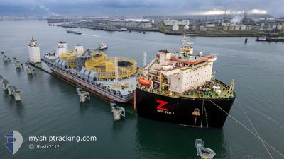
RED ZED 1
Cargo
Current Trip
| Time Travelled | --- |
|---|---|
| Remaining Time | 13 days |
| Distance Travelled | --- |
| Remaining Distance | 2821.39 nm |
| AVG Speed | --- |
| MAX Speed | --- |
| AVG Wind | --- |
| MAX Wind | --- |
| MIN Temp | --- |
| MAX Temp | --- |
| Draught | 8.8 m |
| Position Received | 7 h, 59 m ago |
Current Position
| Longitude | -7.37417° |
|---|---|
| Latitude | 47.35983° |
| Status | Under way using engine |
| Speed | 9.2 Knots |
| Course | 203.5° |
| Area | Celtic Sea |
| Station | T-AIS |
| Position Received | 7 h, 59 m ago |
Information
The current position of RED ZED 1 is in Celtic Sea with coordinates 47.35983° / -7.37417° as reported on 2025-06-05 11:21 by AIS to our vessel tracker app. The vessel's current speed is 9.2 Knots and is heading at the port of PORT SAID. The estimated time of arrival as calculated by MyShipTracking vessel tracking app is 2025-06-19 05:43 LT
The vessel RED ZED 1 (IMO: 9633977, MMSI: 636016990) is a Cargo It's sailing under the flag of [LR] Liberia.
In this page you can find informations about the vessels current position, last detected port calls, and current voyage information. If the vessels is not in coverage by AIS you will find the latest position.
The current position of RED ZED 1 is detected by our AIS receivers and we are not responsible for the reliability of the data. The last position was recorded while the vessel was in Coverage by the Ais receivers of our vessel tracking app.
The current draught of RED ZED 1 as reported by AIS is 8.8 meters
Weather
| Temperature | 15.6°C / 60.08°F |
|---|---|
| Wind Speed | 21 knots |
| Direction | 277° W |
| Pressure | 1011.8 hPa |
| Humidity | 81 % |
| Cloud Coverage | 7 % |
Featured Company
Last Port Calls
| Port | Arrival | Departure | Time In Port |
|---|---|---|---|
| 2025-05-05 09:11 | 2025-05-05 19:46 | 10 h |
Most Visited Ports (Last year)
| Port | Arrivals | |
|---|---|---|
| 3 | ||
| 1 | ||
| 1 |
Last Trips
| Origin | Departure | Destination | Arrival | Distance |
|---|
Events
| Time | Event | Details | Position / Dest | Info |
|---|---|---|---|---|
| 2025-06-05 11:24 | Status Changed | Default Under way using engine |
47.35150 / -7.37903
PORT SAID
|
Speed: 9.2 kn Course: 203.5° |
| 2025-06-05 11:21 | OUT of Coverage |
47.35983 / -7.37417
Celtic Sea
PORT SAID
|
Speed: 9.2 kn Course: 203.5° |
|
| 2025-06-05 11:11 | Status Changed | Under way using engine Default |
47.38343 / -7.36005
PORT SAID
|
Speed: 8.8 kn Course: 200° |
| 2025-06-05 10:54 | Status Changed | Default Under way using engine |
47.42201 / -7.33667
PORT SAID
|
Speed: 8.7 kn Course: 199.7° |
| 2025-06-05 10:45 | Status Changed | Under way using engine Default |
47.44290 / -7.32485
PORT SAID
|
Speed: 8.1 kn Course: 206° |
| 2025-06-05 10:45 | IN Coverage |
47.44290 / -7.32485
Celtic Sea
PORT SAID
|
Speed: 8.7 kn Course: 199.7° |
|
| 2025-06-04 20:35 | Status Changed | Default Under way using engine |
49.08101 / -5.66577
PORT SAID
|
Speed: 8.7 kn Course: 239.7° |
| 2025-06-04 20:30 | OUT of Coverage |
49.08689 / -5.64800
Celtic Sea
PORT SAID
|
Speed: 8.7 kn Course: 239.7° |
|
| 2025-06-04 20:29 | Status Changed | Under way using engine Default |
49.08799 / -5.64476
PORT SAID
|
Speed: 8.5 kn Course: 238° |
| 2025-06-04 20:12 | Status Changed | Default Under way using engine |
49.10693 / -5.59238
PORT SAID
|
Speed: 8.7 kn Course: 242.6° |