

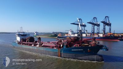
REIMERSWAAL
Trailing Suction Hopper Dredger

Current Trip
DREDGE AREA
| Time Travelled | 1 day |
|---|---|
| Remaining Time | --- |
| Distance Travelled | 161.34 nm |
| Remaining Distance | --- |
| AVG Speed | 10.1 Knots |
| MAX Speed | 14 Knots |
| AVG Wind | 11.8 knots |
| MAX Wind | 20.8 knots |
| MIN Temp | 9.8°C / 49.64°F |
| MAX Temp | 16.2°C / 61.16°F |
| Draught | 4.6 m |
| Position Received | 3 m ago |
Current Position
| Longitude | 1.44919° |
|---|---|
| Latitude | 51.17446° |
| Status | At anchor |
| Speed | 0.2 Knots |
| Course | 318° |
| Area | North Sea |
| Station | T-AIS |
| Position Received | 3 m ago |
Information
The current position of REIMERSWAAL is in North Sea with coordinates 51.17446° / 1.44919° as reported on 2025-06-08 18:40 by AIS to our vessel tracker app. The vessel's current speed is 0.2 Knots
The vessel REIMERSWAAL (IMO: 9618240, MMSI: 244116000) is a Trailing Suction Hopper Dredger that was built in 2012 ( 13 years old ). It's sailing under the flag of [NL] Netherlands.
In this page you can find informations about the vessels current position, last detected port calls, and current voyage information. If the vessels is not in coverage by AIS you will find the latest position.
The current position of REIMERSWAAL is detected by our AIS receivers and we are not responsible for the reliability of the data. The last position was recorded while the vessel was in Coverage by the Ais receivers of our vessel tracking app.
The current draught of REIMERSWAAL as reported by AIS is 4.6 meters
Weather
| Temperature | 14.8°C / 58.64°F |
|---|---|
| Wind Speed | 14 knots |
| Direction | 229° SW |
| Pressure | 1019.8 hPa |
| Humidity | 68.3 % |
| Cloud Coverage | 80 % |


Featured Company
Last Port Calls
| Port | Arrival | Departure | Time In Port |
|---|---|---|---|
| 2025-06-07 04:43 | 2025-06-07 09:32 | 4 h | |
| 2025-06-05 08:36 | 2025-06-05 17:55 | 9 h | |
| 2025-06-03 20:45 | 2025-06-04 06:00 | 9 h | |
| 2025-06-02 03:52 | 2025-06-02 07:52 | 4 h | |
| 2025-05-28 00:27 | 2025-05-28 08:39 | 8 h | |
| 2025-05-23 20:42 | 2025-05-24 00:23 | 3 h | |
| 2025-05-22 01:13 | 2025-05-22 05:12 | 3 h | |
| 2025-05-20 04:41 | 2025-05-20 13:16 | 8 h | |
| 2025-05-17 13:55 | 2025-05-17 16:53 | 2 h | |
| 2025-05-15 12:37 | 2025-05-15 19:32 | 6 h |
Most Visited Ports (Last year)
| Port | Arrivals | |
|---|---|---|
| 31 | ||
| 23 | ||
| 12 | ||
| 10 | ||
| 10 | ||
| 10 |
Last Trips
| Origin | Departure | Destination | Arrival | Distance | |
|---|---|---|---|---|---|
| 2025-06-05 17:55 | 2025-06-07 04:43 | 297.57 nm | |||
| 2025-06-04 06:00 | 2025-06-05 08:36 | 219.30 nm | |||
| 2025-06-02 07:52 | 2025-06-03 20:45 | 316.84 nm | |||
| 2025-05-28 08:39 | 2025-06-02 03:52 | 756.85 nm | |||
| 2025-05-24 00:23 | 2025-05-28 00:27 | 454.44 nm | |||
| 2025-05-22 05:12 | 2025-05-23 20:42 | 366.66 nm | |||
| 2025-05-20 13:16 | 2025-05-22 01:13 | 319.22 nm | |||
| 2025-05-17 16:53 | 2025-05-20 04:41 | 288.77 nm | |||
| 2025-05-15 19:32 | 2025-05-17 13:55 | 391.50 nm | |||
| 2025-05-14 09:43 | 2025-05-15 12:37 | 277.23 nm |
Events
| Time | Event | Details | Position / Dest | Info |
|---|---|---|---|---|
| 2025-06-08 18:28 | Status Changed | At anchor Default |
51.17409 / 1.44864
DREDGE AREA
|
Speed: Course: 327° |
| 2025-06-08 18:25 | Status Changed | Default At anchor |
51.17407 / 1.44863
DREDGE AREA
|
Speed: 0.1 kn Course: 323° |
| 2025-06-08 15:28 | Status Changed | At anchor Default |
51.17427 / 1.44888
DREDGE AREA
|
Speed: 0.1 kn Course: 320° |
| 2025-06-08 15:25 | Status Changed | Default At anchor |
51.17439 / 1.44905
DREDGE AREA
|
Speed: 0.1 kn Course: 313° |
| 2025-06-08 14:04 | Status Changed | At anchor Default |
51.17493 / 1.44960
DREDGE AREA
|
Speed: 0.1 kn Course: 297° |
| 2025-06-08 14:01 | Status Changed | Default At anchor |
51.17494 / 1.44959
DREDGE AREA
|
Speed: 0.1 kn Course: 293° |
| 2025-06-08 12:52 | Status Changed | At anchor Default |
51.17551 / 1.44981
DREDGE AREA
|
Speed: 0.1 kn Course: 251° |
| 2025-06-08 12:49 | Status Changed | Default At anchor |
51.17545 / 1.44974
DREDGE AREA
|
Speed: 0.4 kn Course: 239° |
| 2025-06-08 12:22 | Status Changed | At anchor Default |
51.17592 / 1.44960
DREDGE AREA
|
Speed: 0.2 kn Course: 226° |
| 2025-06-08 12:16 | Status Changed | Default At anchor |
51.17634 / 1.44935
DREDGE AREA
|
Speed: Course: 232° |