

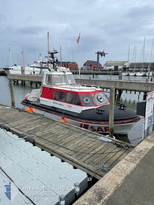
RESCUE LOKE
Search and Rescue vessel

Current Trip
JUELSMINDE
| Time Travelled | 9 days |
|---|---|
| Remaining Time | --- |
| Distance Travelled | 18.88 nm |
| Remaining Distance | --- |
| AVG Speed | 23.3 Knots |
| MAX Speed | 23.3 Knots |
| AVG Wind | 11.8 knots |
| MAX Wind | 15 knots |
| MIN Temp | 8.2°C / 46.76°F |
| MAX Temp | 12.3°C / 54.14°F |
| Draught | 0 m |
| Position Received | 4 m ago |
Current Position
| Longitude | 10.01617° |
|---|---|
| Latitude | 55.71520° |
| Status | Moored |
| Speed | |
| Course | --- |
| Area | Kattegat |
| Station | T-AIS |
| Position Received | 4 m ago |
Information
The current position of RESCUE LOKE is in Kattegat with coordinates 55.71520° / 10.01617° as reported on 2025-05-30 06:59 by AIS to our vessel tracker app. The vessel's current speed is 0 Knots
The vessel RESCUE LOKE (MMSI: 219023737) is a Search and Rescue vessel It's sailing under the flag of [DK] Denmark.
In this page you can find informations about the vessels current position, last detected port calls, and current voyage information. If the vessels is not in coverage by AIS you will find the latest position.
The current position of RESCUE LOKE is detected by our AIS receivers and we are not responsible for the reliability of the data. The last position was recorded while the vessel was in Coverage by the Ais receivers of our vessel tracking app.
Weather
| Temperature | 15.4°C / 59.72°F |
|---|---|
| Wind Speed | 13 knots |
| Direction | 253° WSW |
| Pressure | 1011.7 hPa |
| Humidity | 81.7 % |
| Cloud Coverage | 43 % |


Featured Company
Last Port Calls
| Port | Arrival | Departure | Time In Port |
|---|---|---|---|
| 2025-05-20 20:12 | 2025-05-20 20:35 | 22 m | |
| 2025-05-17 18:26 | 2025-05-17 18:43 | 16 m | |
| 2025-05-09 17:34 | 2025-05-09 18:03 | 29 m | |
| 2025-04-08 21:43 | 2025-04-08 22:13 | 30 m | |
| 2025-04-03 20:55 | 2025-04-03 20:58 | 3 m | |
| 2025-04-03 19:38 | 2025-04-03 20:02 | 23 m | |
| 2025-04-01 20:17 | 2025-04-01 20:39 | 21 m | |
| 2025-03-18 20:38 | 2025-03-18 20:46 | 8 m |
Last Trips
| Origin | Departure | Destination | Arrival | Distance | |
|---|---|---|---|---|---|
| 2025-05-17 18:43 | 2025-05-20 20:12 | 106.46 nm | |||
| 2025-05-09 18:03 | 2025-05-17 18:26 | 83.30 nm | |||
| 2025-04-08 22:13 | 2025-05-09 17:34 | 209.25 nm | |||
| 2025-04-03 20:58 | 2025-04-08 21:43 | 147.26 nm | |||
| 2025-04-03 20:02 | 2025-04-03 20:55 | 5.96 nm | |||
| 2025-04-01 20:39 | 2025-04-03 19:38 | 44.73 nm | |||
| 2025-03-18 20:46 | 2025-04-01 20:17 | 113.08 nm | |||
| 2024-12-29 18:04 | 2025-03-18 20:38 | 66.58 nm |
Events
| Time | Event | Details | Position / Dest | Info |
|---|---|---|---|---|
| 2025-05-20 19:27 | Status Changed | Moored Under way using engine |
55.71524 / 10.01612
JUELSMINDE
|
Speed: 0.1 kn Course: 511° |
| 2025-05-20 19:19 | STOP Moving | 6.56 nm, South of SNAPTUN |
55.71546 / 10.01644
JUELSMINDE
|
Speed: 0.3 kn Course: 511° |
| 2025-05-20 18:35 | PORT DEPARTURE |
|
55.70273 / 9.56875
JUELSMINDE
|
Speed: 20.9 kn Course: 106.7° |
| 2025-05-20 18:33 | Destination Changed | JUELSMINDE ANKAR VIG |
55.70394 / 9.56222
[DK] VEJLE
|
Speed: 5.9 kn Course: 111.1° |
| 2025-05-20 18:32 | START Moving |
55.70511 / 9.56065
[DK] VEJLE
|
Speed: 3.3 kn Course: 190.6° |
|
| 2025-05-20 18:25 | Status Changed | Under way using engine Pushing Ahead - Towing |
55.70661 / 9.55865
[DK] VEJLE
|
Speed: 0.4 kn Course: 511° |
| 2025-05-20 18:22 | STOP Moving |
55.70652 / 9.55855
[DK] VEJLE
|
Speed: 0.3 kn Course: 511° |
|
| 2025-05-20 18:12 | PORT ARRIVAL |
|
55.70310 / 9.56624
[DK] VEJLE
|
Speed: 2.4 kn Course: 511° |
| 2025-05-20 18:08 | Status Changed | Pushing Ahead - Towing Towing Astern |
55.70288 / 9.56859
ANKAR VIG
|
Speed: 0.6 kn Course: 511° |
| 2025-05-20 17:30 | START Moving | 3.3 nm, East of VEJLE |
55.69399 / 9.65710
ANKAR VIG
|
Speed: 6.1 kn Course: 302.2° |