
RIO2
Other Type
Current Trip
| Trip Time | 1 day |
|---|---|
| Trip Distance | 37.76 nm |
| AVG Speed | 4.5 Knots |
| MAX Speed | 5.4 Knots |
| Draught | 1.1 m |
| AVG Wind | 9.1 knots |
| MAX Wind | 13 knots |
| MIN Temp | -0.7°C / 30.74°F |
| MAX Temp | 8.3°C / 46.94°F |
| Position Received | 58 m ago |
Current Position
| Longitude | 6.72623° |
|---|---|
| Latitude | 51.45191° |
| Status | Moored |
| Speed | |
| Course | --- |
| Area | North Sea |
| Station | T-AIS |
| Position Received | 58 m ago |
Info
Information
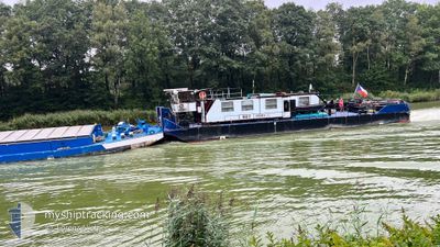
The current position of RIO2 is in North Sea with coordinates 51.45191° / 6.72623° as reported on 2025-03-16 01:17 by AIS to our vessel tracker app. The vessel's current speed is 0 Knots and is currently inside the port of DUISBURG.
The vessel RIO2 (MMSI: 270257000) is a Other Type It's sailing under the flag of [CZ] Czech Republic.
In this page you can find informations about the vessels current position, last detected port calls, and current voyage information. If the vessels is not in coverage by AIS you will find the latest position.
The current position of RIO2 is detected by our AIS receivers and we are not responsible for the reliability of the data. The last position was recorded while the vessel was in Coverage by the Ais receivers of our vessel tracking app.
The current draught of RIO2 as reported by AIS is 1.1 meters
Weather
| Temperature | 2.5°C / 36.5°F |
|---|---|
| Wind Speed | 6 knots |
| Direction | 36° NE |
| Pressure | 1020.4 hPa |
| Humidity | 83.1 % |
| Cloud Coverage | 8 % |
Featured Company
Last Port Calls
| Port | Arrival | Departure | Time In Port |
|---|---|---|---|
| 2025-03-15 21:04 | |||
| 2025-03-14 13:53 | 2025-03-14 14:36 | 42 m | |
| 2025-03-14 10:06 | 2025-03-14 12:24 | 2 h | |
| 2025-03-13 07:59 | 2025-03-13 11:43 | 3 h | |
| 2025-03-09 13:32 | 2025-03-13 07:43 | 3 d | |
| 2025-03-07 06:58 | 2025-03-08 14:34 | 1 d | |
| 2025-03-04 13:38 | 2025-03-05 16:49 | 1 d | |
| 2025-03-03 11:16 | 2025-03-03 12:03 | 47 m | |
| 2025-02-19 07:42 | |||
| 2025-02-15 10:22 | 2025-02-15 10:26 | 3 m |
Last Trips
| Origin | Departure | Destination | Arrival | Distance | |
|---|---|---|---|---|---|
| 2025-03-14 14:36 | 2025-03-15 21:04 | 37.76 nm | |||
| 2025-03-14 12:24 | 2025-03-14 13:53 | 8.67 nm | |||
| 2025-03-13 11:43 | 2025-03-14 10:06 | 63.09 nm | |||
| 2025-03-13 07:43 | 2025-03-13 07:59 | 1.93 nm | |||
| 2025-03-08 14:34 | 2025-03-09 13:32 | 60.30 nm | |||
| 2025-03-05 16:49 | 2025-03-07 06:58 | 75.90 nm | |||
| 2025-03-03 12:03 | 2025-03-04 13:38 | 76.03 nm | |||
| 2025-02-19 07:42 | 2025-03-03 11:16 | 324.82 nm | |||
| 2025-02-08 14:07 | 2025-02-15 10:22 | 234.02 nm | |||
| 2025-02-02 08:37 | 2025-02-08 13:14 | 80.62 nm |
Events
| Time | Event | Details | Position / Dest | Info |
|---|---|---|---|---|
| 2025-03-15 22:11 | IN Coverage |
51.45190 / 6.72626
North Sea
[DE] DUISBURG
|
Speed: Course: 85.7° |
|
| 2025-03-15 20:05 | OUT of Coverage |
51.45188 / 6.72626
North Sea
[DE] DUISBURG
|
Speed: Course: 85.7° |
|
| 2025-03-15 20:05 | IN Coverage |
51.45188 / 6.72626
North Sea
[DE] DUISBURG
|
Speed: Course: 85.7° |
|
| 2025-03-15 20:04 | PORT ARRIVAL |
|
51.45188 / 6.72626
[DE] DUISBURG
|
Speed: 0.6 kn Course: 511° |
| 2025-03-15 14:34 | OUT of Coverage |
51.45188 / 6.72605
North Sea
|
Speed: 0.6 kn Course: 80.9° |
|
| 2025-03-15 12:02 | IN Coverage |
51.57743 / 6.65635
North Sea
|
Speed: 4 kn Course: 82.8° |
|
| 2025-03-15 10:56 | OUT of Coverage |
51.61707 / 6.58685
North Sea
|
Speed: 4.8 kn Course: 161.2° |
|
| 2025-03-15 09:45 | IN Coverage |
51.66127 / 6.51430
North Sea
|
Speed: 4.9 kn Course: 79.6° |
|
| 2025-03-15 06:37 | OUT of Coverage |
51.82368 / 6.25774
North Sea
|
Speed: 5.4 kn Course: 114.6° |
|
| 2025-03-15 05:38 | START Moving | 1.26 nm, East of TOLKAMER |
51.84892 / 6.13768
DECIN
|
Speed: 3.4 kn Course: 132.3° |