
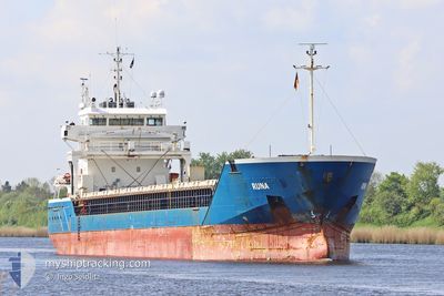
RUNA
General Cargo
Current Trip
| Time Travelled | 18 h, 26 mins |
|---|---|
| Remaining Time | 4 h, 38 mins |
| Distance Travelled | 171.90 nm |
| Remaining Distance | 55.01 nm |
| AVG Speed | 9.8 Knots |
| MAX Speed | 14.1 Knots |
| AVG Wind | 11.3 knots |
| MAX Wind | 25 knots |
| MIN Temp | 1.3°C / 34.34°F |
| MAX Temp | 7.2°C / 44.96°F |
| Draught | 4.1 m |
| Position Received | 2 h, 12 m ago |
Current Position
| Longitude | 4.28756° |
|---|---|
| Latitude | 53.09935° |
| Status | Under way using engine |
| Speed | 9.2 Knots |
| Course | 227.5° |
| Area | North Sea |
| Station | T-AIS |
| Position Received | 2 h, 12 m ago |
Info
Information
The current position of RUNA is in North Sea with coordinates 53.09935° / 4.28756° as reported on 2025-02-05 07:40 by AIS to our vessel tracker app. The vessel's current speed is 9.2 Knots and is heading at the port of AMSTERDAM. The estimated time of arrival as calculated by MyShipTracking vessel tracking app is 2025-02-05 14:31 LT
The vessel RUNA (IMO: 9361328, MMSI: 210353000) is a General Cargo that was built in 2007 ( 18 years old ). It's sailing under the flag of [CY] Cyprus.
In this page you can find informations about the vessels current position, last detected port calls, and current voyage information. If the vessels is not in coverage by AIS you will find the latest position.
The current position of RUNA is detected by our AIS receivers and we are not responsible for the reliability of the data. The last position was recorded while the vessel was in Coverage by the Ais receivers of our vessel tracking app.
The current draught of RUNA as reported by AIS is 4.1 meters
Weather
| Temperature | 6.9°C / 44.42°F |
|---|---|
| Wind Speed | 12 knots |
| Direction | 286° WNW |
| Pressure | 1034.5 hPa |
| Humidity | 87.5 % |
| Cloud Coverage | --- |
Featured Company
Last Port Calls
| Port | Arrival | Departure | Time In Port |
|---|---|---|---|
| 2025-02-03 13:58 | 2025-02-04 15:27 | 1 d | |
| 2025-02-02 23:38 | 2025-02-03 11:00 | 11 h | |
| 2025-01-29 05:17 | 2025-01-31 11:32 | 2 d | |
| 2025-01-26 14:14 | 2025-01-28 14:46 | 2 d | |
| 2025-01-19 08:04 | 2025-01-20 20:07 | 1 d | |
| 2025-01-13 19:02 | 2025-01-15 13:57 | 1 d | |
| 2025-01-11 08:33 | 2025-01-11 11:33 | 3 h | |
| 2025-01-03 11:01 | 2025-01-07 19:00 | 4 d | |
| 2024-12-26 06:59 | 2024-12-30 14:45 | 4 d | |
| 2024-12-21 11:42 | 2024-12-25 01:33 | 3 d |
Most Visited Ports (Last year)
| Port | Arrivals | |
|---|---|---|
| 4 | ||
| 4 | ||
| 3 | ||
| 2 | ||
| 2 | ||
| 2 |
Last Trips
| Origin | Departure | Destination | Arrival | Distance | |
|---|---|---|---|---|---|
| 2025-02-03 12:00 | 2025-02-03 14:58 | 23.48 nm | |||
| 2025-01-31 12:32 | 2025-02-03 00:38 | 410.43 nm | |||
| 2025-01-28 15:46 | 2025-01-29 06:17 | 118.82 nm | |||
| 2025-01-20 21:07 | 2025-01-26 15:14 | 1015.59 nm | |||
| 2025-01-15 14:57 | 2025-01-19 09:04 | 702.32 nm | |||
| 2025-01-11 12:33 | 2025-01-13 20:02 | 457.38 nm | |||
| 2025-01-07 20:00 | 2025-01-11 09:33 | 809.21 nm | |||
| 2024-12-30 14:45 | 2025-01-03 12:01 | 762.47 nm | |||
| 2024-12-25 02:33 | 2024-12-26 06:59 | 253.19 nm | |||
| 2024-12-10 14:20 | 2024-12-21 12:42 | 1298.75 nm |
Events
| Time | Event | Details | Position / Dest | Info |
|---|---|---|---|---|
| 2025-02-05 07:49 | Status Changed | Default Under way using engine |
53.08454 / 4.26002
NLAMS
|
Speed: 9.2 kn Course: 227.5° |
| 2025-02-05 07:40 | OUT of Coverage |
53.09935 / 4.28756
North Sea
NLAMS
|
Speed: 9.2 kn Course: 227.5° |
|
| 2025-02-05 07:30 | Status Changed | Under way using engine Default |
53.11664 / 4.31921
NLAMS
|
Speed: 9.4 kn Course: 228° |
| 2025-02-05 07:29 | Status Changed | Default Under way using engine |
53.11951 / 4.32451
NLAMS
|
Speed: 9.4 kn Course: 227.8° |
| 2025-02-05 06:04 | Status Changed | Under way using engine Default |
53.30187 / 4.50401
NLAMS
|
Speed: 9.4 kn Course: 199° |
| 2025-02-05 06:04 | IN Coverage |
53.30187 / 4.50401
North Sea
NLAMS
|
Speed: 9.4 kn Course: 200° |
|
| 2025-02-05 04:07 | Status Changed | Default Under way using engine |
53.51714 / 4.88405
NLAMS
|
Speed: 11 kn Course: 248.4° |
| 2025-02-05 03:53 | OUT of Coverage |
53.53258 / 4.95060
North Sea
NLAMS
|
Speed: 11 kn Course: 248.4° |
|
| 2025-02-04 23:49 | Status Changed | Under way using engine Default |
53.74042 / 5.97148
NLAMS
|
Speed: 8.3 kn Course: 252° |
| 2025-02-04 23:49 | IN Coverage |
53.74042 / 5.97148
North Sea
NLAMS
|
Speed: 8.4 kn Course: 253.1° |