

SAFI PILOT 1
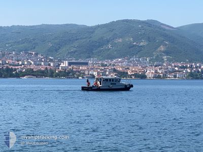
Pilot Vessel

Current Trip
| Trip Time | 10 mins |
|---|---|
| Trip Distance | 0.98 nm |
| AVG Speed | 8.8 Knots |
| MAX Speed | 8.8 Knots |
| Draught | --- |
| AVG Wind | 2.5 knots |
| MAX Wind | 2.6 knots |
| MIN Temp | 21.3°C / 70.34°F |
| MAX Temp | 21.4°C / 70.52°F |
| Position Received | 1 h, 36 m ago |
Current Position
| Longitude | 29.82786° |
|---|---|
| Latitude | 40.74642° |
| Status | Default |
| Speed | 8.8 Knots |
| Course | 75° |
| Area | Sea of Marmara |
| Station | T-AIS |
| Position Received | 1 h, 36 m ago |
Information
The current position of SAFI PILOT 1 is in Sea of Marmara with coordinates 40.74642° / 29.82786° as reported on 2025-05-21 11:41 by AIS to our vessel tracker app. The vessel's current speed is 8.8 Knots and is currently inside the port of DERINCE.
The vessel SAFI PILOT 1 (MMSI: 271044592) is a Pilot Vessel It's sailing under the flag of [TR] Turkey.
In this page you can find informations about the vessels current position, last detected port calls, and current voyage information. If the vessels is not in coverage by AIS you will find the latest position.
The current position of SAFI PILOT 1 is detected by our AIS receivers and we are not responsible for the reliability of the data. The last position was recorded while the vessel was in Coverage by the Ais receivers of our vessel tracking app.
Weather
| Temperature | 21.2°C / 70.16°F |
|---|---|
| Wind Speed | 2 knots |
| Direction | 315° NW |
| Pressure | 1017.8 hPa |
| Humidity | 46.2 % |
| Cloud Coverage | 17 % |


Featured Company
Last Port Calls
| Port | Arrival | Departure | Time In Port |
|---|---|---|---|
| 2025-05-21 14:40 | |||
| 2025-05-21 13:46 | 2025-05-21 14:30 | 44 m | |
| 2025-05-21 09:27 | 2025-05-21 13:31 | 4 h | |
| 2025-05-21 07:16 | 2025-05-21 08:52 | 1 h | |
| 2025-05-21 03:36 | 2025-05-21 07:09 | 3 h | |
| 2025-05-20 14:39 | |||
| 2025-05-20 14:13 | 2025-05-20 14:23 | 9 m | |
| 2025-05-20 10:00 | 2025-05-20 10:26 | 26 m | |
| 2025-05-20 06:56 | 2025-05-20 07:33 | 37 m | |
| 2025-05-19 19:11 | 2025-05-20 06:47 | 11 h |
Most Visited Ports (Last year)
| Port | Arrivals | |
|---|---|---|
| 489 |
Last Trips
| Origin | Departure | Destination | Arrival | Distance | |
|---|---|---|---|---|---|
| 2025-05-21 14:30 | 2025-05-21 14:40 | 0.98 nm | |||
| 2025-05-21 13:31 | 2025-05-21 13:46 | 1.85 nm | |||
| 2025-05-21 08:52 | 2025-05-21 09:27 | 2.36 nm | |||
| 2025-05-21 07:09 | 2025-05-21 07:16 | 0.75 nm | |||
| 2025-05-20 14:23 | 2025-05-21 03:36 | 3.62 nm | |||
| 2025-05-20 14:23 | 2025-05-20 14:39 | 0.72 nm | |||
| 2025-05-20 10:26 | 2025-05-20 14:13 | 6.04 nm | |||
| 2025-05-20 07:33 | 2025-05-20 10:00 | 2.21 nm | |||
| 2025-05-20 06:47 | 2025-05-20 06:56 | 0.36 nm | |||
| 2025-05-19 19:08 | 2025-05-19 19:11 | 0.59 nm |
Events
| Time | Event | Details | Position / Dest | Info |
|---|---|---|---|---|
| 2025-05-21 11:41 | OUT of Coverage |
40.74642 / 29.82786
Sea of Marmara
[TR] DERINCE
|
Speed: 8.8 kn Course: 75° |
|
| 2025-05-21 11:40 | PORT ARRIVAL |
|
40.74642 / 29.82786
[TR] DERINCE
|
Speed: 16.7 kn Course: 10° |
| 2025-05-21 11:30 | PORT DEPARTURE |
|
40.73899 / 29.80891
|
Speed: 11.5 kn Course: 68° |
| 2025-05-21 10:46 | PORT ARRIVAL |
|
40.74488 / 29.82500
[TR] DERINCE
|
Speed: 10 kn Course: 66° |
| 2025-05-21 10:31 | PORT DEPARTURE |
|
40.74108 / 29.81020
|
Speed: 5.2 kn Course: 244° |
| 2025-05-21 09:03 | IN Coverage |
40.74614 / 29.83986
Sea of Marmara
[TR] DERINCE
|
Speed: 12.1 kn Course: 98° |
|
| 2025-05-21 07:31 | OUT of Coverage |
40.74743 / 29.83141
Sea of Marmara
[TR] DERINCE
|
Speed: 0.1 kn Course: 0° |
|
| 2025-05-21 07:31 | IN Coverage |
40.74743 / 29.83141
Sea of Marmara
[TR] DERINCE
|
Speed: 0.1 kn Course: 0° |
|
| 2025-05-21 06:29 | OUT of Coverage |
40.74701 / 29.83126
Sea of Marmara
[TR] DERINCE
|
Speed: 8.2 kn Course: 64° |
|
| 2025-05-21 06:27 | PORT ARRIVAL |
|
40.74496 / 29.82550
[TR] DERINCE
|
Speed: 6.6 kn Course: 337° |