
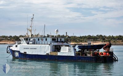
SAMSON EXPLORER
Not available
Current Trip
| Trip Time | 5 days |
|---|---|
| Trip Distance | 541.13 nm |
| AVG Speed | 5 Knots |
| MAX Speed | 10.4 Knots |
| Draught | 0 m |
| AVG Wind | 13.2 knots |
| MAX Wind | 26.7 knots |
| MIN Temp | 11.5°C / 52.7°F |
| MAX Temp | 25.1°C / 77.18°F |
| Position Received | 1 d ago |
Current Position
| Longitude | 144.08403° |
|---|---|
| Latitude | -39.27458° |
| Status | Under way using engine |
| Speed | 8.2 Knots |
| Course | 91.4° |
| Area | Bass Strait |
| Station | T-AIS |
| Position Received | 1 d ago |
Info
Information
The current position of SAMSON EXPLORER is in Bass Strait with coordinates -39.27458° / 144.08403° as reported on 2025-02-22 08:19 by AIS to our vessel tracker app. The vessel's current speed is 8.2 Knots and is currently inside the port of WELSHPOOL.
The vessel SAMSON EXPLORER (IMO: 8322325, MMSI: 503434700) is a Not available It's sailing under the flag of [AU] Australia.
In this page you can find informations about the vessels current position, last detected port calls, and current voyage information. If the vessels is not in coverage by AIS you will find the latest position.
The current position of SAMSON EXPLORER is detected by our AIS receivers and we are not responsible for the reliability of the data. The last position was recorded while the vessel was in Coverage by the Ais receivers of our vessel tracking app.
Weather
| Temperature | 18.3°C / 64.94°F |
|---|---|
| Wind Speed | 15 knots |
| Direction | 240° WSW |
| Pressure | 1022.4 hPa |
| Humidity | 65.3 % |
| Cloud Coverage | 5 % |
Featured Company
Last Port Calls
Most Visited Ports (Last year)
| Port | Arrivals | |
|---|---|---|
| 5 | ||
| 3 | ||
| 1 | ||
| 1 |
Last Trips
| Origin | Departure | Destination | Arrival | Distance | |
|---|---|---|---|---|---|
| 2025-02-18 02:08 | 2025-02-23 18:00 | 541.13 nm | |||
| 2025-02-02 12:02 | 2025-02-04 15:28 | 326.18 nm | |||
| 2025-01-20 02:08 | 2025-01-22 14:02 | 290.52 nm | |||
| 2025-01-09 06:03 | 2025-01-15 19:35 | 135.47 nm | |||
| 2024-12-02 00:19 | 2024-12-06 13:35 | 148.50 nm |
Events
| Time | Event | Details | Position / Dest | Info |
|---|---|---|---|---|
| 2025-02-23 07:04 | STOP Moving |
-38.70297 / 146.46668
[AU] WELSHPOOL
|
Speed: 0.2 kn Course: 260° |
|
| 2025-02-23 07:00 | PORT ARRIVAL |
|
-38.70312 / 146.46668
[AU] WELSHPOOL
|
Speed: 8.7 kn Course: 76° |
| 2025-02-23 06:24 | START Moving | 3.94 nm, South of WELSHPOOL |
-38.76911 / 146.45012
PORT WELSHPOOL
|
Speed: 7 kn Course: 352° |
| 2025-02-22 08:24 | Status Changed | Default Under way using engine |
-39.27496 / 144.10130
PORT WELSHPOOL
|
Speed: 8.2 kn Course: 91.4° |
| 2025-02-22 08:19 | OUT of Coverage |
-39.27458 / 144.08403
Bass Strait
PORT WELSHPOOL
|
Speed: 8.2 kn Course: 91.4° |
|
| 2025-02-22 08:01 | Status Changed | Under way using engine Default |
-39.27401 / 144.02959
PORT WELSHPOOL
|
Speed: 8.3 kn Course: 92° |
| 2025-02-22 07:56 | Status Changed | Default Under way using engine |
-39.27404 / 144.01685
PORT WELSHPOOL
|
Speed: 9 kn Course: 90.2° |
| 2025-02-22 07:39 | Change Sea Area | Australian part of the Bass Strait Australian part of the Great Australian Bight |
-39.27431 / 143.96255
Bass Strait
PORT WELSHPOOL
|
Speed: 8.7 kn Course: 89.2° |
| 2025-02-22 07:39 | Status Changed | Under way using engine Default |
-39.27431 / 143.96255
PORT WELSHPOOL
|
Speed: 8.8 kn Course: 87° |
| 2025-02-22 06:37 | OUT of Coverage |
-39.27620 / 143.75839
Great Australian Bight
PORT WELSHPOOL
|
Speed: 9.3 kn Course: 88.1° |