
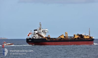
SAND FALCON
Trailing Suction Hopper Dredger
Current Trip
| Trip Time | 2 days |
|---|---|
| Trip Distance | 343.49 nm |
| AVG Speed | 9.9 Knots |
| MAX Speed | 15.3 Knots |
| Draught | 7 m |
| AVG Wind | 21.4 knots |
| MAX Wind | 28.9 knots |
| MIN Temp | 3.4°C / 38.12°F |
| MAX Temp | 7.8°C / 46.04°F |
| Position Received | 33 m ago |
Current Position
| Longitude | -1.47867° |
|---|---|
| Latitude | 54.98617° |
| Status | Moored |
| Speed | |
| Course | 72° |
| Area | North Sea |
| Station | T-AIS |
| Position Received | 33 m ago |
Info
Information
The current position of SAND FALCON is in North Sea with coordinates 54.98617° / -1.47867° as reported on 2025-02-08 09:26 by AIS to our vessel tracker app. The vessel's current speed is 0 Knots and is currently inside the port of TYNE.
The vessel SAND FALCON (IMO: 9151553, MMSI: 232215000) is a Trailing Suction Hopper Dredger that was built in 1998 ( 27 years old ). It's sailing under the flag of [GB] United Kingdom.
In this page you can find informations about the vessels current position, last detected port calls, and current voyage information. If the vessels is not in coverage by AIS you will find the latest position.
The current position of SAND FALCON is detected by our AIS receivers and we are not responsible for the reliability of the data. The last position was recorded while the vessel was in Coverage by the Ais receivers of our vessel tracking app.
The current draught of SAND FALCON as reported by AIS is 7 meters
Weather
| Temperature | 4.5°C / 40.1°F |
|---|---|
| Wind Speed | 10 knots |
| Direction | 90° E |
| Pressure | 1022.7 hPa |
| Humidity | 71.5 % |
| Cloud Coverage | 100 % |
Featured Company
Last Port Calls
| Port | Arrival | Departure | Time In Port |
|---|---|---|---|
| 2025-02-08 08:16 | |||
| 2025-02-05 00:08 | 2025-02-05 18:18 | 18 h | |
| 2025-02-03 01:20 | 2025-02-03 01:22 | 1 m | |
| 2025-02-01 13:31 | 2025-02-01 20:01 | 6 h | |
| 2025-01-31 06:59 | 2025-01-31 15:29 | 8 h | |
| 2025-01-29 11:27 | 2025-01-29 18:18 | 6 h | |
| 2025-01-27 21:20 | 2025-01-27 21:23 | 3 m | |
| 2025-01-26 05:51 | 2025-01-26 15:55 | 10 h | |
| 2025-01-24 17:00 | 2025-01-24 23:23 | 6 h | |
| 2025-01-20 02:45 | 2025-01-20 09:34 | 6 h |
Most Visited Ports (Last year)
| Port | Arrivals | |
|---|---|---|
| 47 | ||
| 16 | ||
| 10 | ||
| 9 | ||
| 8 | ||
| 8 |
Last Trips
| Origin | Departure | Destination | Arrival | Distance | |
|---|---|---|---|---|---|
| 2025-02-05 18:18 | 2025-02-08 08:16 | 343.49 nm | |||
| 2025-02-03 01:22 | 2025-02-05 00:08 | 265.12 nm | |||
| 2025-02-01 20:01 | 2025-02-03 01:20 | 250.14 nm | |||
| 2025-01-31 15:29 | 2025-02-01 13:31 | 159.34 nm | |||
| 2025-01-29 18:18 | 2025-01-31 06:59 | 240.95 nm | |||
| 2025-01-27 21:23 | 2025-01-29 11:27 | 242.00 nm | |||
| 2025-01-26 15:55 | 2025-01-27 21:20 | 156.62 nm | |||
| 2025-01-24 23:23 | 2025-01-26 05:51 | 223.19 nm | |||
| 2025-01-20 09:34 | 2025-01-24 17:00 | 729.96 nm | |||
| 2025-01-19 15:01 | 2025-01-20 02:45 | 47.42 nm |
Events
| Time | Event | Details | Position / Dest | Info |
|---|---|---|---|---|
| 2025-02-08 09:32 | Status Changed | Default Moored |
54.98617 / -1.47867
[GB] TYNE
|
Speed: Course: 72° |
| 2025-02-08 09:23 | Status Changed | Moored Under way using engine |
54.98617 / -1.47867
[GB] TYNE
|
Speed: Course: 72° |
| 2025-02-08 09:01 | STOP Moving |
54.98667 / -1.47883
[GB] TYNE
|
Speed: 0.3 kn Course: 108° |
|
| 2025-02-08 08:16 | PORT ARRIVAL |
|
55.01283 / -1.40333
[GB] TYNE
|
Speed: 8.9 kn Course: 237° |
| 2025-02-08 07:15 | Draught Changed | 7 7.2 |
54.94070 / -1.16619
DREDGEA512>GB TYN
|
Speed: 10.9 kn Course: 310° |
| 2025-02-08 07:12 | Status Changed | Under way using engine Default |
54.93600 / -1.15667
DREDGEA512>GB TYN
|
Speed: 11.6 kn Course: 311° |
| 2025-02-08 07:07 | Status Changed | Default Under way using engine |
54.92633 / -1.13683
DREDGEA512>GB TYN
|
Speed: 11.7 kn Course: 308° |
| 2025-02-08 07:07 | Status Changed | Under way using engine Default |
54.92617 / -1.13633
DREDGEA512>GB TYN
|
Speed: 11.7 kn Course: 314° |
| 2025-02-08 07:03 | Status Changed | Default Under way using engine |
54.91817 / -1.11983
DREDGEA512>GB TYN
|
Speed: 11.3 kn Course: 308° |
| 2025-02-08 06:32 | Status Changed | Under way using engine Default |
54.85483 / -1.00400
DREDGEA512>GB TYN
|
Speed: 5.3 kn Course: 57° |