
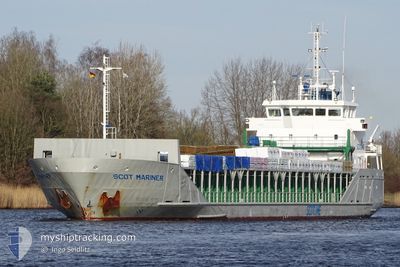
SCOT MARINER
General Cargo
Current Trip
GBRCS
| Time Travelled | 2 days |
|---|---|
| Remaining Time | --- |
| Distance Travelled | 613.04 nm |
| Remaining Distance | --- |
| AVG Speed | 9.6 Knots |
| MAX Speed | 14.1 Knots |
| AVG Wind | 11.8 knots |
| MAX Wind | 20 knots |
| MIN Temp | -0.1°C / 31.82°F |
| MAX Temp | 4.7°C / 40.46°F |
| Draught | 4.9 m |
| Position Received | 2 m ago |
Current Position
| Longitude | 0.51136° |
|---|---|
| Latitude | 51.39395° |
| Status | Moored |
| Speed | |
| Course | 154° |
| Area | North Sea |
| Station | T-AIS |
| Position Received | 2 m ago |
Info
Information
The current position of SCOT MARINER is in North Sea with coordinates 51.39395° / 0.51136° as reported on 2025-02-15 04:26 by AIS to our vessel tracker app. The vessel's current speed is 0 Knots
The vessel SCOT MARINER (IMO: 9243916, MMSI: 235002520) is a General Cargo that was built in 2001 ( 24 years old ). It's sailing under the flag of [GB] United Kingdom.
In this page you can find informations about the vessels current position, last detected port calls, and current voyage information. If the vessels is not in coverage by AIS you will find the latest position.
The current position of SCOT MARINER is detected by our AIS receivers and we are not responsible for the reliability of the data. The last position was recorded while the vessel was in Coverage by the Ais receivers of our vessel tracking app.
The current draught of SCOT MARINER as reported by AIS is 4.9 meters
Weather
| Temperature | 1.5°C / 34.7°F |
|---|---|
| Wind Speed | 7 knots |
| Direction | 144° SE |
| Pressure | 1022.2 hPa |
| Humidity | 82.5 % |
| Cloud Coverage | 100 % |
Featured Company
Last Port Calls
| Port | Arrival | Departure | Time In Port |
|---|---|---|---|
| 2025-02-11 11:54 | 2025-02-12 18:06 | 1 d | |
| 2025-02-10 03:47 | 2025-02-11 10:17 | 1 d | |
| 2025-02-06 09:07 | 2025-02-07 17:46 | 1 d | |
| 2025-01-31 00:26 | 2025-02-05 16:32 | 5 d | |
| 2025-01-28 10:28 | 2025-01-28 22:15 | 11 h | |
| 2025-01-25 19:27 | 2025-01-27 11:33 | 1 d | |
| 2025-01-22 07:52 | 2025-01-25 10:05 | 3 d | |
| 2025-01-14 20:17 | 2025-01-21 18:49 | 6 d | |
| 2025-01-12 14:37 | 2025-01-13 19:07 | 1 d | |
| 2025-01-10 19:07 | 2025-01-12 14:12 | 1 d |
Last Trips
| Origin | Departure | Destination | Arrival | Distance | |
|---|---|---|---|---|---|
| 2025-02-11 11:17 | 2025-02-11 12:54 | 19.42 nm | |||
| 2025-02-07 18:46 | 2025-02-10 04:47 | 600.14 nm | |||
| 2025-02-05 16:32 | 2025-02-06 10:07 | 151.82 nm | |||
| 2025-01-28 22:15 | 2025-01-31 00:26 | 491.13 nm | |||
| 2025-01-27 11:33 | 2025-01-28 10:28 | 242.61 nm | |||
| 2025-01-25 10:05 | 2025-01-25 19:27 | 105.45 nm | |||
| 2025-01-21 18:49 | 2025-01-22 07:52 | 132.98 nm | |||
| 2025-01-13 20:07 | 2025-01-14 20:17 | 275.85 nm | |||
| 2025-01-12 15:12 | 2025-01-12 15:37 | 2.92 nm | |||
| 2025-01-04 02:00 | 2025-01-10 20:07 | 647.81 nm |
Events
| Time | Event | Details | Position / Dest | Info |
|---|---|---|---|---|
| 2025-02-15 01:23 | Status Changed | Moored Default |
51.39391 / .51136
GBRCS
|
Speed: Course: 154° |
| 2025-02-15 01:20 | Status Changed | Default Moored |
51.39391 / .51138
GBRCS
|
Speed: Course: 154° |
| 2025-02-15 00:50 | Status Changed | Moored Under way using engine |
51.39393 / .51136
GBRCS
|
Speed: Course: 154° |
| 2025-02-15 00:38 | STOP Moving | 0.73 nm, North East of STROOD |
51.39399 / .51107
GBRCS
|
Speed: 0.3 kn Course: 151° |
| 2025-02-14 14:23 | Status Changed | Under way using engine Default |
52.24368 / 1.97058
GBRCS
|
Speed: 7.7 kn Course: 206° |
| 2025-02-14 14:17 | Status Changed | Default Under way using engine |
52.25428 / 1.97904
GBRCS
|
Speed: 7.9 kn Course: 228.1° |
| 2025-02-14 14:09 | Status Changed | Under way using engine Default |
52.26765 / 1.99877
GBRCS
|
Speed: 8.1 kn Course: 207° |
| 2025-02-14 13:54 | Status Changed | Default Under way using engine |
52.29935 / 2.02439
GBRCS
|
Speed: 8.5 kn Course: 206.8° |
| 2025-02-14 13:40 | Status Changed | Under way using engine Default |
52.32746 / 2.04816
GBRCS
|
Speed: 8.6 kn Course: 211° |
| 2025-02-14 12:34 | OUT of Coverage |
52.47937 / 2.17645
North Sea
GBRCS
|
Speed: 10.1 kn Course: 205.5° |