

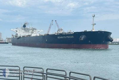
SEAWAYS PECOS
Crude Oil Tanker
Current Trip
| Time Travelled | 11 days |
|---|---|
| Remaining Time | 1 day |
| Distance Travelled | 1205.37 nm |
| Remaining Distance | 337.51 nm |
| AVG Speed | 10.3 Knots |
| MAX Speed | 13.3 Knots |
| AVG Wind | 7.5 knots |
| MAX Wind | 16.9 knots |
| MIN Temp | 27°C / 80.6°F |
| MAX Temp | 30.9°C / 87.62°F |
| Draught | 15.8 m |
| Position Received | 3 d ago |
Current Position
| Longitude | 104.09225° |
|---|---|
| Latitude | 1.25122° |
| Status | Under way using engine |
| Speed | 12.7 Knots |
| Course | 82.7° |
| Area | Singapore Strait |
| Station | T-AIS |
| Position Received | 3 d ago |
Information
The current position of SEAWAYS PECOS is in Singapore Strait with coordinates 1.25122° / 104.09225° as reported on 2025-06-07 12:28 by AIS to our vessel tracker app. The vessel's current speed is 12.7 Knots and is heading at the port of BALIKPAPAN. The estimated time of arrival as calculated by MyShipTracking vessel tracking app is 2025-06-12 05:02 LT
The vessel SEAWAYS PECOS (IMO: 9594743, MMSI: 538004032) is a Crude Oil Tanker that was built in 2012 ( 13 years old ). It's sailing under the flag of [MH] Marshall Is.
In this page you can find informations about the vessels current position, last detected port calls, and current voyage information. If the vessels is not in coverage by AIS you will find the latest position.
The current position of SEAWAYS PECOS is detected by our AIS receivers and we are not responsible for the reliability of the data. The last position was recorded while the vessel was in Coverage by the Ais receivers of our vessel tracking app.
The current draught of SEAWAYS PECOS as reported by AIS is 15.8 meters
Weather
| Temperature | 28.7°C / 83.66°F |
|---|---|
| Wind Speed | 14 knots |
| Direction | 118° ESE |
| Pressure | 1009.5 hPa |
| Humidity | 70.7 % |
| Cloud Coverage | 87 % |
Featured Company
Last Port Calls
| Port | Arrival | Departure | Time In Port |
|---|---|---|---|
| 2025-05-27 08:28 | 2025-05-30 14:15 | 3 d | |
| 2025-04-03 06:30 | 2025-04-04 15:16 | 1 d |
Most Visited Ports (Last year)
| Port | Arrivals | |
|---|---|---|
| 2 | ||
| 1 | ||
| 1 | ||
| 1 | ||
| 1 |
Last Trips
| Origin | Departure | Destination | Arrival | Distance | |
|---|---|---|---|---|---|
| 2025-04-04 15:16 | 2025-05-27 08:28 | 8917.41 nm |
Events
| Time | Event | Details | Position / Dest | Info |
|---|---|---|---|---|
| 2025-06-07 12:35 | Status Changed | Default Under way using engine |
1.25425 / 104.11549
IDBPN
|
Speed: 12.7 kn Course: 82.7° |
| 2025-06-07 12:28 | Status Changed | Under way using engine Default |
1.25122 / 104.09225
IDBPN
|
Speed: 12.8 kn Course: 83° |
| 2025-06-07 12:28 | OUT of Coverage |
1.25122 / 104.09225
Singapore Strait
IDBPN
|
Speed: 12.7 kn Course: 82.7° |
|
| 2025-06-07 12:27 | Status Changed | Default Under way using engine |
1.25064 / 104.08759
IDBPN
|
Speed: 12.8 kn Course: 82.3° |
| 2025-06-07 11:01 | Change Sea Area | Indonesian part of the Singapore Strait Singaporean part of the Singapore Strait |
1.17425 / 103.81177
Singapore Strait
IDBPN
|
Speed: 11.3 kn Course: 68.4° |
| 2025-06-07 10:52 | Change Sea Area | Singaporean part of the Singapore Strait Indonesian part of the Singapore Strait |
1.16051 / 103.78727
Singapore Strait
IDBPN
|
Speed: 11.6 kn Course: 51.9° |
| 2025-06-07 09:40 | Draught Changed | 15.8 9.2 |
1.08058 / 103.59654
IDBPN
|
Speed: 11.8 kn Course: 125.1° |
| 2025-06-07 09:40 | Destination Changed | IDBPN LINGGI MALAYSIA |
1.08058 / 103.59654
IDBPN
|
Speed: 11.8 kn Course: 125.1° |
| 2025-06-07 09:40 | ETA Changed | 2025/06/12 06:00 2025/06/03 13:30 |
1.08058 / 103.59654
IDBPN
|
Speed: 11.8 kn Course: 125.1° |
| 2025-06-07 09:29 | Status Changed | Under way using engine Default |
1.09723 / 103.56884
LINGGI MALAYSIA
|
Speed: 11.9 kn Course: 120° |