
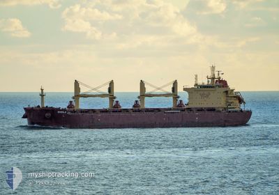
SHEILA
Cargo
Current Trip
| Time Travelled | 4 days |
|---|---|
| Remaining Time | 5 h, 10 mins |
| Distance Travelled | 325.57 nm |
| Remaining Distance | 119.43 nm |
| AVG Speed | 11.3 Knots |
| MAX Speed | 13.3 Knots |
| AVG Wind | 7.6 knots |
| MAX Wind | 15 knots |
| MIN Temp | -4.8°C / 23.36°F |
| MAX Temp | 2.4°C / 36.32°F |
| Draught | 7.3 m |
| Position Received | 4 h, 26 m ago |
Current Position
| Longitude | 16.33269° |
|---|---|
| Latitude | 54.76171° |
| Status | Under way using engine |
| Speed | 11.7 Knots |
| Course | 82.3° |
| Area | Baltic Sea |
| Station | T-AIS |
| Position Received | 4 h, 26 m ago |
Info
Information
The current position of SHEILA is in Baltic Sea with coordinates 54.76171° / 16.33269° as reported on 2025-02-19 06:47 by AIS to our vessel tracker app. The vessel's current speed is 11.7 Knots and is heading at the port of GDYNIA. The estimated time of arrival as calculated by MyShipTracking vessel tracking app is 2025-02-19 16:24 LT
The vessel SHEILA (IMO: 9730244, MMSI: 538008574) is a Cargo It's sailing under the flag of [MH] Marshall Is.
In this page you can find informations about the vessels current position, last detected port calls, and current voyage information. If the vessels is not in coverage by AIS you will find the latest position.
The current position of SHEILA is detected by our AIS receivers and we are not responsible for the reliability of the data. The last position was recorded while the vessel was in Coverage by the Ais receivers of our vessel tracking app.
The current draught of SHEILA as reported by AIS is 7.3 meters
Weather
| Temperature | 1.7°C / 35.06°F |
|---|---|
| Wind Speed | 6 knots |
| Direction | 3° N |
| Pressure | 1031.8 hPa |
| Humidity | 67.1 % |
| Cloud Coverage | 23 % |
Featured Company
Last Port Calls
| Port | Arrival | Departure | Time In Port |
|---|---|---|---|
| 2025-02-10 12:23 | 2025-02-14 18:21 | 4 d | |
| 2025-01-18 11:12 | 2025-02-04 14:09 | 17 d | |
| 2025-01-14 00:19 | 2025-01-16 17:55 | 2 d | |
| 2024-12-01 21:55 |
Events
| Time | Event | Details | Position / Dest | Info |
|---|---|---|---|---|
| 2025-02-19 07:06 | Status Changed | Default Under way using engine |
54.77015 / 16.44085
PL GDY
|
Speed: 11.7 kn Course: 82.3° |
| 2025-02-19 06:47 | OUT of Coverage |
54.76171 / 16.33269
Baltic Sea
PL GDY
|
Speed: 11.7 kn Course: 82.3° |
|
| 2025-02-19 06:43 | Status Changed | Under way using engine Default |
54.75968 / 16.30635
PL GDY
|
Speed: 11.8 kn Course: 84° |
| 2025-02-19 06:21 | Status Changed | Default Under way using engine |
54.75120 / 16.18721
PL GDY
|
Speed: 11.8 kn Course: 80.5° |
| 2025-02-19 02:25 | Change Sea Area | Polish part of the Baltic Sea Danish part of the Kattegat |
54.63636 / 14.87070
Baltic Sea
PL GDY
|
Speed: 11.5 kn Course: 81.7° |
| 2025-02-19 01:22 | Change Sea Area | Danish part of the Kattegat German part of the Baltic Sea |
54.60633 / 14.52291
Kattegat
PL GDY
|
Speed: 11.9 kn Course: 81.5° |
| 2025-02-18 18:29 | Change Sea Area | German part of the Baltic Sea Danish part of the Baltic Sea |
54.58485 / 12.32115
Baltic Sea
PL GDY
|
Speed: 12.6 kn Course: 56.7° |
| 2025-02-18 18:25 | Change Sea Area | Danish part of the Baltic Sea German part of the Baltic Sea |
54.57438 / 12.30662
Baltic Sea
PL GDY
|
Speed: 12.7 kn Course: 19.7° |
| 2025-02-18 17:25 | Change Sea Area | German part of the Baltic Sea Danish part of the Baltic Sea |
54.40966 / 12.12222
Baltic Sea
PL GDY
|
Speed: 13.2 kn Course: 89.3° |
| 2025-02-18 15:29 | Change Sea Area | Danish part of the Baltic Sea German part of the Baltic Sea |
54.50381 / 11.44012
Baltic Sea
PL GDY
|
Speed: 12.3 kn Course: 115.9° |