
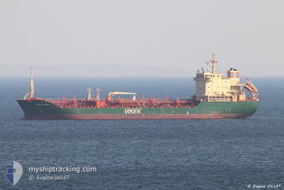
SIENNA
General Cargo
Current Trip
| Time Travelled | 4 days |
|---|---|
| Remaining Time | 1 day |
| Distance Travelled | 875.34 nm |
| Remaining Distance | 414.94 nm |
| AVG Speed | 8.9 Knots |
| MAX Speed | 10.5 Knots |
| AVG Wind | 14.1 knots |
| MAX Wind | 32.2 knots |
| MIN Temp | 6.7°C / 44.06°F |
| MAX Temp | 15.1°C / 59.18°F |
| Draught | 4.2 m |
| Position Received | 15 h, 48 m ago |
Current Position
| Longitude | 25.09192° |
|---|---|
| Latitude | 34.88567° |
| Status | Under way using engine |
| Speed | 9.5 Knots |
| Course | 85° |
| Area | Mediterranean Sea - Eastern Basin |
| Station | T-AIS |
| Position Received | 15 h, 48 m ago |
Info
Information
The current position of SIENNA is in Mediterranean Sea - Eastern Basin with coordinates 34.88567° / 25.09192° as reported on 2025-02-05 19:48 by AIS to our vessel tracker app. The vessel's current speed is 9.5 Knots and is heading at the port of DAMIETTA. The estimated time of arrival as calculated by MyShipTracking vessel tracking app is 2025-02-07 19:30 LT
The vessel SIENNA (IMO: 9353022, MMSI: 256494000) is a General Cargo that was built in 2005 ( 20 years old ). It's sailing under the flag of [MT] Malta.
In this page you can find informations about the vessels current position, last detected port calls, and current voyage information. If the vessels is not in coverage by AIS you will find the latest position.
The current position of SIENNA is detected by our AIS receivers and we are not responsible for the reliability of the data. The last position was recorded while the vessel was in Coverage by the Ais receivers of our vessel tracking app.
The current draught of SIENNA as reported by AIS is 4.2 meters
Weather
| Temperature | 7.4°C / 45.32°F |
|---|---|
| Wind Speed | 9 knots |
| Direction | 2° N |
| Pressure | 1025.6 hPa |
| Humidity | 57.3 % |
| Cloud Coverage | 23 % |
Featured Company
Last Port Calls
| Port | Arrival | Departure | Time In Port |
|---|---|---|---|
| 2025-01-28 13:09 | 2025-02-01 15:09 | 4 d | |
| 2025-01-17 06:30 | 2025-01-20 15:39 | 3 d | |
| 2025-01-10 01:31 | 2025-01-11 03:01 | 1 d | |
| 2025-01-03 21:31 | 2025-01-08 13:38 | 4 d | |
| 2024-12-19 11:24 | 2024-12-24 09:07 | 4 d | |
| 2024-12-16 09:08 | 2024-12-17 10:21 | 1 d |
Most Visited Ports (Last year)
| Port | Arrivals | |
|---|---|---|
| 2 | ||
| 2 | ||
| 2 | ||
| 2 | ||
| 2 | ||
| 1 |
Last Trips
| Origin | Departure | Destination | Arrival | Distance | |
|---|---|---|---|---|---|
| 2025-01-20 18:39 | 2025-01-28 14:09 | 1144.68 nm | |||
| 2025-01-11 06:01 | 2025-01-17 09:30 | 143.51 nm | |||
| 2025-01-08 16:38 | 2025-01-10 04:31 | 331.07 nm | |||
| 2024-12-24 09:07 | 2025-01-04 00:31 | 2104.60 nm | |||
| 2024-12-17 10:21 | 2024-12-19 11:24 | 43.79 nm | |||
| 2024-11-27 00:12 | 2024-12-16 09:08 | 2722.15 nm |
Events
| Time | Event | Details | Position / Dest | Info |
|---|---|---|---|---|
| 2025-02-06 10:32 | STOP Moving | 5.75 nm, East of ARVI |
34.98504 / 25.57103
EG DAM
|
Speed: 0.2 kn Course: 232° |
| 2025-02-05 19:57 | Status Changed | Default Under way using engine |
34.88658 / 25.12140
EG DAM
|
Speed: 9.5 kn Course: 85° |
| 2025-02-05 19:48 | OUT of Coverage |
34.88567 / 25.09192
Mediterranean Sea - Eastern Basin
EG DAM
|
Speed: 9.5 kn Course: 85° |
|
| 2025-02-05 19:41 | Status Changed | Under way using engine Default |
34.88330 / 25.06887
EG DAM
|
Speed: 8.8 kn Course: 85° |
| 2025-02-05 19:27 | IN Coverage |
34.88330 / 25.06887
Mediterranean Sea - Eastern Basin
EG DAM
|
Speed: 9.4 kn Course: 80.2° |
|
| 2025-02-05 18:12 | Status Changed | Default Under way using engine |
34.86713 / 24.78407
EG DAM
|
Speed: 8.5 kn Course: 80.6° |
| 2025-02-05 18:03 | OUT of Coverage |
34.86532 / 24.75868
Mediterranean Sea - Eastern Basin
EG DAM
|
Speed: 8.5 kn Course: 80.6° |
|
| 2025-02-05 18:02 | Status Changed | Under way using engine Default |
34.86495 / 24.75580
EG DAM
|
Speed: 7.4 kn Course: 88° |
| 2025-02-05 18:02 | IN Coverage |
34.86532 / 24.75868
Mediterranean Sea - Eastern Basin
EG DAM
|
Speed: 8.5 kn Course: 80.6° |
|
| 2025-02-05 15:47 | OUT of Coverage |
35.01567 / 24.38732
Mediterranean Sea - Eastern Basin
EG DAM
|
Speed: 9.6 kn Course: 125.2° |