
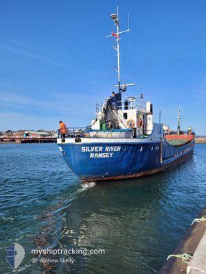
SILVER RIVER
General Cargo
Current Trip
RAMSEY
| Time Travelled | 8 days |
|---|---|
| Remaining Time | --- |
| Distance Travelled | 121.31 nm |
| Remaining Distance | --- |
| AVG Speed | 9.1 Knots |
| MAX Speed | 12.3 Knots |
| AVG Wind | 16.8 knots |
| MAX Wind | 21 knots |
| MIN Temp | 3.3°C / 37.94°F |
| MAX Temp | 5.5°C / 41.9°F |
| Draught | 2.4 m |
| Position Received | 9 d ago |
Current Position
| Longitude | -5.22649° |
|---|---|
| Latitude | 54.59082° |
| Status | Under way using engine |
| Speed | 9.7 Knots |
| Course | 115.3° |
| Area | Inner Seas off the West Coast of Scotland |
| Station | T-AIS |
| Position Received | 9 d ago |
Info
Information
The current position of SILVER RIVER is in Inner Seas off the West Coast of Scotland with coordinates 54.59082° / -5.22649° as reported on 2025-02-12 18:38 by AIS to our vessel tracker app. The vessel's current speed is 9.7 Knots
The vessel SILVER RIVER (IMO: 6825218, MMSI: 232003561) is a General Cargo that was built in 1968 ( 57 years old ). It's sailing under the flag of [GB] United Kingdom.
In this page you can find informations about the vessels current position, last detected port calls, and current voyage information. If the vessels is not in coverage by AIS you will find the latest position.
The current position of SILVER RIVER is detected by our AIS receivers and we are not responsible for the reliability of the data. The last position was recorded while the vessel was in Coverage by the Ais receivers of our vessel tracking app.
The current draught of SILVER RIVER as reported by AIS is 2.4 meters
Weather
| Temperature | 4.9°C / 40.82°F |
|---|---|
| Wind Speed | 18 knots |
| Direction | 135° SE |
| Pressure | 1021.5 hPa |
| Humidity | 79.9 % |
| Cloud Coverage | 100 % |
Featured Company
Last Port Calls
| Port | Arrival | Departure | Time In Port |
|---|---|---|---|
| 2025-02-12 22:31 | 2025-02-13 13:03 | 14 h | |
| 2025-02-12 03:51 | 2025-02-12 15:59 | 12 h | |
| 2025-02-04 22:57 | 2025-02-05 13:16 | 14 h | |
| 2025-02-04 00:51 | 2025-02-04 15:55 | 15 h | |
| 2025-02-03 01:05 | 2025-02-03 13:07 | 12 h | |
| 2025-01-29 21:27 | 2025-02-02 15:38 | 3 d | |
| 2025-01-28 15:52 | 2025-01-29 14:47 | 22 h | |
| 2025-01-26 07:03 | 2025-01-28 09:10 | 2 d | |
| 2025-01-24 06:11 | 2025-01-25 23:26 | 1 d | |
| 2025-01-23 06:03 | 2025-01-23 15:58 | 9 h |
Most Visited Ports (Last year)
| Port | Arrivals | |
|---|---|---|
| 115 | ||
| 70 | ||
| 44 |
Last Trips
| Origin | Departure | Destination | Arrival | Distance | |
|---|---|---|---|---|---|
| 2025-02-12 15:59 | 2025-02-12 22:31 | 60.01 nm | |||
| 2025-02-05 13:16 | 2025-02-12 03:51 | 49.98 nm | |||
| 2025-02-04 15:55 | 2025-02-04 22:57 | 63.92 nm | |||
| 2025-02-03 13:07 | 2025-02-04 00:51 | 66.11 nm | |||
| 2025-02-02 15:38 | 2025-02-03 01:05 | 61.73 nm | |||
| 2025-01-29 14:47 | 2025-01-29 21:27 | 62.99 nm | |||
| 2025-01-28 09:10 | 2025-01-28 15:52 | 62.97 nm | |||
| 2025-01-25 23:26 | 2025-01-26 07:03 | 57.97 nm | |||
| 2025-01-23 15:58 | 2025-01-24 06:11 | 74.52 nm | |||
| 2025-01-22 13:55 | 2025-01-23 06:03 | 62.55 nm |
Events
| Time | Event | Details | Position / Dest | Info |
|---|---|---|---|---|
| 2025-02-13 19:45 | STOP Moving | 3.75 nm, North of FLEETWOOD |
53.97829 / -2.98697
RAMSEY
|
Speed: 0.3 kn Course: 167° |
| 2025-02-13 13:03 | PORT DEPARTURE |
|
54.32353 / -4.36276
RAMSEY
|
Speed: 6.3 kn Course: 82° |
| 2025-02-12 22:31 | PORT ARRIVAL |
|
54.32386 / -4.37772
[IM] RAMSEY
|
Speed: 7.3 kn Course: 204° |
| 2025-02-12 18:43 | Status Changed | Default Under way using engine |
54.58477 / -5.20334
RAMSEY
|
Speed: 9.7 kn Course: 115.3° |
| 2025-02-12 18:38 | OUT of Coverage |
54.59082 / -5.22649
Inner Seas off the West Coast of Scotland
RAMSEY
|
Speed: 9.7 kn Course: 115.3° |
|
| 2025-02-12 16:17 | Draught Changed | 2.4 2 |
54.67639 / -5.80457
RAMSEY
|
Speed: 9.3 kn Course: 70.9° |
| 2025-02-12 16:17 | Destination Changed | RAMSEY BELFAST |
54.67639 / -5.80457
RAMSEY
|
Speed: 9.3 kn Course: 70.9° |
| 2025-02-12 16:17 | ETA Changed | 2025/02/12 22:00 2025/02/12 04:00 |
54.67639 / -5.80457
RAMSEY
|
Speed: 9.3 kn Course: 70.9° |
| 2025-02-12 15:59 | PORT DEPARTURE |
|
54.64724 / -5.86099
BELFAST
|
Speed: 9.4 kn Course: 34° |
| 2025-02-12 15:45 | Status Changed | Under way using engine Default |
54.62276 / -5.89926
[GB] BELFAST
|
Speed: 4.2 kn Course: 54° |