
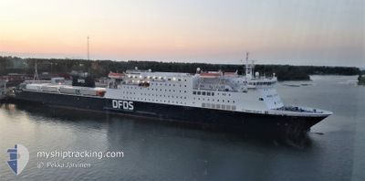
SIRENA SEAWAYS
Ro-Ro/Passenger Ship
Current Trip
| Time Travelled | 7 h, 25 mins |
|---|---|
| Remaining Time | 2 h, 28 mins |
| Distance Travelled | 113.57 nm |
| Remaining Distance | 41.78 nm |
| AVG Speed | 15.9 Knots |
| MAX Speed | 16.4 Knots |
| AVG Wind | 3 knots |
| MAX Wind | 5.8 knots |
| MIN Temp | -1.3°C / 29.66°F |
| MAX Temp | 0.8°C / 33.44°F |
| Draught | 5.4 m |
| Position Received | 1 m ago |
Current Position
| Longitude | 22.82356° |
|---|---|
| Latitude | 59.56182° |
| Status | Under way using engine |
| Speed | 15.5 Knots |
| Course | 108.1° |
| Area | Baltic Sea |
| Station | T-AIS |
| Position Received | 1 m ago |
Info
Information
The current position of SIRENA SEAWAYS is in Baltic Sea with coordinates 59.56182° / 22.82356° as reported on 2025-02-10 15:08 by AIS to our vessel tracker app. The vessel's current speed is 15.5 Knots and is heading at the port of PALDISKI. The estimated time of arrival as calculated by MyShipTracking vessel tracking app is 2025-02-10 19:37 LT
The vessel SIRENA SEAWAYS (IMO: 9212163, MMSI: 277569000) is a Ro-Ro/Passenger Ship that was built in 2003 ( 22 years old ). It's sailing under the flag of [LT] Lithuania.
In this page you can find informations about the vessels current position, last detected port calls, and current voyage information. If the vessels is not in coverage by AIS you will find the latest position.
The current position of SIRENA SEAWAYS is detected by our AIS receivers and we are not responsible for the reliability of the data. The last position was recorded while the vessel was in Coverage by the Ais receivers of our vessel tracking app.
The current draught of SIRENA SEAWAYS as reported by AIS is 5.4 meters
Weather
| Temperature | 0.8°C / 33.44°F |
|---|---|
| Wind Speed | 6 knots |
| Direction | 308° NW |
| Pressure | 1043 hPa |
| Humidity | 77.7 % |
| Cloud Coverage | 7 % |
Featured Company
Last Port Calls
| Port | Arrival | Departure | Time In Port |
|---|---|---|---|
| 2025-02-10 07:14 | 2025-02-10 08:44 | 1 h | |
| 2025-02-09 19:39 | 2025-02-09 22:17 | 2 h | |
| 2025-02-09 07:19 | 2025-02-09 09:33 | 2 h | |
| 2025-02-08 07:44 | 2025-02-08 21:33 | 13 h | |
| 2025-02-07 18:43 | 2025-02-07 21:23 | 2 h | |
| 2025-02-07 07:44 | 2025-02-07 10:08 | 2 h | |
| 2025-02-06 18:42 | 2025-02-06 20:57 | 2 h | |
| 2025-02-06 07:44 | 2025-02-06 09:44 | 2 h | |
| 2025-02-05 07:13 | 2025-02-05 21:12 | 13 h | |
| 2025-02-04 19:45 | 2025-02-04 22:38 | 2 h |
Most Visited Ports (Last year)
| Port | Arrivals | |
|---|---|---|
| 299 | ||
| 277 |
Last Trips
| Origin | Departure | Destination | Arrival | Distance | |
|---|---|---|---|---|---|
| 2025-02-09 22:17 | 2025-02-10 07:14 | 155.74 nm | |||
| 2025-02-09 09:33 | 2025-02-09 19:39 | 154.74 nm | |||
| 2025-02-08 21:33 | 2025-02-09 07:19 | 156.21 nm | |||
| 2025-02-07 21:23 | 2025-02-08 07:44 | 155.50 nm | |||
| 2025-02-07 10:08 | 2025-02-07 18:43 | 155.90 nm | |||
| 2025-02-06 20:57 | 2025-02-07 07:44 | 157.78 nm | |||
| 2025-02-06 09:44 | 2025-02-06 18:42 | 156.15 nm | |||
| 2025-02-05 21:12 | 2025-02-06 07:44 | 156.04 nm | |||
| 2025-02-04 22:38 | 2025-02-05 07:13 | 156.75 nm | |||
| 2025-02-04 09:35 | 2025-02-04 19:45 | 155.95 nm |
Events
| Time | Event | Details | Position / Dest | Info |
|---|---|---|---|---|
| 2025-02-10 14:19 | Status Changed | Under way using engine Default |
59.57829 / 22.41294
EE PLN <=> SE KPS
|
Speed: 15.6 kn Course: 88° |
| 2025-02-10 14:01 | IN Coverage |
59.57832 / 22.41462
Baltic Sea
EE PLN <=> SE KPS
|
Speed: 15.5 kn Course: 88.5° |
|
| 2025-02-10 12:47 | Status Changed | Default Under way using engine |
59.58268 / 21.62783
EE PLN <=> SE KPS
|
Speed: 15.8 kn Course: 99.4° |
| 2025-02-10 12:44 | OUT of Coverage |
59.58481 / 21.60213
Baltic Sea
EE PLN <=> SE KPS
|
Speed: 15.8 kn Course: 99.4° |
|
| 2025-02-10 12:04 | Status Changed | Under way using engine Default |
59.61396 / 21.25874
EE PLN <=> SE KPS
|
Speed: 16 kn Course: 98° |
| 2025-02-10 12:04 | IN Coverage |
59.61369 / 21.26220
Baltic Sea
EE PLN <=> SE KPS
|
Speed: 15.9 kn Course: 99° |
|
| 2025-02-10 10:05 | Status Changed | Default Under way using engine |
59.74471 / 20.28658
EE PLN <=> SE KPS
|
Speed: 16.2 kn Course: 91.8° |
| 2025-02-10 10:01 | OUT of Coverage |
59.74512 / 20.25097
Baltic Sea
EE PLN <=> SE KPS
|
Speed: 16.2 kn Course: 91.8° |
|
| 2025-02-10 09:04 | Change Sea Area | Finnish part of the Baltic Sea Swedish part of the Baltic Sea |
59.74620 / 19.74257
Baltic Sea
EE PLN <=> SE KPS
|
Speed: 16.4 kn Course: 90.3° |
| 2025-02-10 07:44 | PORT DEPARTURE |
|
59.72180 / 19.07509
EE PLN <=> SE KPS
|
Speed: 4.8 kn Course: 87° |