

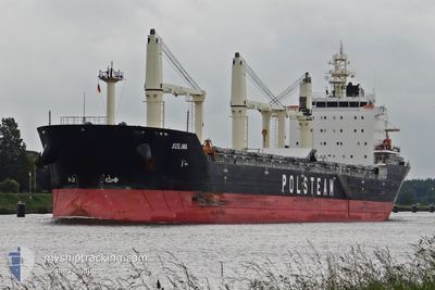
SOLINA
Bulk Carrier

Current Trip
| Time Travelled | 4 days |
|---|---|
| Remaining Time | 2 days |
| Distance Travelled | 1067.60 nm |
| Remaining Distance | 606.92 nm |
| AVG Speed | 9 Knots |
| MAX Speed | 13.6 Knots |
| AVG Wind | 11.4 knots |
| MAX Wind | 24.8 knots |
| MIN Temp | 14.3°C / 57.74°F |
| MAX Temp | 24.9°C / 76.82°F |
| Draught | 9.6 m |
| Position Received | 2 h, 44 m ago |
Current Position
| Longitude | -6.65243° |
|---|---|
| Latitude | 47.49429° |
| Status | Under way using engine |
| Speed | 8.2 Knots |
| Course | 18° |
| Area | Celtic Sea |
| Station | T-AIS |
| Position Received | 2 h, 44 m ago |
Information
The current position of SOLINA is in Celtic Sea with coordinates 47.49429° / -6.65243° as reported on 2025-06-01 11:05 by AIS to our vessel tracker app. The vessel's current speed is 8.2 Knots and is heading at the port of HULL. The estimated time of arrival as calculated by MyShipTracking vessel tracking app is 2025-06-04 09:31 LT
The vessel SOLINA (IMO: 9496252, MMSI: 311058500) is a Bulk Carrier that was built in 2012 ( 13 years old ). It's sailing under the flag of [BS] Bahamas.
In this page you can find informations about the vessels current position, last detected port calls, and current voyage information. If the vessels is not in coverage by AIS you will find the latest position.
The current position of SOLINA is detected by our AIS receivers and we are not responsible for the reliability of the data. The last position was recorded while the vessel was in Coverage by the Ais receivers of our vessel tracking app.
The current draught of SOLINA as reported by AIS is 9.6 meters
Weather
| Temperature | 14.8°C / 58.64°F |
|---|---|
| Wind Speed | 13 knots |
| Direction | 284° WNW |
| Pressure | 1020.5 hPa |
| Humidity | 77.4 % |
| Cloud Coverage | 9 % |


Featured Company
Last Port Calls
| Port | Arrival | Departure | Time In Port |
|---|---|---|---|
| 2025-05-26 11:55 | 2025-05-27 16:39 | 1 d | |
| 2025-05-16 02:22 | 2025-05-22 13:33 | 6 d | |
| 2025-04-23 18:52 | 2025-04-26 12:05 | 2 d | |
| 2025-04-04 15:48 | 2025-04-16 21:17 | 12 d | |
| 2025-04-01 17:15 | 2025-04-03 02:39 | 1 d |
Most Visited Ports (Last year)
| Port | Arrivals | |
|---|---|---|
| 5 | ||
| 4 | ||
| 4 | ||
| 3 | ||
| 2 | ||
| 2 |
Last Trips
| Origin | Departure | Destination | Arrival | Distance | |
|---|---|---|---|---|---|
| 2025-05-22 13:33 | 2025-05-26 11:55 | 432.84 nm | |||
| 2025-04-26 12:05 | 2025-05-16 02:22 | 2503.81 nm | |||
| 2025-04-16 21:17 | 2025-04-23 18:52 | 380.89 nm | |||
| 2025-04-03 02:39 | 2025-04-04 15:48 | 249.11 nm | |||
| 2025-03-22 08:26 | 2025-04-01 17:15 | 2403.11 nm |
Events
| Time | Event | Details | Position / Dest | Info |
|---|---|---|---|---|
| 2025-06-01 11:14 | Status Changed | Default Under way using engine |
47.51618 / -6.64309
GB HUL
|
Speed: 8.2 kn Course: 18° |
| 2025-06-01 11:05 | OUT of Coverage |
47.49429 / -6.65243
Celtic Sea
GB HUL
|
Speed: 8.2 kn Course: 18° |
|
| 2025-06-01 10:59 | Change Sea Area | French part of the Celtic Sea Portuguese part of the North Atlantic Ocean |
47.48215 / -6.65602
Celtic Sea
GB HUL
|
Speed: 8.5 kn Course: 12.9° |
| 2025-06-01 10:52 | Status Changed | Under way using engine Default |
47.46386 / -6.66104
GB HUL
|
Speed: 9.2 kn Course: 29° |
| 2025-06-01 10:52 | IN Coverage |
47.48215 / -6.65602
Celtic Sea
GB HUL
|
Speed: 8.5 kn Course: 12.9° |
|
| 2025-05-30 14:25 | Status Changed | Default Under way using engine |
41.33219 / -9.81503
GB HUL
|
Speed: 8.1 kn Course: 0.9° |
| 2025-05-30 14:16 | OUT of Coverage |
41.31278 / -9.81555
North Atlantic Ocean
GB HUL
|
Speed: 8.1 kn Course: 0.9° |
|
| 2025-05-30 14:15 | Status Changed | Under way using engine Default |
41.31052 / -9.81561
GB HUL
|
Speed: 8.1 kn Course: 2° |
| 2025-05-30 14:12 | IN Coverage |
41.31278 / -9.81555
North Atlantic Ocean
GB HUL
|
Speed: 8.1 kn Course: 0.9° |
|
| 2025-05-30 11:55 | OUT of Coverage |
40.99565 / -9.82295
North Atlantic Ocean
GB HUL
|
Speed: 8 kn Course: 2.2° |