

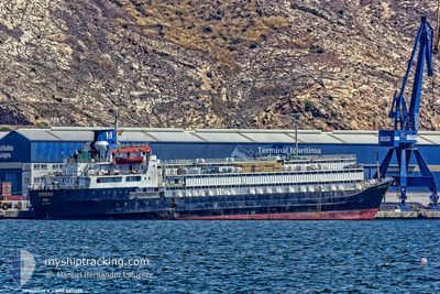
SPIRIDON II
General Cargo
Current Trip
| Time Travelled | 6 days |
|---|---|
| Remaining Time | --- |
| Distance Travelled | 1647.32 nm |
| Remaining Distance | --- |
| AVG Speed | 10.6 Knots |
| MAX Speed | 12 Knots |
| AVG Wind | 16.7 knots |
| MAX Wind | 28.3 knots |
| MIN Temp | 15.7°C / 60.26°F |
| MAX Temp | 21.1°C / 69.98°F |
| Draught | 7 m |
| Position Received | 2 d ago |
Current Position
| Longitude | -14.39962° |
|---|---|
| Latitude | 27.68008° |
| Status | Under way sailing |
| Speed | 11.4 Knots |
| Course | 231.2° |
| Area | North Atlantic Ocean |
| Station | T-AIS |
| Position Received | 2 d ago |
Information
The current position of SPIRIDON II is in North Atlantic Ocean with coordinates 27.68008° / -14.39962° as reported on 2025-04-20 03:32 by AIS to our vessel tracker app. The vessel's current speed is 11.4 Knots and is heading at the port of VILA DO CONDE. The estimated time of arrival as calculated by MyShipTracking vessel tracking app is 2025-04-30 05:00 LT
The vessel SPIRIDON II (IMO: 7311329, MMSI: 671114100) is a General Cargo that was built in 1973 ( 52 years old ). It's sailing under the flag of [TG] Togo.
In this page you can find informations about the vessels current position, last detected port calls, and current voyage information. If the vessels is not in coverage by AIS you will find the latest position.
The current position of SPIRIDON II is detected by our AIS receivers and we are not responsible for the reliability of the data. The last position was recorded while the vessel was in Coverage by the Ais receivers of our vessel tracking app.
The current draught of SPIRIDON II as reported by AIS is 7 meters
Weather
| Temperature | 20.9°C / 69.62°F |
|---|---|
| Wind Speed | 17 knots |
| Direction | 46° NE |
| Pressure | 1016.1 hPa |
| Humidity | 77.4 % |
| Cloud Coverage | 92 % |
Featured Company
Last Port Calls
| Port | Arrival | Departure | Time In Port |
|---|---|---|---|
| 2025-04-15 07:59 | 2025-04-16 12:12 | 1 d | |
| 2025-04-04 02:16 | 2025-04-05 20:32 | 1 d | |
| 2025-03-15 10:04 | 2025-03-17 09:09 | 1 d | |
| 2025-02-15 12:20 | 2025-02-15 18:30 | 6 h | |
| 2025-02-09 06:05 | 2025-02-10 19:55 | 1 d |
Most Visited Ports (Last year)
| Port | Arrivals | |
|---|---|---|
| 4 | ||
| 3 | ||
| 2 | ||
| 2 | ||
| 2 | ||
| 2 |
Last Trips
| Origin | Departure | Destination | Arrival | Distance | |
|---|---|---|---|---|---|
| 2025-04-05 20:32 | 2025-04-15 07:59 | 604.28 nm | |||
| 2025-03-17 09:09 | 2025-04-04 02:16 | 3804.29 nm | |||
| 2025-02-15 18:30 | 2025-03-15 10:04 | 3649.23 nm | |||
| 2025-02-10 19:55 | 2025-02-15 12:20 | 320.13 nm | |||
| 2025-01-16 21:28 | 2025-02-09 06:05 | 4889.02 nm |
Events
| Time | Event | Details | Position / Dest | Info |
|---|---|---|---|---|
| 2025-04-20 03:48 | Status Changed | Default Under way sailing |
27.64747 / -14.44515
BR_VDC
|
Speed: 11.4 kn Course: 231.2° |
| 2025-04-20 03:32 | Status Changed | Under way sailing Default |
27.68008 / -14.39962
BR_VDC
|
Speed: 11.4 kn Course: 232° |
| 2025-04-20 03:32 | OUT of Coverage |
27.68008 / -14.39962
North Atlantic Ocean
BR_VDC
|
Speed: 11.4 kn Course: 231.2° |
|
| 2025-04-20 03:19 | IN Coverage |
27.68008 / -14.39962
North Atlantic Ocean
BR_VDC
|
Speed: 11.4 kn Course: 231.2° |
|
| 2025-04-20 00:11 | Status Changed | Default Under way sailing |
28.06584 / -13.82784
BR_VDC
|
Speed: 11.1 kn Course: 231.3° |
| 2025-04-20 00:04 | OUT of Coverage |
28.08038 / -13.80690
North Atlantic Ocean
BR_VDC
|
Speed: 11.1 kn Course: 231.3° |
|
| 2025-04-19 23:19 | Status Changed | Under way sailing Default |
28.16458 / -13.68016
BR_VDC
|
Speed: 11.6 kn Course: 205° |
| 2025-04-19 22:25 | Status Changed | Default Under way sailing |
28.32129 / -13.59152
BR_VDC
|
Speed: 11.7 kn Course: 204.5° |
| 2025-04-19 21:27 | Detected in Sea | Spanish (Canary Islands) part of the North Atlantic Ocean |
28.48905 / -13.50634
North Atlantic Ocean
BR_VDC
|
Speed: 11.3 kn Course: 203.3° |
| 2025-04-19 21:27 | Status Changed | Under way sailing Default |
28.48905 / -13.50634
BR_VDC
|
Speed: 11.2 kn Course: 205° |