
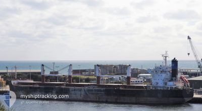
ST GREG
Bulk Carrier
Current Trip
| Trip Time | 35 days |
|---|---|
| Trip Distance | 7428.93 nm |
| AVG Speed | 11 Knots |
| MAX Speed | 15.2 Knots |
| Draught | 10.2 m |
| AVG Wind | 10.8 knots |
| MAX Wind | 21.8 knots |
| MIN Temp | 16°C / 60.8°F |
| MAX Temp | 33.4°C / 92.12°F |
| Position Received | 2025-11-13 23:59 |
Current Position
| Longitude | -17.91169° |
|---|---|
| Latitude | 12.39882° |
| Status | Under way using engine |
| Speed | 12.2 Knots |
| Course | 170° |
| Area | North Atlantic Ocean |
| Station | T-AIS |
| Position Received | 2025-11-13 23:59 |
Info
Information
The current position of ST GREG is in North Atlantic Ocean with coordinates 12.39882° / -17.91169° as reported on 2025-11-13 23:59 by AIS to our vessel tracker app. The vessel's current speed is 12.2 Knots and is currently inside the port of VILA DO CONDE.
The vessel ST GREG (IMO: 9596179, MMSI: 538007639) is a Bulk Carrier that was built in 2013 ( 12 years old ). It's sailing under the flag of [MH] Marshall Is.
In this page you can find informations about the vessels current position, last detected port calls, and current voyage information. If the vessels is not in coverage by AIS you will find the latest position.
The current position of ST GREG is detected by our AIS receivers and we are not responsible for the reliability of the data. The last position was recorded while the vessel was in Coverage by the Ais receivers of our vessel tracking app.
The current draught of ST GREG as reported by AIS is 10.2 meters
Weather
| Temperature | 28.5°C / 83.3°F |
|---|---|
| Wind Speed | 5 knots |
| Direction | 14° NNE |
| Pressure | 1010 hPa |
| Humidity | 70.1 % |
| Cloud Coverage | 100 % |
Featured Company
Last Port Calls
| Port | Arrival | Departure | Time In Port |
|---|---|---|---|
| 2025-12-13 09:06 | |||
| 2025-11-05 14:42 | 2025-11-08 00:19 | 2 d | |
| 2025-10-31 08:24 | 2025-11-01 21:04 | 1 d | |
| 2025-10-21 23:58 | 2025-10-22 19:00 | 19 h | |
| 2025-10-11 08:05 | 2025-10-12 19:09 | 1 d | |
| 2025-10-03 21:03 |
Most Visited Ports (Last year)
| Port | Arrivals | |
|---|---|---|
| 4 | ||
| 2 | ||
| 2 | ||
| 2 | ||
| 1 | ||
| 1 |
Last Trips
| Origin | Departure | Destination | Arrival | Distance | |
|---|---|---|---|---|---|
| 2025-11-08 01:19 | 2025-12-13 06:06 | 7428.93 nm | |||
| 2025-11-01 22:04 | 2025-11-05 15:42 | 660.27 nm | |||
| 2025-10-22 21:00 | 2025-10-31 09:24 | 2428.08 nm | |||
| 2025-10-12 19:09 | 2025-10-22 01:58 | 2536.83 nm | |||
| 2025-10-03 21:03 | 2025-10-11 08:05 | 262.65 nm |
Events
| Time | Event | Details | Position / Dest | Info |
|---|---|---|---|---|
| 2025-12-13 09:06 | STOP Moving |
-1.50553 / -48.73758
[BR] VILA DO CONDE
|
Speed: 0.2 kn Course: 24° |
|
| 2025-12-13 09:06 | PORT ARRIVAL |
|
-1.50553 / -48.73758
[BR] VILA DO CONDE
|
Speed: 1.6 kn Course: 32° |
| 2025-12-12 03:54 | START Moving |
-.15681 / -47.82400
NG PHC
|
Speed: 3.1 kn Course: 89° |
|
| 2025-12-11 19:32 | STOP Moving |
-.08389 / -47.81649
NG PHC
|
Speed: 0.3 kn Course: 148° |
|
| 2025-12-11 11:17 | START Moving |
-.06387 / -47.79839
NG PHC
|
Speed: 3.7 kn Course: 335° |
|
| 2025-12-11 09:35 | STOP Moving |
-.06506 / -47.80344
NG PHC
|
Speed: 0.3 kn Course: 331° |