
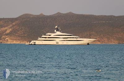
STARBURST IV
Pleasure Craft
Current Trip
| Trip Time | 23 h, 18 mins |
|---|---|
| Trip Distance | 188.46 nm |
| AVG Speed | 7.1 Knots |
| MAX Speed | 11.6 Knots |
| Draught | 4 m |
| AVG Wind | 13.7 knots |
| MAX Wind | 14 knots |
| MIN Temp | 22.1°C / 71.78°F |
| MAX Temp | 22.8°C / 73.04°F |
| Position Received | 1 m ago |
Current Position
| Longitude | -77.33497° |
|---|---|
| Latitude | 25.07921° |
| Status | Moored |
| Speed | 0.1 Knots |
| Course | 93° |
| Area | North Atlantic Ocean |
| Station | T-AIS |
| Position Received | 1 m ago |
Info
Information
The current position of STARBURST IV is in North Atlantic Ocean with coordinates 25.07921° / -77.33497° as reported on 2025-03-03 22:08 by AIS to our vessel tracker app. The vessel's current speed is 0.1 Knots and is currently inside the port of NASSAU.
The vessel STARBURST IV (IMO: 1012218, MMSI: 248149000) is a Pleasure Craft It's sailing under the flag of [MT] Malta.
In this page you can find informations about the vessels current position, last detected port calls, and current voyage information. If the vessels is not in coverage by AIS you will find the latest position.
The current position of STARBURST IV is detected by our AIS receivers and we are not responsible for the reliability of the data. The last position was recorded while the vessel was in Coverage by the Ais receivers of our vessel tracking app.
The current draught of STARBURST IV as reported by AIS is 4 meters
Weather
| Temperature | 23.2°C / 73.76°F |
|---|---|
| Wind Speed | 12 knots |
| Direction | 47° NE |
| Pressure | 1017.3 hPa |
| Humidity | 60.7 % |
| Cloud Coverage | 14 % |
Featured Company
Last Port Calls
| Port | Arrival | Departure | Time In Port |
|---|---|---|---|
| 2025-03-03 15:08 | |||
| 2025-03-02 15:33 | 2025-03-02 15:50 | 17 m | |
| 2025-01-20 18:02 | |||
| 2025-01-06 21:35 | 2025-01-14 13:35 | 7 d |
Most Visited Ports (Last year)
| Port | Arrivals | |
|---|---|---|
| 2 | ||
| 2 | ||
| 2 | ||
| 1 | ||
| 1 | ||
| 1 |
Last Trips
| Origin | Departure | Destination | Arrival | Distance | |
|---|---|---|---|---|---|
| 2025-03-02 10:50 | 2025-03-03 10:08 | 188.46 nm | |||
| 2025-01-14 09:35 | 2025-03-02 10:33 | 1.79 nm | |||
| 2025-01-14 09:35 | 2025-01-20 13:02 | 1209.70 nm | |||
| 2024-12-23 08:17 | 2025-01-06 17:35 | 324.89 nm |
Events
| Time | Event | Details | Position / Dest | Info |
|---|---|---|---|---|
| 2025-03-03 15:38 | Status Changed | Moored Under way using engine |
25.07920 / -77.33497
[BS] NASSAU
|
Speed: Course: 93° |
| 2025-03-03 15:27 | STOP Moving |
25.07926 / -77.33503
[BS] NASSAU
|
Speed: 0.2 kn Course: 102° |
|
| 2025-03-03 15:08 | PORT ARRIVAL |
|
25.08121 / -77.33334
[BS] NASSAU
|
Speed: 0.7 kn Course: 165° |
| 2025-03-03 14:44 | START Moving | 2.21 nm, North West of NASSAU |
25.10121 / -77.36579
US PAB
|
Speed: 7.9 kn Course: 151.5° |
| 2025-03-03 14:29 | STOP Moving | 2.34 nm, North West of NASSAU |
25.10512 / -77.36561
US PAB
|
Speed: 0.2 kn Course: 19° |
| 2025-03-03 13:46 | IN Coverage |
25.21594 / -77.38389
North Atlantic Ocean
|
Speed: 11.5 kn Course: 174° |
|
| 2025-03-02 23:02 | OUT of Coverage |
26.48220 / -78.58050
North Atlantic Ocean
|
Speed: 11 kn Course: 69° |
|
| 2025-03-02 22:54 | Change Sea Area | Bahamas part of the North Atlantic Ocean United States part of the North Atlantic Ocean |
26.47356 / -78.60634
North Atlantic Ocean
|
Speed: 11 kn Course: 69° |
| 2025-03-02 22:54 | IN Coverage |
26.47356 / -78.60634
North Atlantic Ocean
|
Speed: 11 kn Course: 69° |
|
| 2025-03-02 16:24 | OUT of Coverage |
26.76291 / -79.96751
North Atlantic Ocean
|
Speed: 11.6 kn Course: 106.4° |