
STARNES
Cargo
Current Trip
| Time Travelled | 4 days |
|---|---|
| Remaining Time | --- |
| Distance Travelled | 743.44 nm |
| Remaining Distance | --- |
| AVG Speed | 10.3 Knots |
| MAX Speed | 14.9 Knots |
| AVG Wind | 16.3 knots |
| MAX Wind | 28 knots |
| MIN Temp | -10.5°C / 13.1°F |
| MAX Temp | 2.1°C / 35.78°F |
| Draught | 10.6 m |
| Position Received | 2 m ago |
Current Position
| Longitude | 6.04704° |
|---|---|
| Latitude | 59.37810° |
| Status | Moored |
| Speed | |
| Course | 225° |
| Area | North Sea |
| Station | T-AIS |
| Position Received | 2 m ago |
Info
Information
The current position of STARNES is in North Sea with coordinates 59.37810° / 6.04704° as reported on 2026-01-10 15:31 by AIS to our vessel tracker app. The vessel's current speed is 0 Knots
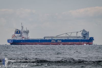
The vessel STARNES (IMO: 9858424, MMSI: 304819000) is a Cargo It's sailing under the flag of [AG] Antigua Barbuda.
In this page you can find informations about the vessels current position, last detected port calls, and current voyage information. If the vessels is not in coverage by AIS you will find the latest position.
The current position of STARNES is detected by our AIS receivers and we are not responsible for the reliability of the data. The last position was recorded while the vessel was in Coverage by the Ais receivers of our vessel tracking app.
The current draught of STARNES as reported by AIS is 10.6 meters
Weather
| Temperature | -8.9°C / 15.98°F |
|---|---|
| Wind Speed | 6 knots |
| Direction | 59° ENE |
| Pressure | 1024.7 hPa |
| Humidity | 63.9 % |
| Cloud Coverage | 100 % |
Featured Company
Last Port Calls
| Port | Arrival | Departure | Time In Port |
|---|---|---|---|
| 2026-01-05 10:27 | 2026-01-06 07:15 | 20 h | |
| 2025-12-30 16:46 | 2026-01-01 21:19 | 2 d | |
| 2025-12-27 18:08 | 2025-12-28 03:08 | 8 h | |
| 2025-12-26 23:16 | 2025-12-27 08:34 | 9 h | |
| 2025-12-18 10:46 | 2025-12-19 07:19 | 20 h | |
| 2025-12-18 07:28 | 2025-12-18 10:28 | 2 h | |
| 2025-12-17 11:47 | 2025-12-18 05:20 | 17 h | |
| 2025-12-14 13:46 | 2025-12-15 04:39 | 14 h | |
| 2025-12-10 07:26 | 2025-12-11 08:25 | 1 d | |
| 2025-12-09 06:30 | 2025-12-09 11:55 | 5 h |
Last Trips
| Origin | Departure | Destination | Arrival | Distance | |
|---|---|---|---|---|---|
| 2026-01-01 21:19 | 2026-01-05 10:27 | 876.66 nm | |||
| 2025-12-28 03:08 | 2025-12-30 16:46 | 594.92 nm | |||
| 2025-12-27 08:34 | 2025-12-27 18:08 | 95.70 nm | |||
| 2025-12-19 07:19 | 2025-12-26 23:16 | 1455.14 nm | |||
| 2025-12-18 10:28 | 2025-12-18 10:46 | 0.20 nm | |||
| 2025-12-18 05:20 | 2025-12-18 07:28 | 19.69 nm | |||
| 2025-12-15 04:39 | 2025-12-17 11:47 | 677.89 nm | |||
| 2025-12-11 08:25 | 2025-12-14 13:46 | 836.56 nm | |||
| 2025-12-09 11:55 | 2025-12-10 07:26 | 255.36 nm | |||
| 2025-12-07 09:53 | 2025-12-09 06:30 | 433.63 nm |
Events
| Time | Event | Details | Position / Dest | Info |
|---|---|---|---|---|
| 2026-01-09 22:09 | Status Changed | Moored Default |
59.37788 / 6.04667
DKAAB
|
Speed: Course: 225° |
| 2026-01-09 22:04 | Status Changed | Default Moored |
59.37786 / 6.04667
DKAAB
|
Speed: Course: 225° |
| 2026-01-09 18:18 | Status Changed | Moored Default |
59.37787 / 6.04667
DKAAB
|
Speed: Course: 225° |
| 2026-01-09 18:16 | Status Changed | Default Moored |
59.37786 / 6.04665
DKAAB
|
Speed: Course: 225° |
| 2026-01-09 15:59 | ETA Changed | 2026/01/12 18:00 2026/01/09 12:00 |
59.37770 / 6.04635
DKAAB
|
Speed: Course: 227° |
| 2026-01-09 15:58 | Draught Changed | 10.6 6.5 |
59.37770 / 6.04635
DKAAB
|
Speed: Course: 227° |
| 2026-01-09 15:58 | Destination Changed | DKAAB NOJEL |
59.37770 / 6.04635
DKAAB
|
Speed: Course: 227° |
| 2026-01-09 15:40 | Status Changed | Moored Under way using engine |
59.37770 / 6.04634
NOJEL
|
Speed: Course: 226° |
| 2026-01-09 15:27 | STOP Moving | 2.71 nm, North of JELSA |
59.37763 / 6.04603
NOJEL
|
Speed: 0.3 kn Course: 227° |
| 2026-01-09 10:23 | START Moving | 8.3 nm, South West of TANANGER |
58.82522 / 5.40337
NOJEL
|
Speed: 3.1 kn Course: 262° |