
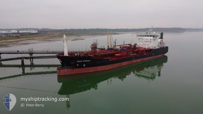
STOLT FULMAR
Oil/Chemical Tanker
Current Trip
| Time Travelled | 5 h, 49 mins |
|---|---|
| Remaining Time | --- |
| Distance Travelled | 20.67 nm |
| Remaining Distance | --- |
| AVG Speed | 10.9 Knots |
| MAX Speed | 12.6 Knots |
| AVG Wind | 6.5 knots |
| MAX Wind | 7 knots |
| MIN Temp | 3.5°C / 38.3°F |
| MAX Temp | 4.9°C / 40.82°F |
| Draught | 5 m |
| Position Received | 3 m ago |
Current Position
| Longitude | 9.50159° |
|---|---|
| Latitude | 53.67233° |
| Status | At anchor |
| Speed | |
| Course | 17° |
| Area | North Sea |
| Station | T-AIS |
| Position Received | 3 m ago |
Info
Information
The current position of STOLT FULMAR is in North Sea with coordinates 53.67233° / 9.50159° as reported on 2025-12-21 02:07 by AIS to our vessel tracker app. The vessel's current speed is 0 Knots
The vessel STOLT FULMAR (IMO: 9148972, MMSI: 255806426) is a Oil/Chemical Tanker that was built in 2000 ( 25 years old ). It's sailing under the flag of [PT] Portugal.
In this page you can find informations about the vessels current position, last detected port calls, and current voyage information. If the vessels is not in coverage by AIS you will find the latest position.
The current position of STOLT FULMAR is detected by our AIS receivers and we are not responsible for the reliability of the data. The last position was recorded while the vessel was in Coverage by the Ais receivers of our vessel tracking app.
The current draught of STOLT FULMAR as reported by AIS is 5 meters
Weather
| Temperature | 5.7°C / 42.26°F |
|---|---|
| Wind Speed | 9 knots |
| Direction | 100° E |
| Pressure | 1016.7 hPa |
| Humidity | 82.5 % |
| Cloud Coverage | 100 % |
Featured Company
Last Port Calls
| Port | Arrival | Departure | Time In Port |
|---|---|---|---|
| 2025-12-20 18:56 | 2025-12-20 21:22 | 2 h | |
| 2025-12-06 13:35 | 2025-12-18 17:49 | 12 d | |
| 2025-11-26 09:59 | 2025-11-28 13:10 | 2 d | |
| 2025-11-23 10:02 | 2025-11-24 11:28 | 1 d | |
| 2025-11-21 11:44 | 2025-11-22 03:54 | 16 h | |
| 2025-11-10 13:35 | 2025-11-11 04:35 | 14 h | |
| 2025-11-05 20:04 | 2025-11-07 12:36 | 1 d | |
| 2025-11-03 13:22 | 2025-11-05 02:25 | 1 d | |
| 2025-10-29 04:24 | 2025-10-29 18:09 | 13 h | |
| 2025-10-26 05:43 | 2025-10-26 06:43 | 59 m |
Last Trips
| Origin | Departure | Destination | Arrival | Distance | |
|---|---|---|---|---|---|
| 2025-12-18 17:49 | 2025-12-20 18:56 | 372.32 nm | |||
| 2025-11-28 13:10 | 2025-12-06 13:35 | 774.14 nm | |||
| 2025-11-24 11:28 | 2025-11-26 09:59 | 261.27 nm | |||
| 2025-11-22 03:54 | 2025-11-23 10:02 | 271.39 nm | |||
| 2025-11-11 04:35 | 2025-11-21 11:44 | 396.69 nm | |||
| 2025-11-07 12:36 | 2025-11-10 13:35 | 391.36 nm | |||
| 2025-11-05 02:25 | 2025-11-05 20:04 | 132.23 nm | |||
| 2025-10-29 18:09 | 2025-11-03 13:22 | 374.97 nm | |||
| 2025-10-26 06:43 | 2025-10-29 04:24 | 455.82 nm | |||
| 2025-10-25 19:18 | 2025-10-26 05:43 | 2.94 nm |
Events
| Time | Event | Details | Position / Dest | Info |
|---|---|---|---|---|
| 2025-12-20 22:28 | Status Changed | At anchor Under way using engine |
53.67213 / 9.50146
DESTA
|
Speed: 0.3 kn Course: 354° |
| 2025-12-20 22:27 | STOP Moving | 1.15 nm, North of BUETZFLETH |
53.67210 / 9.50156
DESTA
|
Speed: 0.3 kn Course: 348° |
| 2025-12-20 20:22 | Change Sea Area | German part of the North Sea German part of the Baltic Sea |
53.89264 / 9.14203
North Sea
DESTA
|
Speed: 3.6 kn Course: 228.8° |
| 2025-12-20 20:22 | START Moving | 0.89 nm, South West of BRUNSBUETTEL |
53.89264 / 9.14203
DESTA
|
Speed: 3.6 kn Course: 226° |
| 2025-12-20 20:22 | PORT DEPARTURE |
|
53.89264 / 9.14203
DESTA
|
Speed: 2.7 kn Course: 227° |
| 2025-12-20 18:24 | STOP Moving |
53.90362 / 9.16188
[DE] BRUNSBUETTEL
|
Speed: 0.2 kn Course: 228° |
|
| 2025-12-20 17:56 | PORT ARRIVAL |
|
53.91013 / 9.17489
[DE] BRUNSBUETTEL
|
Speed: 0.5 kn Course: 226° |
| 2025-12-20 17:43 | Status Changed | Under way using engine Default |
53.91715 / 9.18802
DESTA
|
Speed: 6 kn Course: 226° |
| 2025-12-20 17:42 | Status Changed | Default Under way using engine |
53.91877 / 9.19096
DESTA
|
Speed: 6.1 kn Course: 218.3° |
| 2025-12-20 17:28 | Status Changed | Under way using engine Default |
53.93740 / 9.21714
DESTA
|
Speed: 6.5 kn Course: 217° |