
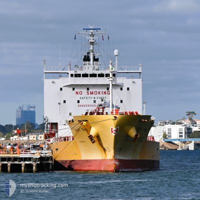
STOLT HAGI
Tanker
Current Trip
TH MAP TA PHUT
| Time Travelled | 1 day |
|---|---|
| Remaining Time | --- |
| Distance Travelled | 251.55 nm |
| Remaining Distance | --- |
| AVG Speed | 13.9 Knots |
| MAX Speed | 15.4 Knots |
| AVG Wind | 7.5 knots |
| MAX Wind | 15 knots |
| MIN Temp | 26.9°C / 80.42°F |
| MAX Temp | 28°C / 82.4°F |
| Draught | 5.6 m |
| Position Received | 3 d ago |
Current Position
| Longitude | 103.67781° |
|---|---|
| Latitude | 4.52348° |
| Status | Under way using engine |
| Speed | 12.8 Knots |
| Course | 27.5° |
| Area | South China Sea |
| Station | T-AIS |
| Position Received | 3 d ago |
Info
Information
The current position of STOLT HAGI is in South China Sea with coordinates 4.52348° / 103.67781° as reported on 2025-02-25 01:24 by AIS to our vessel tracker app. The vessel's current speed is 12.8 Knots
The vessel STOLT HAGI (IMO: 9750206, MMSI: 563206200) is a Tanker It's sailing under the flag of [SG] Singapore.
In this page you can find informations about the vessels current position, last detected port calls, and current voyage information. If the vessels is not in coverage by AIS you will find the latest position.
The current position of STOLT HAGI is detected by our AIS receivers and we are not responsible for the reliability of the data. The last position was recorded while the vessel was in Coverage by the Ais receivers of our vessel tracking app.
The current draught of STOLT HAGI as reported by AIS is 5.6 meters
Weather
| Temperature | 26.9°C / 80.42°F |
|---|---|
| Wind Speed | 15 knots |
| Direction | 123° ESE |
| Pressure | 1012 hPa |
| Humidity | 77.8 % |
| Cloud Coverage | 8 % |
Featured Company
Last Port Calls
| Port | Arrival | Departure | Time In Port |
|---|---|---|---|
| 2025-02-27 05:25 | 2025-02-27 18:21 | 12 h | |
| 2025-02-22 20:10 | 2025-02-24 23:30 | 2 d | |
| 2025-01-30 09:29 | 2025-01-31 18:18 | 1 d | |
| 2025-01-23 02:01 | 2025-01-25 03:03 | 2 d | |
| 2025-01-15 10:52 | 2025-01-17 13:50 | 2 d | |
| 2025-01-05 18:07 | 2025-01-07 18:52 | 2 d | |
| 2025-01-04 02:19 | 2025-01-05 06:23 | 1 d | |
| 2024-12-15 12:27 | 2024-12-16 10:06 | 21 h | |
| 2024-12-09 14:00 | 2024-12-10 09:59 | 19 h | |
| 2024-12-08 16:55 | 2024-12-09 11:32 | 18 h |
Last Trips
| Origin | Departure | Destination | Arrival | Distance | |
|---|---|---|---|---|---|
| 2025-02-25 07:30 | 2025-02-27 12:25 | 549.09 nm | |||
| 2025-02-01 05:18 | 2025-02-23 04:10 | 6225.60 nm | |||
| 2025-01-25 14:03 | 2025-01-30 20:29 | 801.95 nm | |||
| 2025-01-17 21:50 | 2025-01-23 13:01 | 1723.47 nm | |||
| 2025-01-08 02:52 | 2025-01-15 18:52 | 2344.55 nm | |||
| 2025-01-05 14:23 | 2025-01-06 02:07 | 11.62 nm | |||
| 2024-12-16 21:06 | 2025-01-04 10:19 | 4004.82 nm | |||
| 2024-12-10 20:59 | 2024-12-15 23:27 | 996.92 nm | |||
| 2024-12-09 22:32 | 2024-12-10 01:00 | 32.60 nm | |||
| 2024-12-03 09:56 | 2024-12-09 03:55 | 1720.68 nm |
Events
| Time | Event | Details | Position / Dest | Info |
|---|---|---|---|---|
| 2025-02-28 00:37 | START Moving | 5.95 nm, South East of MAP TA PHUT |
12.57320 / 101.21030
TH MAP TA PHUT
|
Speed: 4.1 kn Course: 220° |
| 2025-02-27 19:06 | STOP Moving | 5.81 nm, South East of MAP TA PHUT |
12.57594 / 101.21014
TH MAP TA PHUT
|
Speed: 0.3 kn Course: 133° |
| 2025-02-27 18:21 | PORT DEPARTURE |
|
12.62483 / 101.15628
TH MAP TA PHUT
|
Speed: 10.8 kn Course: 165° |
| 2025-02-27 18:02 | START Moving |
12.66411 / 101.14311
[TH] MAP TA PHUT
|
Speed: 3.9 kn Course: 102° |
|
| 2025-02-27 06:00 | STOP Moving |
12.66337 / 101.14076
[TH] MAP TA PHUT
|
Speed: Course: 89° |
|
| 2025-02-27 05:25 | PORT ARRIVAL |
|
12.64205 / 101.15203
[TH] MAP TA PHUT
|
Speed: 11.2 kn Course: 345° |
| 2025-02-27 04:42 | START Moving | 6.22 nm, South East of MAP TA PHUT |
12.57002 / 101.21371
TH MAP TA PHUT
|
Speed: 5.9 kn Course: 285° |
| 2025-02-26 20:20 | STOP Moving | 6.29 nm, South East of MAP TA PHUT |
12.57118 / 101.21701
TH MAP TA PHUT
|
Speed: 0.3 kn Course: 115° |
| 2025-02-25 01:28 | Status Changed | Default Under way using engine |
4.53696 / 103.68504
TH MAP TA PHUT
|
Speed: 12.8 kn Course: 27.5° |
| 2025-02-25 01:24 | OUT of Coverage |
4.52348 / 103.67781
South China Sea
TH MAP TA PHUT
|
Speed: 12.8 kn Course: 27.5° |