
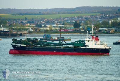
SWALINGE
Hopper Dredger
Current Trip
| Time Travelled | 2 days |
|---|---|
| Remaining Time | --- |
| Distance Travelled | 210.29 nm |
| Remaining Distance | --- |
| AVG Speed | 7.8 Knots |
| MAX Speed | 13.2 Knots |
| AVG Wind | 21.3 knots |
| MAX Wind | 30 knots |
| MIN Temp | 4°C / 39.2°F |
| MAX Temp | 6.5°C / 43.7°F |
| Draught | 6.2 m |
| Position Received | 1 m ago |
Current Position
| Longitude | 1.86972° |
|---|---|
| Latitude | 52.58251° |
| Status | Under way using engine |
| Speed | 0.3 Knots |
| Course | 126° |
| Area | North Sea |
| Station | T-AIS |
| Position Received | 1 m ago |
Info
Information
The current position of SWALINGE is in North Sea with coordinates 52.58251° / 1.86972° as reported on 2025-02-09 22:40 by AIS to our vessel tracker app. The vessel's current speed is 0.3 Knots and is heading at the port of BRUGGE.
The vessel SWALINGE (IMO: 7637448, MMSI: 244209000) is a Hopper Dredger that was built in 1977 ( 48 years old ). It's sailing under the flag of [NL] Netherlands.
In this page you can find informations about the vessels current position, last detected port calls, and current voyage information. If the vessels is not in coverage by AIS you will find the latest position.
The current position of SWALINGE is detected by our AIS receivers and we are not responsible for the reliability of the data. The last position was recorded while the vessel was in Coverage by the Ais receivers of our vessel tracking app.
The current draught of SWALINGE as reported by AIS is 6.2 meters
Weather
| Temperature | 5°C / 41°F |
|---|---|
| Wind Speed | 17 knots |
| Direction | 68° ENE |
| Pressure | 1030.4 hPa |
| Humidity | 81.2 % |
| Cloud Coverage | 100 % |
Featured Company
Last Port Calls
| Port | Arrival | Departure | Time In Port |
|---|---|---|---|
| 2025-02-07 09:22 | 2025-02-07 11:46 | 2 h | |
| 2025-02-07 00:40 | 2025-02-07 00:55 | 15 m | |
| 2025-02-06 21:34 | 2025-02-07 00:02 | 2 h | |
| 2025-02-05 13:48 | 2025-02-05 16:21 | 2 h | |
| 2025-02-05 02:56 | 2025-02-05 03:09 | 12 m | |
| 2025-02-05 00:48 | 2025-02-05 02:17 | 1 h | |
| 2025-02-04 12:53 | 2025-02-04 18:30 | 5 h | |
| 2025-01-13 11:28 | 2025-02-04 12:27 | 22 d | |
| 2025-01-11 17:04 | 2025-01-13 11:11 | 1 d | |
| 2025-01-11 11:54 | 2025-01-11 13:03 | 1 h |
Last Trips
| Origin | Departure | Destination | Arrival | Distance | |
|---|---|---|---|---|---|
| 2025-02-07 01:55 | 2025-02-07 10:22 | 1.99 nm | |||
| 2025-02-07 01:02 | 2025-02-07 01:40 | 2.59 nm | |||
| 2025-02-05 17:21 | 2025-02-06 22:34 | 298.09 nm | |||
| 2025-02-05 04:09 | 2025-02-05 14:48 | 4.51 nm | |||
| 2025-02-05 03:17 | 2025-02-05 03:56 | 2.68 nm | |||
| 2025-02-04 19:30 | 2025-02-05 01:48 | 58.87 nm | |||
| 2025-02-04 13:27 | 2025-02-04 13:53 | 2.02 nm | |||
| 2025-01-13 12:11 | 2025-01-13 12:28 | 0.87 nm | |||
| 2025-01-11 14:03 | 2025-01-11 18:04 | 27.75 nm | |||
| 2025-01-10 23:01 | 2025-01-11 12:54 | 6.04 nm |
Events
| Time | Event | Details | Position / Dest | Info |
|---|---|---|---|---|
| 2025-02-08 20:59 | STOP Moving | 5.28 nm, East of GREAT YARMOUTH |
52.58360 / 1.87069
BRUGGE
|
Speed: 0.2 kn Course: 156° |
| 2025-02-08 17:03 | Destination Changed | BRUGGE DREDGE AREA |
53.16952 / 1.35664
BRUGGE
|
Speed: 11 kn Course: 145° |
| 2025-02-08 16:46 | Status Changed | Under way using engine Default |
53.21095 / 1.31234
DREDGE AREA
|
Speed: 11 kn Course: 147° |
| 2025-02-08 16:37 | IN Coverage |
53.20885 / 1.31451
North Sea
|
Speed: 10.9 kn Course: 148° |
|
| 2025-02-08 08:06 | STOP Moving |
53.43327 / 1.13694
DREDGE AREA
|
Speed: 0.1 kn Course: 116° |
|
| 2025-02-08 05:58 | Status Changed | Default Under way using engine |
53.36295 / 1.23456
DREDGE AREA
|
Speed: 4.7 kn Course: 15° |
| 2025-02-08 05:54 | Status Changed | Under way using engine Default |
53.35706 / 1.23477
DREDGE AREA
|
Speed: 5 kn Course: 346° |
| 2025-02-08 05:54 | IN Coverage |
53.35706 / 1.23477
North Sea
|
Speed: 4.7 kn Course: 1° |
|
| 2025-02-08 05:54 | OUT of Coverage |
53.35706 / 1.23477
North Sea
|
Speed: 4.7 kn Course: 1° |
|
| 2025-02-08 03:59 | OUT of Coverage |
53.21441 / 1.31927
North Sea
|
Speed: 4.3 kn Course: 338° |