
SYNTHESE-1
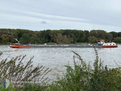
Tanker B
Current Trip
Current Position
| Longitude | 7.10037° |
|---|---|
| Latitude | 51.69630° |
| Status | Moored |
| Speed | |
| Course | 237° |
| Area | North Sea |
| Station | T-AIS |
| Position Received | 16 m ago |
Info
Information
The current position of SYNTHESE-1 is in North Sea with coordinates 51.69630° / 7.10037° as reported on 2025-12-14 12:48 by AIS to our vessel tracker app. The vessel's current speed is 0 Knots and is currently inside the port of MARL.
The vessel SYNTHESE-1 (MMSI: 244650812) is a Tanker B It's sailing under the flag of [NL] Netherlands.
In this page you can find informations about the vessels current position, last detected port calls, and current voyage information. If the vessels is not in coverage by AIS you will find the latest position.
The current position of SYNTHESE-1 is detected by our AIS receivers and we are not responsible for the reliability of the data. The last position was recorded while the vessel was in Coverage by the Ais receivers of our vessel tracking app.
Weather
| Temperature | 7.6°C / 45.68°F |
|---|---|
| Wind Speed | 7 knots |
| Direction | 201° SSW |
| Pressure | 1024.2 hPa |
| Humidity | 78.9 % |
| Cloud Coverage | 29 % |
Featured Company
Last Port Calls
| Port | Arrival | Departure | Time In Port |
|---|---|---|---|
| 2025-12-14 12:02 | |||
| 2025-12-09 22:56 | 2025-12-13 06:24 | 3 d | |
| 2025-12-09 08:42 | 2025-12-09 22:36 | 13 h | |
| 2025-12-07 10:54 | 2025-12-09 07:51 | 1 d | |
| 2025-12-05 13:14 | 2025-12-07 06:52 | 1 d | |
| 2025-12-03 16:03 | 2025-12-05 12:53 | 1 d | |
| 2025-12-02 08:04 | 2025-12-03 09:54 | 1 d | |
| 2025-11-30 12:17 | 2025-12-02 06:51 | 1 d | |
| 2025-11-30 02:27 | 2025-11-30 03:06 | 39 m | |
| 2025-11-28 05:37 | 2025-11-29 09:25 | 1 d |
Last Trips
| Origin | Departure | Destination | Arrival | Distance | |
|---|---|---|---|---|---|
| 2025-12-13 06:24 | 2025-12-14 12:02 | 36.46 nm | |||
| 2025-12-09 22:36 | 2025-12-09 22:56 | 4.83 nm | |||
| 2025-12-09 07:51 | 2025-12-09 08:42 | 4.26 nm | |||
| 2025-12-07 06:52 | 2025-12-07 10:54 | 39.63 nm | |||
| 2025-12-05 12:53 | 2025-12-05 13:14 | 2.18 nm | |||
| 2025-12-03 09:54 | 2025-12-03 16:03 | 35.10 nm | |||
| 2025-12-02 06:51 | 2025-12-02 08:04 | 4.17 nm | |||
| 2025-11-30 03:06 | 2025-11-30 12:17 | 42.06 nm | |||
| 2025-11-29 09:25 | 2025-11-30 02:27 | 97.86 nm | |||
| 2025-11-27 23:47 | 2025-11-28 05:37 | 37.49 nm |
Events
| Time | Event | Details | Position / Dest | Info |
|---|---|---|---|---|
| 2025-12-14 12:30 | IN Coverage |
51.69630 / 7.10036
North Sea
[DE] MARL
|
Speed: Course: 274.4° |
|
| 2025-12-14 11:02 | STOP Moving |
51.69631 / 7.10037
[DE] MARL
|
Speed: Course: 237° |
|
| 2025-12-14 11:02 | Status Changed | Moored Default |
51.69631 / 7.10037
[DE] MARL
|
Speed: 2.2 kn Course: 234° |
| 2025-12-14 11:02 | PORT ARRIVAL |
|
51.69631 / 7.10037
[DE] MARL
|
Speed: 2.2 kn Course: 234° |
| 2025-12-13 16:14 | OUT of Coverage |
51.63068 / 6.60889
North Sea
|
Speed: Course: 232.4° |
|
| 2025-12-13 16:14 | IN Coverage |
51.63068 / 6.60889
North Sea
|
Speed: Course: 232.4° |
|
| 2025-12-13 11:50 | OUT of Coverage |
51.63067 / 6.60891
North Sea
|
Speed: Course: 232.4° |
|
| 2025-12-13 11:50 | IN Coverage |
51.63067 / 6.60891
North Sea
|
Speed: Course: 232.4° |
|
| 2025-12-13 08:38 | OUT of Coverage |
51.63068 / 6.60892
North Sea
|
Speed: Course: 232.4° |
|
| 2025-12-13 07:55 | Status Changed | Moored Under way using engine |
51.63070 / 6.60895
1
|
Speed: 1.2 kn Course: 142° |