

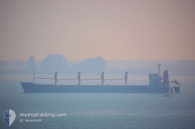
TARSUS M
Bulk Carrier

Current Trip
| Time Travelled | 4 days |
|---|---|
| Remaining Time | 1 day |
| Distance Travelled | 1027.29 nm |
| Remaining Distance | 374.26 nm |
| AVG Speed | 10.4 Knots |
| MAX Speed | 12.5 Knots |
| AVG Wind | 8.5 knots |
| MAX Wind | 26 knots |
| MIN Temp | 15.6°C / 60.08°F |
| MAX Temp | 24.5°C / 76.1°F |
| Draught | 9.8 m |
| Position Received | 4 h, 17 m ago |
Current Position
| Longitude | 15.00968° |
|---|---|
| Latitude | 38.83770° |
| Status | Under way using engine |
| Speed | 10.8 Knots |
| Course | 314° |
| Area | Tyrrhenian Sea |
| Station | T-AIS |
| Position Received | 4 h, 17 m ago |
Information
The current position of TARSUS M is in Tyrrhenian Sea with coordinates 38.83770° / 15.00968° as reported on 2025-05-28 01:14 by AIS to our vessel tracker app. The vessel's current speed is 10.8 Knots and is heading at the port of LIVORNO. The estimated time of arrival as calculated by MyShipTracking vessel tracking app is 2025-05-29 11:06 LT
The vessel TARSUS M (IMO: 9188908, MMSI: 352001472) is a Bulk Carrier that was built in 2006 ( 19 years old ). It's sailing under the flag of [PA] Panama.
In this page you can find informations about the vessels current position, last detected port calls, and current voyage information. If the vessels is not in coverage by AIS you will find the latest position.
The current position of TARSUS M is detected by our AIS receivers and we are not responsible for the reliability of the data. The last position was recorded while the vessel was in Coverage by the Ais receivers of our vessel tracking app.
The current draught of TARSUS M as reported by AIS is 9.8 meters
Weather
| Temperature | 19.3°C / 66.74°F |
|---|---|
| Wind Speed | 6 knots |
| Direction | 329° NNW |
| Pressure | 1016.7 hPa |
| Humidity | 78.2 % |
| Cloud Coverage | 3 % |


Featured Company
Last Trips
| Origin | Departure | Destination | Arrival | Distance | |
|---|---|---|---|---|---|
| 2025-05-08 17:41 | 2025-05-21 17:06 | 2983.67 nm | |||
| 2025-05-08 17:41 | 2025-05-21 07:46 | 2902.47 nm | |||
| 2025-04-21 15:37 | 2025-05-03 04:34 | 1282.46 nm | |||
| 2025-03-13 08:00 | 2025-03-19 04:08 | 1273.22 nm | |||
| 2025-02-27 14:49 | 2025-03-08 17:45 | 252.58 nm |
Events
| Time | Event | Details | Position / Dest | Info |
|---|---|---|---|---|
| 2025-05-28 01:14 | OUT of Coverage |
38.83770 / 15.00968
Tyrrhenian Sea
IT LIV
|
Speed: 10.8 kn Course: 314° |
|
| 2025-05-27 20:43 | Change Sea Area | Italian part of the Tyrrhenian Sea Italian part of the Ionian Sea |
38.24953 / 15.66382
Tyrrhenian Sea
IT LIV
|
Speed: 8.5 kn Course: 62° |
| 2025-05-27 15:52 | Draught Changed | 9.8 10.9 |
37.62862 / 16.13122
IT LIV
|
Speed: 11.3 kn Course: 297° |
| 2025-05-27 15:52 | Destination Changed | IT LIV EG PSD |
37.62862 / 16.13122
IT LIV
|
Speed: 11.3 kn Course: 297° |
| 2025-05-27 15:52 | ETA Changed | 2025/05/29 11:00 2025/05/20 11:00 |
37.62862 / 16.13122
IT LIV
|
Speed: 11.3 kn Course: 297° |
| 2025-05-27 15:43 | Status Changed | Under way using engine Default |
37.61502 / 16.16347
EG PSD
|
Speed: 11.4 kn Course: 298° |
| 2025-05-27 15:38 | Status Changed | Default Under way using engine |
37.60902 / 16.17758
EG PSD
|
Speed: 11.3 kn Course: 297° |
| 2025-05-27 14:59 | Status Changed | Under way using engine Default |
37.55282 / 16.31368
EG PSD
|
Speed: 11 kn Course: 295° |
| 2025-05-27 14:26 | Status Changed | Default Under way using engine |
37.50900 / 16.42747
EG PSD
|
Speed: 10.6 kn Course: 295° |
| 2025-05-27 14:19 | Status Changed | Under way using engine Default |
37.49902 / 16.45383
EG PSD
|
Speed: 10.6 kn Course: 295° |