
TASMAN STRAIT
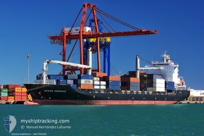
Container Ship
Current Trip
| Trip Time | 2 days |
|---|---|
| Trip Distance | 136.05 nm |
| AVG Speed | 11.9 Knots |
| MAX Speed | 14.1 Knots |
| Draught | 8.9 m |
| AVG Wind | 6.1 knots |
| MAX Wind | 9 knots |
| MIN Temp | 25.5°C / 77.9°F |
| MAX Temp | 30.9°C / 87.62°F |
| Position Received | 2023-06-22 15:37 |
Current Position
| Longitude | -13.60980° |
|---|---|
| Latitude | 28.12267° |
| Status | Under way using engine |
| Speed | 18.6 Knots |
| Course | 211° |
| Area | North Atlantic Ocean |
| Station | T-AIS |
| Position Received | 2023-06-22 15:37 |
Info
Information
The current position of TASMAN STRAIT is in North Atlantic Ocean with coordinates 28.12267° / -13.60980° as reported on 2023-06-22 15:37 by AIS to our vessel tracker app. The vessel's current speed is 18.6 Knots and is currently inside the port of OWENDO.
The vessel TASMAN STRAIT (IMO: 9351218, MMSI: 636092855) is a Container Ship that was built in 2008 ( 17 years old ). It's sailing under the flag of [LR] Liberia.
In this page you can find informations about the vessels current position, last detected port calls, and current voyage information. If the vessels is not in coverage by AIS you will find the latest position.
The current position of TASMAN STRAIT is detected by our AIS receivers and we are not responsible for the reliability of the data. The last position was recorded while the vessel was in Coverage by the Ais receivers of our vessel tracking app.
The current draught of TASMAN STRAIT as reported by AIS is 8.9 meters
Weather
| Temperature | 26.6°C / 79.88°F |
|---|---|
| Wind Speed | 8 knots |
| Direction | 194° SSW |
| Pressure | 1009.3 hPa |
| Humidity | 85 % |
| Cloud Coverage | 93 % |
Featured Company
Last Port Calls
| Port | Arrival | Departure | Time In Port |
|---|---|---|---|
| 2025-02-14 18:29 | |||
| 2025-02-11 06:53 | 2025-02-12 08:49 | 1 d | |
| 2025-02-09 13:37 | 2025-02-10 10:33 | 20 h | |
| 2025-02-04 05:16 | 2025-02-07 17:24 | 3 d | |
| 2025-01-29 05:54 | 2025-01-31 07:49 | 2 d | |
| 2025-01-21 06:57 | 2025-01-22 08:29 | 1 d | |
| 2025-01-19 12:41 | 2025-01-20 11:21 | 22 h | |
| 2025-01-15 18:16 | 2025-01-17 14:32 | 1 d | |
| 2025-01-04 08:01 | 2025-01-06 08:41 | 2 d | |
| 2025-01-02 07:05 | 2025-01-03 08:33 | 1 d |
Last Trips
| Origin | Departure | Destination | Arrival | Distance | |
|---|---|---|---|---|---|
| 2025-02-12 09:49 | 2025-02-14 19:29 | 136.05 nm | |||
| 2025-02-10 11:33 | 2025-02-11 07:53 | 142.10 nm | |||
| 2025-02-07 18:24 | 2025-02-09 14:37 | 654.31 nm | |||
| 2025-01-31 08:49 | 2025-02-04 06:16 | 488.28 nm | |||
| 2025-01-22 09:29 | 2025-01-29 06:54 | 137.96 nm | |||
| 2025-01-20 12:21 | 2025-01-21 07:57 | 141.73 nm | |||
| 2025-01-17 15:32 | 2025-01-19 13:41 | 656.11 nm | |||
| 2025-01-06 09:41 | 2025-01-15 19:16 | 583.97 nm | |||
| 2025-01-03 09:33 | 2025-01-04 09:01 | 135.06 nm | |||
| 2024-12-31 19:29 | 2025-01-02 08:05 | 142.28 nm |
Events
| Time | Event | Details | Position / Dest | Info |
|---|---|---|---|---|
| 2025-02-14 18:29 | STOP Moving |
.28367 / 9.50567
[GA] OWENDO
|
Speed: 0.1 kn Course: 73° |
|
| 2025-02-14 18:29 | PORT ARRIVAL |
|
.28367 / 9.50567
[GA] OWENDO
|
Speed: 3.6 kn Course: 82° |
| 2025-02-14 17:05 | START Moving | 5.22 nm, South of LIBREVILLE |
.31468 / 9.40955
CG PNR
|
Speed: 3.1 kn Course: 54° |
| 2025-02-12 18:44 | STOP Moving | 5.21 nm, South of LIBREVILLE |
.31567 / 9.40717
CG PNR
|
Speed: 0.3 kn Course: 149° |
| 2025-02-12 08:49 | PORT DEPARTURE |
|
1.83417 / 9.72950
CG PNR
|
Speed: 3.2 kn Course: 325° |
| 2025-02-12 08:45 | START Moving |
1.82967 / 9.73283
[GQ] BATA
|
Speed: 3.2 kn Course: 325° |
|
| 2025-02-11 07:05 | STOP Moving |
1.82486 / 9.73507
[GQ] BATA
|
Speed: 0.2 kn Course: 181° |
|
| 2025-02-11 06:53 | PORT ARRIVAL |
|
1.82874 / 9.73456
[GQ] BATA
|
Speed: 3.4 kn Course: 148° |
| 2025-02-11 06:49 | START Moving | 0.24 nm, North West of BATA |
1.83168 / 9.73280
CG PNR
|
Speed: 3.4 kn Course: 148° |
| 2025-02-11 06:33 | STOP Moving | 0.58 nm, North West of BATA |
1.83633 / 9.72967
CG PNR
|
Speed: 0.1 kn Course: 175° |