
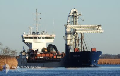
TERNESKJAER
General Cargo
Current Trip
| Time Travelled | 17 h, 33 mins |
|---|---|
| Remaining Time | 3 days |
| Distance Travelled | 141.67 nm |
| Remaining Distance | 694.25 nm |
| AVG Speed | 9.8 Knots |
| MAX Speed | 11.6 Knots |
| AVG Wind | 10.9 knots |
| MAX Wind | 22 knots |
| MIN Temp | 3.2°C / 37.76°F |
| MAX Temp | 8.8°C / 47.84°F |
| Draught | 4 m |
| Position Received | 3 m ago |
Current Position
| Longitude | 4.86539° |
|---|---|
| Latitude | 60.40965° |
| Status | Under way using engine |
| Speed | 8.2 Knots |
| Course | 329.3° |
| Area | North Sea |
| Station | T-AIS |
| Position Received | 3 m ago |
Info
Information
The current position of TERNESKJAER is in North Sea with coordinates 60.40965° / 4.86539° as reported on 2025-12-20 16:05 by AIS to our vessel tracker app. The vessel's current speed is 8.2 Knots and is heading at the port of TROMSO. The estimated time of arrival as calculated by MyShipTracking vessel tracking app is 2025-12-23 17:23 LT
The vessel TERNESKJAER (IMO: 9375446, MMSI: 258015890) is a General Cargo that was built in 2008 ( 17 years old ). It's sailing under the flag of [NO] Norway.
In this page you can find informations about the vessels current position, last detected port calls, and current voyage information. If the vessels is not in coverage by AIS you will find the latest position.
The current position of TERNESKJAER is detected by our AIS receivers and we are not responsible for the reliability of the data. The last position was recorded while the vessel was in Coverage by the Ais receivers of our vessel tracking app.
The current draught of TERNESKJAER as reported by AIS is 4 meters
Weather
| Temperature | 8.8°C / 47.84°F |
|---|---|
| Wind Speed | 11 knots |
| Direction | 155° SSE |
| Pressure | 1014 hPa |
| Humidity | 81.8 % |
| Cloud Coverage | 58 % |
Featured Company
Last Port Calls
| Port | Arrival | Departure | Time In Port |
|---|---|---|---|
| 2025-12-19 23:23 | 2025-12-19 23:35 | 11 m | |
| 2025-12-19 18:05 | 2025-12-19 22:52 | 4 h | |
| 2025-12-18 20:26 | 2025-12-18 21:30 | 1 h | |
| 2025-12-15 09:47 | 2025-12-16 10:50 | 1 d | |
| 2025-12-15 08:33 | 2025-12-15 09:14 | 41 m | |
| 2025-12-15 06:12 | 2025-12-15 08:12 | 1 h | |
| 2025-12-12 23:56 | 2025-12-13 00:45 | 48 m | |
| 2025-12-12 21:58 | 2025-12-12 23:27 | 1 h | |
| 2025-12-11 15:16 | 2025-12-11 15:24 | 8 m | |
| 2025-12-08 19:15 | 2025-12-09 09:46 | 14 h |
Most Visited Ports (Last year)
| Port | Arrivals | |
|---|---|---|
| 54 | ||
| 51 | ||
| 43 | ||
| 39 | ||
| 20 | ||
| 20 |
Last Trips
| Origin | Departure | Destination | Arrival | Distance | |
|---|---|---|---|---|---|
| 2025-12-19 22:52 | 2025-12-19 23:23 | 4.14 nm | |||
| 2025-12-18 21:30 | 2025-12-19 18:05 | 74.18 nm | |||
| 2025-12-16 10:50 | 2025-12-18 20:26 | 416.94 nm | |||
| 2025-12-15 09:14 | 2025-12-15 09:47 | 3.82 nm | |||
| 2025-12-15 08:12 | 2025-12-15 08:33 | 3.32 nm | |||
| 2025-12-13 00:45 | 2025-12-15 06:12 | 413.40 nm | |||
| 2025-12-12 23:27 | 2025-12-12 23:56 | 4.09 nm | |||
| 2025-12-11 15:24 | 2025-12-12 21:58 | 77.33 nm | |||
| 2025-12-09 09:46 | 2025-12-11 15:16 | 397.59 nm | |||
| 2025-12-08 18:56 | 2025-12-08 19:15 | 3.11 nm |
Events
| Time | Event | Details | Position / Dest | Info |
|---|---|---|---|---|
| 2025-12-20 15:09 | START Moving | 5.35 nm, South West of KNAPPSKOG |
60.30649 / 4.96113
FISHFARMS
|
Speed: 3.1 kn Course: 308° |
| 2025-12-20 13:47 | STOP Moving | 5.45 nm, South West of KNAPPSKOG |
60.30393 / 4.96286
FISHFARMS
|
Speed: Course: 14° |
| 2025-12-20 10:08 | START Moving | 6.34 nm, North East of OSOYRO |
60.24920 / 5.63302
FISHFARMS
|
Speed: 7 kn Course: 284.4° |
| 2025-12-20 09:20 | STOP Moving | 6.42 nm, North East of OSOYRO |
60.24856 / 5.63757
FISHFARMS
|
Speed: 0.1 kn Course: 191° |
| 2025-12-20 06:12 | Status Changed | Under way using engine Default |
60.09664 / 5.92953
FISHFARMS
|
Speed: 9.4 kn Course: 176° |
| 2025-12-20 06:04 | Status Changed | Default Under way using engine |
60.11742 / 5.92533
FISHFARMS
|
Speed: 7.5 kn Course: 198.9° |
| 2025-12-20 06:01 | Status Changed | Under way using engine Default |
60.12453 / 5.92495
FISHFARMS
|
Speed: Course: 127° |
| 2025-12-20 06:01 | START Moving | 2.65 nm, North West of VARALDSOY |
60.12453 / 5.92495
FISHFARMS
|
Speed: 7.5 kn Course: 198.9° |
| 2025-12-20 05:40 | Status Changed | Default Under way using engine |
60.12769 / 5.93162
FISHFARMS
|
Speed: Course: 127° |
| 2025-12-20 05:31 | Status Changed | Under way using engine Default |
60.12768 / 5.93159
FISHFARMS
|
Speed: 0.7 kn Course: 134° |