

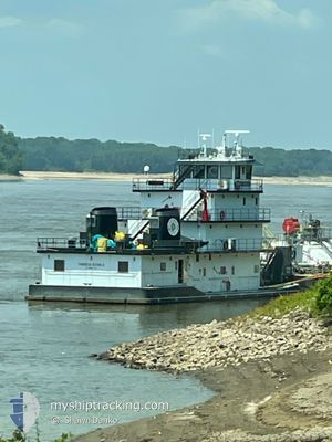
THERESA ECHOLS
Spare - Local Vessel

Current Trip
US^0GUB>0X92
| Time Travelled | 15 days |
|---|---|
| Remaining Time | --- |
| Distance Travelled | 1052.47 nm |
| Remaining Distance | --- |
| AVG Speed | 8.4 Knots |
| MAX Speed | 15.5 Knots |
| AVG Wind | 4.8 knots |
| MAX Wind | 12.9 knots |
| MIN Temp | 17.3°C / 63.14°F |
| MAX Temp | 35.2°C / 95.36°F |
| Draught | 2.8 m |
| Position Received | 1 d ago |
Current Position
| Longitude | -91.18846° |
|---|---|
| Latitude | 31.96288° |
| Status | Pushing Ahead - Towing |
| Speed | 14.2 Knots |
| Course | 204.8° |
| Area | Gulf of Mexico |
| Station | T-AIS |
| Position Received | 1 d ago |
Information
The current position of THERESA ECHOLS is in Gulf of Mexico with coordinates 31.96288° / -91.18846° as reported on 2025-06-06 08:11 by AIS to our vessel tracker app. The vessel's current speed is 14.2 Knots
The vessel THERESA ECHOLS (IMO: 1249509, MMSI: 367590790) is a Spare - Local Vessel It's sailing under the flag of [US] USA.
In this page you can find informations about the vessels current position, last detected port calls, and current voyage information. If the vessels is not in coverage by AIS you will find the latest position.
The current position of THERESA ECHOLS is detected by our AIS receivers and we are not responsible for the reliability of the data. The last position was recorded while the vessel was in Coverage by the Ais receivers of our vessel tracking app.
The current draught of THERESA ECHOLS as reported by AIS is 2.8 meters
Weather
| Temperature | 26°C / 78.8°F |
|---|---|
| Wind Speed | 7 knots |
| Direction | 213° SSW |
| Pressure | 1013.5 hPa |
| Humidity | 80 % |
| Cloud Coverage | --- |


Featured Company
Last Port Calls
| Port | Arrival | Departure | Time In Port |
|---|---|---|---|
| 2025-05-22 12:52 | 2025-05-23 03:48 | 14 h | |
| 2025-04-23 12:04 | 2025-04-23 12:28 | 24 m | |
| 2025-04-21 18:44 | 2025-04-23 02:20 | 1 d |
Most Visited Ports (Last year)
| Port | Arrivals | |
|---|---|---|
| 10 | ||
| 2 | ||
| 1 |
Last Trips
| Origin | Departure | Destination | Arrival | Distance | |
|---|---|---|---|---|---|
| 2025-04-23 12:28 | 2025-05-22 12:52 | 1910.87 nm | |||
| 2025-04-23 02:20 | 2025-04-23 12:04 | 31.10 nm |
Events
| Time | Event | Details | Position / Dest | Info |
|---|---|---|---|---|
| 2025-06-07 10:17 | START Moving | 2.75 nm, South West of BURNSIDE |
30.10362 / -90.96343
US^0GUB>0X92
|
Speed: 5.5 kn Course: 274° |
| 2025-06-06 23:01 | STOP Moving | 2.67 nm, South West of BURNSIDE |
30.10341 / -90.96134
US^0GUB>0X92
|
Speed: Course: 255° |
| 2025-06-06 08:17 | Status Changed | Default Pushing Ahead - Towing |
31.94090 / -91.19335
US^0GUB>0X92
|
Speed: 14.2 kn Course: 204.8° |
| 2025-06-06 08:11 | OUT of Coverage |
31.96288 / -91.18846
Gulf of Mexico
|
Speed: 14.2 kn Course: 204.8° |
|
| 2025-06-06 08:06 | Status Changed | Pushing Ahead - Towing Default |
31.97756 / -91.17655
US^0GUB>0X92
|
Speed: 13 kn Course: 247° |
| 2025-06-06 07:57 | Status Changed | Default Pushing Ahead - Towing |
31.98274 / -91.13534
US^0GUB>0X92
|
Speed: 13.5 kn Course: 234.5° |
| 2025-06-06 03:46 | Status Changed | Pushing Ahead - Towing Default |
32.63432 / -91.15365
US^0GUB>0X92
|
Speed: 14 kn Course: 192° |
| 2025-06-06 03:45 | Status Changed | Default Pushing Ahead - Towing |
32.64049 / -91.15243
US^0GUB>0X92
|
Speed: 13.7 kn Course: 230.9° |
| 2025-06-06 03:31 | Status Changed | Pushing Ahead - Towing Default |
32.67216 / -91.10710
US^0GUB>0X92
|
Speed: 14.5 kn Course: 256° |
| 2025-06-06 03:31 | IN Coverage |
32.67169 / -91.10942
Gulf of Mexico
|
Speed: 14.6 kn Course: 255.9° |