
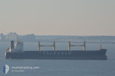
THOR BREEZE
Cargo
Current Trip
| Time Travelled | 6 days |
|---|---|
| Remaining Time | --- |
| Distance Travelled | 1558.09 nm |
| Remaining Distance | --- |
| AVG Speed | 9.8 Knots |
| MAX Speed | 13.7 Knots |
| AVG Wind | 19.6 knots |
| MAX Wind | 31.7 knots |
| MIN Temp | 8.8°C / 47.84°F |
| MAX Temp | 16.9°C / 62.42°F |
| Draught | 10.7 m |
| Position Received | 1 m ago |
Current Position
| Longitude | -4.94668° |
|---|---|
| Latitude | 36.25290° |
| Status | Under way using engine |
| Speed | 2 Knots |
| Course | 306° |
| Area | Alboran Sea |
| Station | T-AIS |
| Position Received | 1 m ago |
Info
Information
The current position of THOR BREEZE is in Alboran Sea with coordinates 36.25290° / -4.94668° as reported on 2025-03-13 12:54 by AIS to our vessel tracker app. The vessel's current speed is 2 Knots
The vessel THOR BREEZE (IMO: 9474802, MMSI: 566985000) is a Cargo It's sailing under the flag of [SG] Singapore.
In this page you can find informations about the vessels current position, last detected port calls, and current voyage information. If the vessels is not in coverage by AIS you will find the latest position.
The current position of THOR BREEZE is detected by our AIS receivers and we are not responsible for the reliability of the data. The last position was recorded while the vessel was in Coverage by the Ais receivers of our vessel tracking app.
The current draught of THOR BREEZE as reported by AIS is 10.7 meters
Weather
| Temperature | 15.3°C / 59.54°F |
|---|---|
| Wind Speed | 29 knots |
| Direction | 244° WSW |
| Pressure | 999.7 hPa |
| Humidity | 79.8 % |
| Cloud Coverage | 73 % |
Featured Company
Most Visited Ports (Last year)
| Port | Arrivals | |
|---|---|---|
| 2 | ||
| 1 | ||
| 1 | ||
| 1 | ||
| 1 | ||
| 1 |
Events
| Time | Event | Details | Position / Dest | Info |
|---|---|---|---|---|
| 2025-03-13 04:05 | Change Sea Area | Spanish part of the Alboran Sea Gibraltarian part of the Alboran Sea |
36.13257 / -5.08282
Alboran Sea
ESALG
|
Speed: 10.7 kn Course: 78.8° |
| 2025-03-13 02:44 | Change Sea Area | Gibraltarian part of the Alboran Sea Spanish part of the Alboran Sea |
36.01520 / -5.28808
Alboran Sea
ESALG
|
Speed: 11.3 kn Course: 27.8° |
| 2025-03-13 02:32 | Change Sea Area | Spanish part of the Alboran Sea Spanish part of the Strait of Gibraltar |
35.99331 / -5.31755
Alboran Sea
ESALG
|
Speed: 8.3 kn Course: 78° |
| 2025-03-13 02:10 | Change Sea Area | Spanish part of the Strait of Gibraltar Moroccan part of the Strait of Gibraltar |
35.98059 / -5.37617
Strait of Gibraltar
ESALG
|
Speed: 7.9 kn Course: 73.4° |
| 2025-03-13 00:04 | Draught Changed | 10.7 10.5 |
35.91514 / -5.80077
ESALG
|
Speed: 11.6 kn Course: 87.1° |
| 2025-03-13 00:04 | ETA Changed | 2025/03/13 04:00 2025/03/12 12:00 |
35.91514 / -5.80077
ESALG
|
Speed: 11.6 kn Course: 87.1° |
| 2025-03-12 23:29 | Change Sea Area | Moroccan part of the Strait of Gibraltar Moroccan part of the North Atlantic Ocean |
35.91062 / -5.93480
Strait of Gibraltar
|
Speed: 10.8 kn Course: 90.3° |
| 2025-03-12 23:29 | Status Changed | Under way using engine Default |
35.91062 / -5.93480
ESALG
|
Speed: 10.8 kn Course: 90° |
| 2025-03-12 23:24 | Status Changed | Default Under way using engine |
35.91050 / -5.95322
ESALG
|
Speed: 10.7 kn Course: 89° |
| 2025-03-12 23:14 | Status Changed | Under way using engine Default |
35.90964 / -5.98963
ESALG
|
Speed: 10.8 kn Course: 89° |