
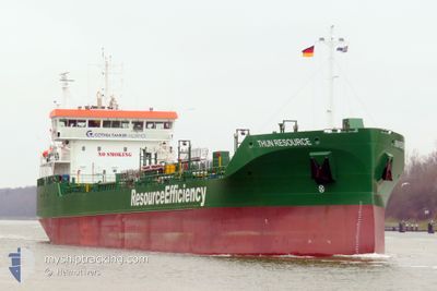
THUN RESOURCE
Tanker
Current Trip
| Time Travelled | 20 h, 37 mins |
|---|---|
| Remaining Time | 1 h, 20 mins |
| Distance Travelled | 225.85 nm |
| Remaining Distance | 14.20 nm |
| AVG Speed | 10.5 Knots |
| MAX Speed | 13.4 Knots |
| AVG Wind | 14.9 knots |
| MAX Wind | 21 knots |
| MIN Temp | 6.1°C / 42.98°F |
| MAX Temp | 10.6°C / 51.08°F |
| Draught | 6 m |
| Position Received | 1 m ago |
Current Position
| Longitude | -0.03295° |
|---|---|
| Latitude | 53.59707° |
| Status | Under way using engine |
| Speed | 9.4 Knots |
| Course | 306.3° |
| Area | North Sea |
| Station | T-AIS |
| Position Received | 1 m ago |
Info
Information
The current position of THUN RESOURCE is in North Sea with coordinates 53.59707° / -0.03295° as reported on 2025-12-16 05:19 by AIS to our vessel tracker app. The vessel's current speed is 9.4 Knots and is heading at the port of HULL. The estimated time of arrival as calculated by MyShipTracking vessel tracking app is 2025-12-16 06:41 LT
The vessel THUN RESOURCE (IMO: 9970507, MMSI: 245313000) is a Tanker It's sailing under the flag of [NL] Netherlands.
In this page you can find informations about the vessels current position, last detected port calls, and current voyage information. If the vessels is not in coverage by AIS you will find the latest position.
The current position of THUN RESOURCE is detected by our AIS receivers and we are not responsible for the reliability of the data. The last position was recorded while the vessel was in Coverage by the Ais receivers of our vessel tracking app.
The current draught of THUN RESOURCE as reported by AIS is 6 meters
Weather
| Temperature | 8.7°C / 47.66°F |
|---|---|
| Wind Speed | 3 knots |
| Direction | 319° NW |
| Pressure | 1004.9 hPa |
| Humidity | 98.1 % |
| Cloud Coverage | 100 % |
Featured Company
Last Port Calls
| Port | Arrival | Departure | Time In Port |
|---|---|---|---|
| 2025-12-13 08:40 | 2025-12-15 09:44 | 2 d | |
| 2025-12-09 15:49 | 2025-12-10 06:49 | 14 h | |
| 2025-12-03 05:27 | 2025-12-04 13:24 | 1 d | |
| 2025-11-29 11:25 | 2025-11-30 01:09 | 13 h | |
| 2025-11-21 23:35 | 2025-11-23 11:18 | 1 d | |
| 2025-11-20 12:14 | 2025-11-20 13:36 | 1 h | |
| 2025-11-18 03:36 | 2025-11-18 23:36 | 19 h | |
| 2025-11-12 12:50 | 2025-11-13 01:00 | 12 h | |
| 2025-11-10 02:00 | 2025-11-11 14:25 | 1 d | |
| 2025-11-07 00:00 | 2025-11-07 01:52 | 1 h |
Last Trips
| Origin | Departure | Destination | Arrival | Distance | |
|---|---|---|---|---|---|
| 2025-12-10 06:49 | 2025-12-13 08:40 | 689.02 nm | |||
| 2025-12-04 13:24 | 2025-12-09 15:49 | 989.57 nm | |||
| 2025-11-30 01:09 | 2025-12-03 05:27 | 684.49 nm | |||
| 2025-11-23 11:18 | 2025-11-29 11:25 | 992.19 nm | |||
| 2025-11-20 13:36 | 2025-11-21 23:35 | 347.42 nm | |||
| 2025-11-18 23:36 | 2025-11-20 12:14 | 337.26 nm | |||
| 2025-11-13 01:00 | 2025-11-18 03:36 | 1006.99 nm | |||
| 2025-11-11 14:25 | 2025-11-12 12:50 | 238.78 nm | |||
| 2025-11-07 01:52 | 2025-11-10 02:00 | 351.35 nm | |||
| 2025-11-05 09:00 | 2025-11-07 00:00 | 337.57 nm |
Events
| Time | Event | Details | Position / Dest | Info |
|---|---|---|---|---|
| 2025-12-16 04:21 | Status Changed | Under way using engine Default |
53.55049 / .20507
GB HUL
|
Speed: 10.6 kn Course: 265° |
| 2025-12-16 04:21 | IN Coverage |
53.55017 / .19835
North Sea
GB HUL
|
Speed: 10.8 kn Course: 265.5° |
|
| 2025-12-15 23:58 | Status Changed | Default Under way using engine |
53.13660 / 1.26718
GB HUL
|
Speed: 12.1 kn Course: 319.2° |
| 2025-12-15 23:51 | OUT of Coverage |
53.11821 / 1.28985
North Sea
GB HUL
|
Speed: 12.1 kn Course: 319.2° |
|
| 2025-12-15 21:50 | Detected in Sea | United Kingdom part of the North Sea |
52.82964 / 1.81733
North Sea
GB HUL
|
Speed: 12.4 kn Course: 306.4° |
| 2025-12-15 21:47 | Status Changed | Under way using engine Default |
52.82339 / 1.83104
GB HUL
|
Speed: 12.3 kn Course: 307° |
| 2025-12-15 21:38 | IN Coverage |
52.82964 / 1.81733
North Sea
GB HUL
|
Speed: 12.4 kn Course: 306.4° |
|
| 2025-12-15 15:38 | Status Changed | Default Under way using engine |
51.98943 / 3.00505
GB HUL
|
Speed: 11 kn Course: 331.1° |
| 2025-12-15 15:33 | OUT of Coverage |
51.97572 / 3.01764
North Sea
GB HUL
|
Speed: 11 kn Course: 331.1° |
|
| 2025-12-15 08:44 | PORT DEPARTURE |
|
51.36870 / 4.22084
GB HUL
|
Speed: 9.8 kn Course: 342° |