

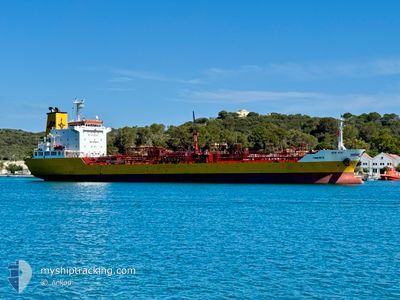
TINERFE
Oil/Chemical Tanker
Current Trip
| Trip Time | 1 day |
|---|---|
| Trip Distance | 485.32 nm |
| AVG Speed | 11.5 Knots |
| MAX Speed | 14.5 Knots |
| Draught | 5.8 m |
| AVG Wind | 6.5 knots |
| MAX Wind | 12 knots |
| MIN Temp | 19.7°C / 67.46°F |
| MAX Temp | 29.4°C / 84.92°F |
| Position Received | 5 m ago |
Current Position
| Longitude | -5.39935° |
|---|---|
| Latitude | 36.17724° |
| Status | Moored |
| Speed | 0.1 Knots |
| Course | 262° |
| Area | Strait of Gibraltar |
| Station | T-AIS |
| Position Received | 5 m ago |
Information
The current position of TINERFE is in Strait of Gibraltar with coordinates 36.17724° / -5.39935° as reported on 2025-06-01 10:32 by AIS to our vessel tracker app. The vessel's current speed is 0.1 Knots and is currently inside the port of CARTEYA GUADARRANQUE.
The vessel TINERFE (IMO: 9498107, MMSI: 255831000) is a Oil/Chemical Tanker that was built in 2009 ( 16 years old ). It's sailing under the flag of [PT] Portugal.
In this page you can find informations about the vessels current position, last detected port calls, and current voyage information. If the vessels is not in coverage by AIS you will find the latest position.
The current position of TINERFE is detected by our AIS receivers and we are not responsible for the reliability of the data. The last position was recorded while the vessel was in Coverage by the Ais receivers of our vessel tracking app.
The current draught of TINERFE as reported by AIS is 5.8 meters
Weather
| Temperature | 26°C / 78.8°F |
|---|---|
| Wind Speed | 11 knots |
| Direction | 110° ESE |
| Pressure | 1017.8 hPa |
| Humidity | 47.8 % |
| Cloud Coverage | 81 % |
Featured Company
Last Port Calls
| Port | Arrival | Departure | Time In Port |
|---|---|---|---|
| 2025-05-31 19:42 | |||
| 2025-05-28 15:01 | 2025-05-29 19:52 | 1 d | |
| 2025-05-27 02:26 | 2025-05-28 04:14 | 1 d | |
| 2025-05-25 08:36 | 2025-05-26 09:25 | 1 d | |
| 2025-05-24 04:49 | 2025-05-24 19:39 | 14 h | |
| 2025-05-20 14:28 | 2025-05-23 14:04 | 2 d | |
| 2025-05-17 09:56 | 2025-05-18 08:40 | 22 h | |
| 2025-05-15 20:13 | 2025-05-17 00:33 | 1 d | |
| 2025-05-13 15:42 | 2025-05-14 07:38 | 15 h | |
| 2025-05-12 06:32 | 2025-05-13 09:50 | 1 d |
Most Visited Ports (Last year)
| Port | Arrivals | |
|---|---|---|
| 29 | ||
| 26 | ||
| 25 | ||
| 23 | ||
| 21 | ||
| 17 |
Last Trips
| Origin | Departure | Destination | Arrival | Distance | |
|---|---|---|---|---|---|
| 2025-05-29 19:52 | 2025-05-31 19:42 | 485.32 nm | |||
| 2025-05-28 04:14 | 2025-05-28 15:01 | 132.04 nm | |||
| 2025-05-26 09:25 | 2025-05-27 02:26 | 221.64 nm | |||
| 2025-05-24 19:39 | 2025-05-25 08:36 | 163.47 nm | |||
| 2025-05-23 14:04 | 2025-05-24 04:49 | 174.97 nm | |||
| 2025-05-18 08:40 | 2025-05-20 14:28 | 176.22 nm | |||
| 2025-05-17 00:33 | 2025-05-17 09:56 | 106.24 nm | |||
| 2025-05-14 07:38 | 2025-05-15 20:13 | 440.39 nm | |||
| 2025-05-13 09:50 | 2025-05-13 15:42 | 71.93 nm | |||
| 2025-05-11 16:30 | 2025-05-12 06:32 | 168.43 nm |
Events
| Time | Event | Details | Position / Dest | Info |
|---|---|---|---|---|
| 2025-06-01 01:22 | Destination Changed | ES MOT ES ALG |
36.17721 / -5.39932
[ES] CARTEYA GUADARRANQUE
|
Speed: Course: 262° |
| 2025-06-01 01:22 | ETA Changed | 2025/06/01 17:00 2026/05/31 07:00 |
36.17721 / -5.39932
[ES] CARTEYA GUADARRANQUE
|
Speed: Course: 262° |
| 2025-06-01 00:02 | ETA Changed | 2026/05/31 07:00 2025/05/31 07:00 |
36.17726 / -5.39939
[ES] CARTEYA GUADARRANQUE
|
Speed: Course: 262° |
| 2025-05-31 17:42 | STOP Moving |
36.17726 / -5.39944
[ES] CARTEYA GUADARRANQUE
|
Speed: 0.1 kn Course: 262° |
|
| 2025-05-31 17:42 | PORT ARRIVAL |
|
36.17728 / -5.39948
[ES] CARTEYA GUADARRANQUE
|
Speed: 0.6 kn Course: 262° |
| 2025-05-31 17:42 | Status Changed | Moored Under way using engine |
36.17728 / -5.39949
ES ALG
|
Speed: 0.7 kn Course: 261° |
| 2025-05-31 17:22 | START Moving | 0.46 nm, South of PALMONES |
36.16841 / -5.42313
ES ALG
|
Speed: 4.4 kn Course: 59° |
| 2025-05-31 17:10 | Status Changed | Under way using engine At anchor |
36.16979 / -5.42618
ES ALG
|
Speed: Course: 156° |
| 2025-05-31 11:01 | Status Changed | At anchor Moored |
36.16717 / -5.42540
ES ALG
|
Speed: Course: 12° |
| 2025-05-31 11:01 | Status Changed | Moored Under way using engine |
36.16717 / -5.42539
ES ALG
|
Speed: Course: 11° |