
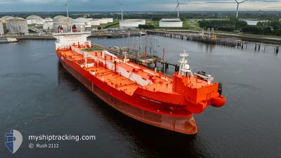
TORILL KNUTSEN
Shuttle Tanker
Current Trip
| Time Travelled | 53 days |
|---|---|
| Remaining Time | --- |
| Distance Travelled | 3856.54 nm |
| Remaining Distance | --- |
| AVG Speed | 9.8 Knots |
| MAX Speed | 14.6 Knots |
| AVG Wind | 17 knots |
| MAX Wind | 30.8 knots |
| MIN Temp | 0.2°C / 32.36°F |
| MAX Temp | 12.6°C / 54.68°F |
| Draught | 11.4 m |
| Position Received | 6 m ago |
Current Position
| Longitude | -0.25710° |
|---|---|
| Latitude | 49.62071° |
| Status | At anchor |
| Speed | 0.1 Knots |
| Course | 178° |
| Area | English Channel |
| Station | T-AIS |
| Position Received | 6 m ago |
Info
Information
The current position of TORILL KNUTSEN is in English Channel with coordinates 49.62071° / -0.25710° as reported on 2025-12-16 09:05 by AIS to our vessel tracker app. The vessel's current speed is 0.1 Knots
The vessel TORILL KNUTSEN (IMO: 9630030, MMSI: 257896000) is a Shuttle Tanker that was built in 2013 ( 12 years old ). It's sailing under the flag of [NO] Norway.
In this page you can find informations about the vessels current position, last detected port calls, and current voyage information. If the vessels is not in coverage by AIS you will find the latest position.
The current position of TORILL KNUTSEN is detected by our AIS receivers and we are not responsible for the reliability of the data. The last position was recorded while the vessel was in Coverage by the Ais receivers of our vessel tracking app.
The current draught of TORILL KNUTSEN as reported by AIS is 11.4 meters
Weather
| Temperature | 10.5°C / 50.9°F |
|---|---|
| Wind Speed | 14 knots |
| Direction | 197° SSW |
| Pressure | 1008.5 hPa |
| Humidity | 88.9 % |
| Cloud Coverage | 100 % |
Featured Company
Events
| Time | Event | Details | Position / Dest | Info |
|---|---|---|---|---|
| 2025-12-16 08:41 | Status Changed | At anchor Default |
49.62065 / -.25643
LE HAVRE
|
Speed: Course: 194° |
| 2025-12-16 08:35 | Status Changed | Default At anchor |
49.62071 / -.25621
LE HAVRE
|
Speed: Course: 195° |
| 2025-12-16 07:53 | Status Changed | At anchor Default |
49.62065 / -.25596
LE HAVRE
|
Speed: 0.1 kn Course: 198° |
| 2025-12-16 07:47 | Status Changed | Default At anchor |
49.62063 / -.25587
LE HAVRE
|
Speed: 0.1 kn Course: 199° |
| 2025-12-16 07:11 | Status Changed | At anchor Default |
49.62020 / -.25450
LE HAVRE
|
Speed: 0.4 kn Course: 211° |
| 2025-12-16 07:05 | Status Changed | Default At anchor |
49.62035 / -.25478
LE HAVRE
|
Speed: 0.2 kn Course: 214° |
| 2025-12-16 06:41 | Status Changed | At anchor Default |
49.62017 / -.25452
LE HAVRE
|
Speed: 0.3 kn Course: 213° |
| 2025-12-16 06:29 | Status Changed | Default At anchor |
49.62036 / -.25470
LE HAVRE
|
Speed: 0.2 kn Course: 215° |
| 2025-12-16 06:17 | Status Changed | At anchor Default |
49.62026 / -.25442
LE HAVRE
|
Speed: 0.2 kn Course: 224° |
| 2025-12-16 06:11 | Status Changed | Default At anchor |
49.62006 / -.25419
LE HAVRE
|
Speed: Course: 224° |