

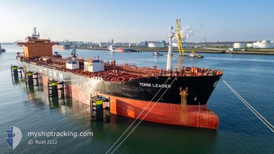
TORM LEADER
Oil/Chemical Tanker

Current Trip
USLDJ
| Time Travelled | 1 day |
|---|---|
| Remaining Time | --- |
| Distance Travelled | 2.70 nm |
| Remaining Distance | --- |
| AVG Speed | 4.9 Knots |
| MAX Speed | 5.7 Knots |
| AVG Wind | 11.2 knots |
| MAX Wind | 12.9 knots |
| MIN Temp | 13.2°C / 55.76°F |
| MAX Temp | 13.8°C / 56.84°F |
| Draught | 10.2 m |
| Position Received | 19 m ago |
Current Position
| Longitude | -74.20528° |
|---|---|
| Latitude | 40.60923° |
| Status | Moored |
| Speed | |
| Course | 189° |
| Area | North Atlantic Ocean |
| Station | T-AIS |
| Position Received | 19 m ago |
Information
The current position of TORM LEADER is in North Atlantic Ocean with coordinates 40.60923° / -74.20528° as reported on 2025-06-02 14:54 by AIS to our vessel tracker app. The vessel's current speed is 0 Knots
The vessel TORM LEADER (IMO: 9343194, MMSI: 219028423) is a Oil/Chemical Tanker that was built in 2009 ( 16 years old ). It's sailing under the flag of [DK] Denmark.
In this page you can find informations about the vessels current position, last detected port calls, and current voyage information. If the vessels is not in coverage by AIS you will find the latest position.
The current position of TORM LEADER is detected by our AIS receivers and we are not responsible for the reliability of the data. The last position was recorded while the vessel was in Coverage by the Ais receivers of our vessel tracking app.
The current draught of TORM LEADER as reported by AIS is 10.2 meters
Weather
| Temperature | 18°C / 64.4°F |
|---|---|
| Wind Speed | 4 knots |
| Direction | 307° NW |
| Pressure | 1016 hPa |
| Humidity | 41.7 % |
| Cloud Coverage | 7 % |


Featured Company
Last Port Calls
| Port | Arrival | Departure | Time In Port |
|---|---|---|---|
| 2025-05-31 18:26 | 2025-05-31 19:54 | 1 h | |
| 2025-05-28 07:35 | 2025-05-29 18:23 | 1 d | |
| 2025-05-12 01:37 | 2025-05-15 08:50 | 3 d | |
| 2025-05-11 08:46 | 2025-05-12 00:42 | 15 h | |
| 2025-05-06 02:01 | 2025-05-10 19:29 | 4 d | |
| 2025-04-27 15:47 | 2025-04-29 22:45 | 2 d | |
| 2025-04-21 11:35 | 2025-04-23 21:32 | 2 d | |
| 2025-04-08 20:58 | 2025-04-10 06:59 | 1 d | |
| 2025-04-06 21:10 | 2025-04-08 19:15 | 1 d | |
| 2025-04-05 10:06 | 2025-04-06 20:34 | 1 d |
Last Trips
| Origin | Departure | Destination | Arrival | Distance | |
|---|---|---|---|---|---|
| 2025-05-29 18:23 | 2025-05-31 18:26 | 48.47 nm | |||
| 2025-05-15 08:50 | 2025-05-28 07:35 | 3517.54 nm | |||
| 2025-05-12 00:42 | 2025-05-12 01:37 | 4.06 nm | |||
| 2025-05-10 19:29 | 2025-05-11 08:46 | 121.83 nm | |||
| 2025-04-29 22:45 | 2025-05-06 02:01 | 1137.27 nm | |||
| 2025-04-23 21:32 | 2025-04-27 15:47 | 1014.88 nm | |||
| 2025-04-10 06:59 | 2025-04-21 11:35 | 2722.03 nm | |||
| 2025-04-08 19:15 | 2025-04-08 20:58 | 20.89 nm | |||
| 2025-04-06 20:34 | 2025-04-06 21:10 | 2.67 nm | |||
| 2025-04-05 07:41 | 2025-04-05 10:06 | 18.76 nm |
Events
| Time | Event | Details | Position / Dest | Info |
|---|---|---|---|---|
| 2025-06-02 15:00 | Status Changed | Default Moored |
40.60925 / -74.20530
USLDJ
|
Speed: Course: 189° |
| 2025-06-02 14:42 | Status Changed | Moored Default |
40.60926 / -74.20529
USLDJ
|
Speed: Course: 189° |
| 2025-06-02 14:42 | IN Coverage |
40.60926 / -74.20529
North Atlantic Ocean
|
Speed: Course: 308.3° |
|
| 2025-06-02 13:39 | Status Changed | Default Moored |
40.60926 / -74.20527
USLDJ
|
Speed: Course: 189° |
| 2025-06-02 13:12 | Status Changed | Moored Default |
40.60923 / -74.20529
USLDJ
|
Speed: Course: 189° |
| 2025-06-02 13:12 | IN Coverage |
40.60923 / -74.20529
North Atlantic Ocean
|
Speed: Course: 152° |
|
| 2025-06-02 13:12 | OUT of Coverage |
40.60923 / -74.20529
North Atlantic Ocean
|
Speed: Course: 152° |
|
| 2025-06-02 11:27 | Status Changed | Default Moored |
40.60927 / -74.20529
USLDJ
|
Speed: Course: 189° |
| 2025-06-02 11:12 | OUT of Coverage |
40.60926 / -74.20528
North Atlantic Ocean
|
Speed: Course: 41.9° |
|
| 2025-06-02 10:54 | Status Changed | Moored Default |
40.60922 / -74.20529
USLDJ
|
Speed: Course: 189° |