
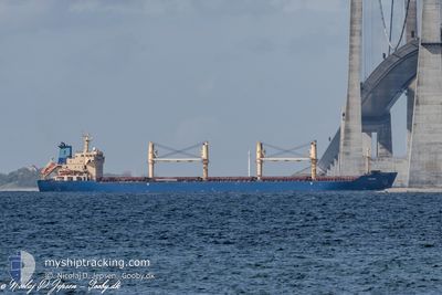
TULPAR
Bulk Carrier
Current Trip
| Time Travelled | 6 days |
|---|---|
| Remaining Time | 3 h, 54 mins |
| Distance Travelled | 1434.86 nm |
| Remaining Distance | 152.08 nm |
| AVG Speed | 11 Knots |
| MAX Speed | 14.6 Knots |
| AVG Wind | 13.4 knots |
| MAX Wind | 31.8 knots |
| MIN Temp | 2.9°C / 37.22°F |
| MAX Temp | 17.3°C / 63.14°F |
| Draught | 5.8 m |
| Position Received | 7 h, 42 m ago |
Current Position
| Longitude | 29.23786° |
|---|---|
| Latitude | 41.49804° |
| Status | Under way using engine |
| Speed | 13.8 Knots |
| Course | 353.4° |
| Area | Black Sea |
| Station | T-AIS |
| Position Received | 7 h, 42 m ago |
Info
Information
The current position of TULPAR is in Black Sea with coordinates 41.49804° / 29.23786° as reported on 2026-01-07 06:10 by AIS to our vessel tracker app. The vessel's current speed is 13.8 Knots and is heading at the port of CONSTANTA. The estimated time of arrival as calculated by MyShipTracking vessel tracking app is 2026-01-07 19:46 LT
The vessel TULPAR (IMO: 9285407, MMSI: 538007583) is a Bulk Carrier that was built in 2003 ( 23 years old ). It's sailing under the flag of [MH] Marshall Is.
In this page you can find informations about the vessels current position, last detected port calls, and current voyage information. If the vessels is not in coverage by AIS you will find the latest position.
The current position of TULPAR is detected by our AIS receivers and we are not responsible for the reliability of the data. The last position was recorded while the vessel was in Coverage by the Ais receivers of our vessel tracking app.
The current draught of TULPAR as reported by AIS is 5.8 meters
Weather
| Temperature | 11.7°C / 53.06°F |
|---|---|
| Wind Speed | 18 knots |
| Direction | 195° SSW |
| Pressure | 1009.2 hPa |
| Humidity | 91.1 % |
| Cloud Coverage | 100 % |
Featured Company
Last Port Calls
| Port | Arrival | Departure | Time In Port |
|---|---|---|---|
| 2025-12-27 05:05 | 2025-12-31 19:43 | 4 d | |
| 2025-12-23 07:38 | 2025-12-23 12:06 | 4 h | |
| 2025-11-23 02:26 | 2025-11-26 15:43 | 3 d | |
| 2025-11-21 01:11 | 2025-11-22 20:17 | 1 d | |
| 2025-11-13 11:25 | 2025-11-18 01:04 | 4 d |
Last Trips
| Origin | Departure | Destination | Arrival | Distance | |
|---|---|---|---|---|---|
| 2025-12-23 12:06 | 2025-12-27 05:05 | 688.93 nm | |||
| 2025-11-26 15:43 | 2025-12-23 07:38 | 5800.19 nm | |||
| 2025-11-22 20:17 | 2025-11-23 02:26 | 55.31 nm | |||
| 2025-11-18 01:04 | 2025-11-21 01:11 | 498.94 nm | |||
| 2025-10-03 16:54 | 2025-11-13 11:25 | 7804.78 nm |
Events
| Time | Event | Details | Position / Dest | Info |
|---|---|---|---|---|
| 2026-01-07 06:17 | Status Changed | Default Under way using engine |
41.52496 / 29.23263
ROCND
|
Speed: 13.8 kn Course: 353.4° |
| 2026-01-07 06:10 | OUT of Coverage |
41.49804 / 29.23786
Black Sea
ROCND
|
Speed: 13.8 kn Course: 353.4° |
|
| 2026-01-07 05:11 | ETA Changed | 2026/01/07 18:00 2026/01/06 18:00 |
41.28192 / 29.22153
ROCND
|
Speed: 13.5 kn Course: 30.1° |
| 2026-01-07 04:52 | Change Sea Area | Turkish part of the Black Sea Turkish part of the Sea of Marmara |
41.23249 / 29.15324
Black Sea
|
Speed: 13.4 kn Course: 56.1° |
| 2026-01-07 00:35 | START Moving | 11.22 nm, South West of MALTEPE |
40.76106 / 28.98904
ROCND
|
Speed: 3.1 kn Course: 27° |
| 2026-01-06 18:47 | STOP Moving | 11.98 nm, South West of MALTEPE |
40.74568 / 28.98996
ROCND
|
Speed: 0.2 kn Course: 177° |
| 2026-01-06 13:59 | START Moving | 11.82 nm, South West of MALTEPE |
40.74796 / 28.99160
ROCND
|
Speed: 3.1 kn Course: 272° |
| 2026-01-06 13:41 | STOP Moving | 11.58 nm, South West of MALTEPE |
40.75225 / 28.99232
ROCND
|
Speed: 0.3 kn Course: 150° |
| 2026-01-06 09:03 | Status Changed | Under way using engine Default |
40.80333 / 28.28147
ROCND
|
Speed: 13.4 kn Course: 82° |
| 2026-01-06 09:01 | Status Changed | Default Under way using engine |
40.80224 / 28.27086
ROCND
|
Speed: 13.3 kn Course: 80.6° |