
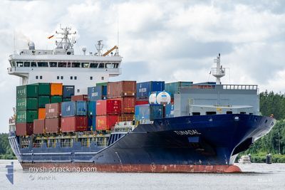
TUNADAL
Container Ship
Current Trip
| Time Travelled | 5 h, 26 mins |
|---|---|
| Remaining Time | 2 h, 15 mins |
| Distance Travelled | 52.80 nm |
| Remaining Distance | 25.40 nm |
| AVG Speed | 10.4 Knots |
| MAX Speed | 14.7 Knots |
| AVG Wind | 8.7 knots |
| MAX Wind | 12.3 knots |
| MIN Temp | -5.6°C / 21.92°F |
| MAX Temp | -3.7°C / 25.34°F |
| Draught | 7.6 m |
| Position Received | 1 m ago |
Current Position
| Longitude | 26.40340° |
|---|---|
| Latitude | 60.22230° |
| Status | Under way using engine |
| Speed | 10.4 Knots |
| Course | 24.4° |
| Area | Gulf of Finland |
| Station | T-AIS |
| Position Received | 1 m ago |
Info
Information
The current position of TUNADAL is in Gulf of Finland with coordinates 60.22230° / 26.40340° as reported on 2025-02-04 19:48 by AIS to our vessel tracker app. The vessel's current speed is 10.4 Knots and is heading at the port of KOTKA. The estimated time of arrival as calculated by MyShipTracking vessel tracking app is 2025-02-04 22:04 LT
The vessel TUNADAL (IMO: 9429235, MMSI: 636020533) is a Container Ship that was built in 2012 ( 13 years old ). It's sailing under the flag of [LR] Liberia.
In this page you can find informations about the vessels current position, last detected port calls, and current voyage information. If the vessels is not in coverage by AIS you will find the latest position.
The current position of TUNADAL is detected by our AIS receivers and we are not responsible for the reliability of the data. The last position was recorded while the vessel was in Coverage by the Ais receivers of our vessel tracking app.
The current draught of TUNADAL as reported by AIS is 7.6 meters
Weather
| Temperature | -4.6°C / 23.72°F |
|---|---|
| Wind Speed | 12 knots |
| Direction | 150° SSE |
| Pressure | 1029.6 hPa |
| Humidity | 73.5 % |
| Cloud Coverage | 100 % |
Featured Company
Last Port Calls
| Port | Arrival | Departure | Time In Port |
|---|---|---|---|
| 2025-02-03 13:07 | 2025-02-04 14:23 | 1 d | |
| 2025-02-01 18:58 | 2025-02-01 19:03 | 4 m | |
| 2025-01-30 23:33 | 2025-01-31 13:53 | 14 h | |
| 2025-01-30 07:05 | 2025-01-30 21:42 | 14 h | |
| 2025-01-29 09:57 | 2025-01-30 06:56 | 20 h | |
| 2025-01-27 22:12 | 2025-01-28 11:24 | 13 h | |
| 2025-01-27 17:31 | 2025-01-27 19:26 | 1 h | |
| 2025-01-24 17:33 | 2025-01-26 08:22 | 1 d | |
| 2025-01-22 17:32 | 2025-01-23 04:54 | 11 h | |
| 2025-01-21 22:24 | 2025-01-22 03:20 | 4 h |
Most Visited Ports (Last year)
| Port | Arrivals | |
|---|---|---|
| 43 | ||
| 21 | ||
| 20 | ||
| 15 | ||
| 11 | ||
| 11 |
Last Trips
| Origin | Departure | Destination | Arrival | Distance | |
|---|---|---|---|---|---|
| 2025-02-01 20:03 | 2025-02-03 15:07 | 649.33 nm | |||
| 2025-01-31 14:53 | 2025-02-01 19:58 | 330.23 nm | |||
| 2025-01-30 22:42 | 2025-01-31 00:33 | 16.25 nm | |||
| 2025-01-30 07:56 | 2025-01-30 08:05 | 1.00 nm | |||
| 2025-01-28 12:24 | 2025-01-29 10:57 | 313.69 nm | |||
| 2025-01-27 20:26 | 2025-01-27 23:12 | 36.40 nm | |||
| 2025-01-26 09:22 | 2025-01-27 18:31 | 406.27 nm | |||
| 2025-01-23 06:54 | 2025-01-24 18:33 | 164.22 nm | |||
| 2025-01-22 04:20 | 2025-01-22 19:32 | 169.42 nm | |||
| 2025-01-20 18:10 | 2025-01-21 23:24 | 360.62 nm |
Events
| Time | Event | Details | Position / Dest | Info |
|---|---|---|---|---|
| 2025-02-04 18:48 | Status Changed | Under way using engine Default |
60.08912 / 26.20096
FIKTK
|
Speed: 9.8 kn Course: 44° |
| 2025-02-04 18:45 | IN Coverage |
60.08949 / 26.20165
Gulf of Finland
FIKTK
|
Speed: 9.9 kn Course: 43.2° |
|
| 2025-02-04 17:21 | Status Changed | Default Under way using engine |
59.96765 / 25.81496
FIKTK
|
Speed: 10 kn Course: 80.3° |
| 2025-02-04 17:16 | OUT of Coverage |
59.96533 / 25.78777
Gulf of Finland
FIKTK
|
Speed: 10 kn Course: 80.3° |
|
| 2025-02-04 17:15 | Status Changed | Under way using engine Default |
59.96462 / 25.77981
FIKTK
|
Speed: 9.9 kn Course: 80° |
| 2025-02-04 16:57 | Status Changed | Default Under way using engine |
59.95579 / 25.68316
FIKTK
|
Speed: 9.9 kn Course: 81° |
| 2025-02-04 14:23 | PORT DEPARTURE |
|
60.20941 / 25.20739
FIKTK
|
Speed: 8.5 kn Course: 122° |
| 2025-02-04 14:18 | START Moving |
60.21476 / 25.18948
[FI] VUOSAARI
|
Speed: 4.5 kn Course: 133° |
|
| 2025-02-04 14:07 | Status Changed | Under way using engine Moored |
60.21586 / 25.18624
[FI] VUOSAARI
|
Speed: Course: 140° |
| 2025-02-04 13:35 | Destination Changed | FIKTK FIHEL |
60.21585 / 25.18626
[FI] VUOSAARI
|
Speed: Course: 140° |