

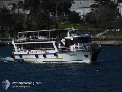
TURYOL-5
Passenger

Current Trip
| Trip Time | 1 h, 56 mins |
|---|---|
| Trip Distance | 16.74 nm |
| AVG Speed | 8.4 Knots |
| MAX Speed | 9.2 Knots |
| Draught | 0 m |
| AVG Wind | 10 knots |
| MAX Wind | 10 knots |
| MIN Temp | 3.9°C / 39.02°F |
| MAX Temp | 4.8°C / 40.64°F |
| Position Received | 3 d ago |
Current Position
| Longitude | 29.28749° |
|---|---|
| Latitude | 40.85507° |
| Status | Default |
| Speed | |
| Course | --- |
| Area | Sea of Marmara |
| Station | T-AIS |
| Position Received | 3 d ago |
Information
The current position of TURYOL-5 is in Sea of Marmara with coordinates 40.85507° / 29.28749° as reported on 2025-04-11 11:12 by AIS to our vessel tracker app. The vessel's current speed is 0 Knots and is currently inside the port of TUZLA.
The vessel TURYOL-5 (MMSI: 271010290) is a Passenger It's sailing under the flag of [TR] Turkey.
In this page you can find informations about the vessels current position, last detected port calls, and current voyage information. If the vessels is not in coverage by AIS you will find the latest position.
The current position of TURYOL-5 is detected by our AIS receivers and we are not responsible for the reliability of the data. The last position was recorded while the vessel was in Coverage by the Ais receivers of our vessel tracking app.
Weather
| Temperature | 5.8°C / 42.44°F |
|---|---|
| Wind Speed | 15 knots |
| Direction | 256° WSW |
| Pressure | 1017 hPa |
| Humidity | 45.9 % |
| Cloud Coverage | 77 % |


Featured Company
Last Port Calls
| Port | Arrival | Departure | Time In Port |
|---|---|---|---|
| 2025-04-11 10:28 | |||
| 2025-04-11 08:32 | |||
| 2025-04-09 10:30 | |||
| 2025-04-09 10:30 | |||
| 2025-04-09 09:45 | |||
| 2025-04-05 17:26 | 2025-04-09 09:37 | 3 d | |
| 2025-04-05 09:41 | |||
| 2025-04-01 09:03 | |||
| 2025-04-01 09:03 | |||
| 2025-04-01 08:19 |
Most Visited Ports (Last year)
| Port | Arrivals | |
|---|---|---|
| 72 | ||
| 20 | ||
| 1 | ||
| 1 |
Last Trips
| Origin | Departure | Destination | Arrival | Distance | |
|---|---|---|---|---|---|
| 2025-04-11 08:32 | 2025-04-11 10:28 | 16.74 nm | |||
| 2025-04-09 09:37 | 2025-04-09 10:30 | 2.76 nm | |||
| 2025-04-09 09:37 | 2025-04-09 09:45 | 1.16 nm | |||
| 2025-04-05 09:41 | 2025-04-05 17:26 | 21.18 nm | |||
| 2025-04-01 08:11 | 2025-04-01 09:03 | 2.98 nm | |||
| 2025-04-01 08:11 | 2025-04-01 08:19 | 1.11 nm | |||
| 2025-03-29 11:25 | 2025-03-29 15:40 | 20.32 nm | |||
| 2025-03-25 10:10 | 2025-03-25 10:50 | 2.58 nm | |||
| 2025-03-25 10:10 | 2025-03-25 10:21 | 1.24 nm | |||
| 2025-03-16 18:03 | 2025-03-16 18:06 | 0.58 nm |
Events
| Time | Event | Details | Position / Dest | Info |
|---|---|---|---|---|
| 2025-04-11 11:12 | OUT of Coverage |
40.85507 / 29.28749
Sea of Marmara
[TR] TUZLA
|
Speed: Course: 35.1° |
|
| 2025-04-11 07:42 | STOP Moving |
40.85470 / 29.28687
[TR] TUZLA
|
Speed: Course: 511° |
|
| 2025-04-11 07:28 | PORT ARRIVAL |
|
40.85197 / 29.28024
[TR] TUZLA
|
Speed: 8.4 kn Course: 88° |
| 2025-04-11 05:32 | PORT DEPARTURE |
|
41.00651 / 29.00072
|
Speed: 9.9 kn Course: 155° |
| 2025-04-11 05:19 | START Moving |
41.02058 / 28.96951
[TR] ISTANBUL
|
Speed: 8.3 kn Course: 79.9° |
|
| 2025-04-11 05:03 | IN Coverage |
41.01980 / 28.96681
Sea of Marmara
[TR] ISTANBUL
|
Speed: Course: 353° |
|
| 2025-04-10 15:21 | OUT of Coverage |
41.01969 / 28.96681
Sea of Marmara
[TR] ISTANBUL
|
Speed: Course: 0° |
|
| 2025-04-10 11:57 | IN Coverage |
41.01969 / 28.96685
Sea of Marmara
[TR] ISTANBUL
|
Speed: Course: 0° |
|
| 2025-04-10 10:33 | OUT of Coverage |
41.01968 / 28.96681
Sea of Marmara
[TR] ISTANBUL
|
Speed: Course: 188.1° |
|
| 2025-04-10 09:07 | IN Coverage |
41.01966 / 28.96681
Sea of Marmara
[TR] ISTANBUL
|
Speed: 0.1 kn Course: 126.9° |