
TX27 BONA FIDE
Fishing
Current Trip
| Trip Time | 1 day |
|---|---|
| Trip Distance | 118.45 nm |
| AVG Speed | 3.9 Knots |
| MAX Speed | 10.1 Knots |
| Draught | 0 m |
| AVG Wind | 15.5 knots |
| MAX Wind | 23 knots |
| MIN Temp | 3.3°C / 37.94°F |
| MAX Temp | 4.7°C / 40.46°F |
| Position Received | 1 m ago |
Current Position
| Longitude | 4.85187° |
|---|---|
| Latitude | 53.03966° |
| Status | Engaged in Fishing |
| Speed | 3.6 Knots |
| Course | 353° |
| Area | North Sea |
| Station | T-AIS |
| Position Received | 1 m ago |
Info
Information
The current position of TX27 BONA FIDE is in North Sea with coordinates 53.03966° / 4.85187° as reported on 2026-01-06 07:46 by AIS to our vessel tracker app. The vessel's current speed is 3.6 Knots and is currently inside the port of OUDESCHILD.
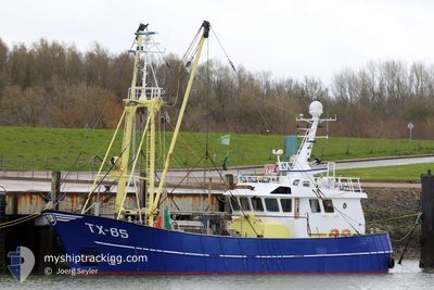
The vessel TX27 BONA FIDE (IMO: 9845398, MMSI: 244013121) is a Fishing It's sailing under the flag of [NL] Netherlands.
In this page you can find informations about the vessels current position, last detected port calls, and current voyage information. If the vessels is not in coverage by AIS you will find the latest position.
The current position of TX27 BONA FIDE is detected by our AIS receivers and we are not responsible for the reliability of the data. The last position was recorded while the vessel was in Coverage by the Ais receivers of our vessel tracking app.
Weather
| Temperature | 4.5°C / 40.1°F |
|---|---|
| Wind Speed | 10 knots |
| Direction | 262° W |
| Pressure | 1013 hPa |
| Humidity | 62.1 % |
| Cloud Coverage | 16 % |
Featured Company
Last Port Calls
| Port | Arrival | Departure | Time In Port |
|---|---|---|---|
| 2026-01-06 08:45 | |||
| 2025-12-10 10:36 | 2026-01-05 00:01 | 25 d | |
| 2025-12-10 08:02 | 2025-12-10 10:00 | 1 h | |
| 2025-12-06 08:11 | 2025-12-07 23:48 | 1 d | |
| 2025-12-06 04:56 | 2025-12-06 07:38 | 2 h | |
| 2025-12-05 09:08 | |||
| 2025-11-24 17:46 | 2025-11-24 20:34 | 2 h | |
| 2025-11-19 22:41 | 2025-11-24 15:17 | 4 d | |
| 2025-11-14 04:29 | 2025-11-14 10:39 | 6 h | |
| 2025-11-06 09:06 | 2025-11-10 14:27 | 4 d |
Most Visited Ports (Last year)
| Port | Arrivals | |
|---|---|---|
| 40 | ||
| 13 | ||
| 6 | ||
| 2 | ||
| 2 | ||
| 1 |
Last Trips
| Origin | Departure | Destination | Arrival | Distance | |
|---|---|---|---|---|---|
| 2026-01-05 00:01 | 2026-01-06 08:45 | 118.45 nm | |||
| 2025-12-10 10:00 | 2025-12-10 10:36 | 5.52 nm | |||
| 2025-12-07 23:48 | 2025-12-10 08:02 | 190.61 nm | |||
| 2025-12-06 07:38 | 2025-12-06 08:11 | 5.55 nm | |||
| 2025-12-05 09:08 | 2025-12-06 04:56 | 118.70 nm | |||
| 2025-11-24 15:17 | 2025-11-24 17:46 | 12.68 nm | |||
| 2025-11-14 10:39 | 2025-11-19 22:41 | 15.75 nm | |||
| 2025-11-10 14:27 | 2025-11-14 04:29 | 24.06 nm | |||
| 2025-11-04 12:52 | 2025-11-06 09:06 | 101.46 nm | |||
| 2025-10-29 06:23 | 2025-11-03 10:27 | 407.12 nm |
Events
| Time | Event | Details | Position / Dest | Info |
|---|---|---|---|---|
| 2026-01-06 07:45 | PORT ARRIVAL |
|
53.03905 / 4.85338
[NL] OUDESCHILD
|
Speed: 4.6 kn Course: 289° |
| 2026-01-06 06:55 | START Moving | 5.02 nm, East of OUDESCHILD |
53.07299 / 4.98331
VISGRONDEN
|
Speed: 6.1 kn Course: 248° |
| 2026-01-06 06:53 | STOP Moving | 5.13 nm, East of OUDESCHILD |
53.07335 / 4.98640
VISGRONDEN
|
Speed: 0.2 kn Course: 284° |
| 2026-01-06 04:42 | START Moving | 3.17 nm, North East of OUDESCHILD |
53.07285 / 4.92577
VISGRONDEN
|
Speed: 3.1 kn Course: 238° |
| 2026-01-06 04:33 | STOP Moving | 3.05 nm, North East of OUDESCHILD |
53.07373 / 4.92061
VISGRONDEN
|
Speed: 0.2 kn Course: 95° |
| 2026-01-06 02:08 | START Moving | 2.73 nm, North East of OUDESCHILD |
53.07138 / 4.91219
VISGRONDEN
|
Speed: 4.6 kn Course: 39° |
| 2026-01-06 02:06 | STOP Moving | 2.62 nm, North East of OUDESCHILD |
53.07004 / 4.91001
VISGRONDEN
|
Speed: 0.3 kn Course: 46° |
| 2026-01-05 23:53 | START Moving | 4.78 nm, North East of OUDESCHILD |
53.07823 / 4.97233
VISGRONDEN
|
Speed: 4.3 kn Course: 85° |
| 2026-01-05 23:50 | STOP Moving | 4.7 nm, North East of OUDESCHILD |
53.07855 / 4.96932
VISGRONDEN
|
Speed: 0.3 kn Course: 75° |
| 2026-01-05 02:39 | START Moving | 6.43 nm, North East of DEN OEVER |
53.03427 / 5.11306
VISGRONDEN
|
Speed: 3.4 kn Course: 97° |