

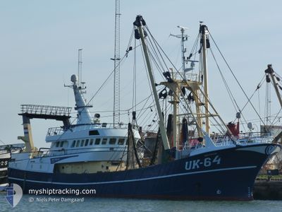
UK64 MATTANJA
Trawler

Current Trip
| Trip Time | 4 days |
|---|---|
| Trip Distance | 593.07 nm |
| AVG Speed | 8.3 Knots |
| MAX Speed | 11.7 Knots |
| Draught | 5.1 m |
| AVG Wind | 15.4 knots |
| MAX Wind | 30 knots |
| MIN Temp | 10.9°C / 51.62°F |
| MAX Temp | 14.8°C / 58.64°F |
| Position Received | 3 m ago |
Current Position
| Longitude | 8.22066° |
|---|---|
| Latitude | 56.70268° |
| Status | Under way using engine |
| Speed | |
| Course | 232° |
| Area | North Sea |
| Station | T-AIS |
| Position Received | 3 m ago |
Information
The current position of UK64 MATTANJA is in North Sea with coordinates 56.70268° / 8.22066° as reported on 2025-06-09 15:55 by AIS to our vessel tracker app. The vessel's current speed is 0 Knots and is currently inside the port of THYBORON.
The vessel UK64 MATTANJA (IMO: 8985165, MMSI: 245265000) is a Trawler that was built in 2004 ( 21 years old ). It's sailing under the flag of [NL] Netherlands.
In this page you can find informations about the vessels current position, last detected port calls, and current voyage information. If the vessels is not in coverage by AIS you will find the latest position.
The current position of UK64 MATTANJA is detected by our AIS receivers and we are not responsible for the reliability of the data. The last position was recorded while the vessel was in Coverage by the Ais receivers of our vessel tracking app.
The current draught of UK64 MATTANJA as reported by AIS is 5.1 meters
Weather
| Temperature | 12.6°C / 54.68°F |
|---|---|
| Wind Speed | 13 knots |
| Direction | 230° SW |
| Pressure | 1016.1 hPa |
| Humidity | 77.3 % |
| Cloud Coverage | 16 % |


Featured Company
Last Port Calls
| Port | Arrival | Departure | Time In Port |
|---|---|---|---|
| 2025-06-06 19:34 | |||
| 2025-05-27 16:32 | 2025-06-02 01:55 | 5 d | |
| 2025-05-24 16:26 | 2025-05-27 11:43 | 2 d | |
| 2025-05-21 19:34 | 2025-05-22 12:27 | 16 h | |
| 2025-05-16 14:50 | 2025-05-19 10:35 | 2 d | |
| 2025-05-09 21:54 | 2025-05-12 01:28 | 2 d | |
| 2025-05-01 16:27 | 2025-05-05 07:42 | 3 d | |
| 2025-04-26 20:22 | 2025-04-27 23:32 | 1 d | |
| 2025-04-18 09:40 | 2025-04-22 06:56 | 3 d | |
| 2025-04-15 21:47 | 2025-04-17 09:42 | 1 d |
Most Visited Ports (Last year)
| Port | Arrivals | |
|---|---|---|
| 25 | ||
| 24 | ||
| 4 | ||
| 1 | ||
| 1 |
Last Trips
| Origin | Departure | Destination | Arrival | Distance | |
|---|---|---|---|---|---|
| 2025-06-02 01:55 | 2025-06-06 19:34 | 593.07 nm | |||
| 2025-05-27 11:43 | 2025-05-27 16:32 | 41.29 nm | |||
| 2025-05-22 12:27 | 2025-05-24 16:26 | 409.79 nm | |||
| 2025-05-19 10:35 | 2025-05-21 19:34 | 353.31 nm | |||
| 2025-05-12 01:28 | 2025-05-16 14:50 | 672.18 nm | |||
| 2025-05-05 07:42 | 2025-05-09 21:54 | 728.84 nm | |||
| 2025-04-27 23:32 | 2025-05-01 16:27 | 513.00 nm | |||
| 2025-04-22 06:56 | 2025-04-26 20:22 | 683.38 nm | |||
| 2025-04-17 09:42 | 2025-04-18 09:40 | 169.29 nm | |||
| 2025-04-14 01:49 | 2025-04-15 21:47 | 275.80 nm |
Events
| Time | Event | Details | Position / Dest | Info |
|---|---|---|---|---|
| 2025-06-06 17:39 | STOP Moving |
56.70251 / 8.22069
[DK] THYBORON
|
Speed: 0.2 kn Course: 221° |
|
| 2025-06-06 17:34 | PORT ARRIVAL |
|
56.69992 / 8.22570
[DK] THYBORON
|
Speed: 5 kn Course: 258° |
| 2025-06-06 15:44 | IN Coverage |
56.89574 / 7.95723
North Sea
|
Speed: 10.3 kn Course: 139° |
|
| 2025-06-06 12:55 | OUT of Coverage |
57.10386 / 7.54970
North Sea
|
Speed: 6.3 kn Course: 85° |
|
| 2025-06-06 10:40 | IN Coverage |
57.00243 / 7.27580
North Sea
|
Speed: 6.7 kn Course: 307° |
|
| 2025-06-06 09:26 | OUT of Coverage |
57.11467 / 7.36428
North Sea
|
Speed: 7 kn Course: 84° |
|
| 2025-06-06 08:09 | IN Coverage |
57.00502 / 7.27564
North Sea
|
Speed: 6.7 kn Course: 313° |
|
| 2025-06-06 06:54 | OUT of Coverage |
57.09690 / 7.35394
North Sea
|
Speed: 6.2 kn Course: 118° |
|
| 2025-06-06 05:11 | IN Coverage |
57.06725 / 7.39569
North Sea
|
Speed: 6.3 kn Course: 95° |
|
| 2025-06-06 04:03 | OUT of Coverage |
57.05339 / 7.18711
North Sea
|
Speed: 7.5 kn Course: 128° |