
ULTRA TATIO
Cargo
Current Trip
| Trip Time | 1 day |
|---|---|
| Trip Distance | 7.73 nm |
| AVG Speed | 3.1 Knots |
| MAX Speed | 4.4 Knots |
| Draught | 10.6 m |
| AVG Wind | 7.2 knots |
| MAX Wind | 12.8 knots |
| MIN Temp | 12.9°C / 55.22°F |
| MAX Temp | 16.7°C / 62.06°F |
| Position Received | 7 d ago |
Current Position
| Longitude | -71.92032° |
|---|---|
| Latitude | -33.20681° |
| Status | Under way using engine |
| Speed | 10.7 Knots |
| Course | 158.1° |
| Area | South Pacific Ocean |
| Station | T-AIS |
| Position Received | 7 d ago |
Info
Information
The current position of ULTRA TATIO is in South Pacific Ocean with coordinates -33.20681° / -71.92032° as reported on 2025-02-13 06:50 by AIS to our vessel tracker app. The vessel's current speed is 10.7 Knots and is currently inside the port of SAN ANTONIO.
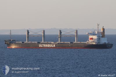
The vessel ULTRA TATIO (IMO: 9782986, MMSI: 538007122) is a Cargo It's sailing under the flag of [MH] Marshall Is.
In this page you can find informations about the vessels current position, last detected port calls, and current voyage information. If the vessels is not in coverage by AIS you will find the latest position.
The current position of ULTRA TATIO is detected by our AIS receivers and we are not responsible for the reliability of the data. The last position was recorded while the vessel was in Coverage by the Ais receivers of our vessel tracking app.
The current draught of ULTRA TATIO as reported by AIS is 10.6 meters
Weather
| Temperature | 20.3°C / 68.54°F |
|---|---|
| Wind Speed | 8 knots |
| Direction | 259° W |
| Pressure | 1014.3 hPa |
| Humidity | 58.2 % |
| Cloud Coverage | --- |
Featured Company
Last Port Calls
| Port | Arrival | Departure | Time In Port |
|---|---|---|---|
| 2025-02-18 06:24 | |||
| 2025-02-13 07:29 | 2025-02-16 22:31 | 3 d | |
| 2024-12-15 07:01 | 2024-12-21 18:02 | 6 d | |
| 2024-12-08 13:44 | 2024-12-11 17:40 | 3 d |
Last Trips
| Origin | Departure | Destination | Arrival | Distance | |
|---|---|---|---|---|---|
| 2025-02-16 22:31 | 2025-02-18 06:24 | 7.73 nm | |||
| 2024-12-21 18:02 | 2025-02-13 07:29 | 7581.33 nm | |||
| 2024-12-11 17:40 | 2024-12-15 07:01 | 424.46 nm | |||
| 2024-10-20 11:21 | 2024-12-08 13:44 | 1636.70 nm |
Events
| Time | Event | Details | Position / Dest | Info |
|---|---|---|---|---|
| 2025-02-18 09:37 | STOP Moving |
-33.58822 / -71.61842
[CL] SAN ANTONIO
|
Speed: 0.3 kn Course: 338° |
|
| 2025-02-18 09:24 | PORT ARRIVAL |
|
-33.58709 / -71.62035
[CL] SAN ANTONIO
|
Speed: 3.7 kn Course: 99° |
| 2025-02-18 08:20 | START Moving | 2.7 nm, West of SAN ANTONIO |
-33.60020 / -71.67149
CLSAI
|
Speed: 3.6 kn Course: 46° |
| 2025-02-17 02:55 | STOP Moving | 2.77 nm, South West of SAN ANTONIO |
-33.60755 / -71.66915
CLSAI
|
Speed: 0.3 kn Course: 319° |
| 2025-02-17 01:31 | PORT DEPARTURE |
|
-33.58379 / -71.62795
CLSAI
|
Speed: 3 kn Course: 264° |
| 2025-02-17 01:21 | START Moving |
-33.58878 / -71.62019
[CL] SAN ANTONIO
|
Speed: 3.7 kn Course: 345° |
|
| 2025-02-13 10:58 | STOP Moving |
-33.59406 / -71.61766
[CL] SAN ANTONIO
|
Speed: 0.3 kn Course: 348° |
|
| 2025-02-13 10:29 | PORT ARRIVAL |
|
-33.58633 / -71.62112
[CL] SAN ANTONIO
|
Speed: 3.8 kn Course: 100° |
| 2025-02-13 06:57 | Status Changed | Default Under way using engine |
-33.22517 / -71.91193
CLSAI
|
Speed: 10.7 kn Course: 158.1° |
| 2025-02-13 06:50 | OUT of Coverage |
-33.20681 / -71.92032
South Pacific Ocean
CLSAI
|
Speed: 10.7 kn Course: 158.1° |