
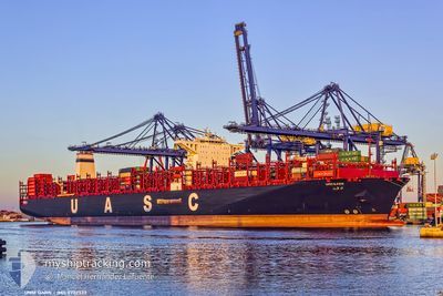
UMM QARN
Cargo A
Current Trip
| Time Travelled | 31 days |
|---|---|
| Remaining Time | 51 mins |
| Distance Travelled | 12653.76 nm |
| Remaining Distance | 71.30 nm |
| AVG Speed | 17 Knots |
| MAX Speed | 21.5 Knots |
| AVG Wind | 10.3 knots |
| MAX Wind | 38 knots |
| MIN Temp | 15.4°C / 59.72°F |
| MAX Temp | 28.7°C / 83.66°F |
| Draught | 15.9 m |
| Position Received | 3 d ago |
Current Position
| Longitude | 14.58445° |
|---|---|
| Latitude | 36.33850° |
| Status | Under way using engine |
| Speed | 12.8 Knots |
| Course | 110.3° |
| Area | Mediterranean Sea - Eastern Basin |
| Station | T-AIS |
| Position Received | 3 d ago |
Info
Information
The current position of UMM QARN is in Mediterranean Sea - Eastern Basin with coordinates 36.33850° / 14.58445° as reported on 2025-12-12 13:56 by AIS to our vessel tracker app. The vessel's current speed is 12.8 Knots and is heading at the port of PORT SAID. The estimated time of arrival as calculated by MyShipTracking vessel tracking app is 2025-12-15 23:47 LT
The vessel UMM QARN (IMO: 9732333, MMSI: 211882930) is a Cargo A It's sailing under the flag of [DE] Germany.
In this page you can find informations about the vessels current position, last detected port calls, and current voyage information. If the vessels is not in coverage by AIS you will find the latest position.
The current position of UMM QARN is detected by our AIS receivers and we are not responsible for the reliability of the data. The last position was recorded while the vessel was in Coverage by the Ais receivers of our vessel tracking app.
The current draught of UMM QARN as reported by AIS is 15.9 meters
Weather
| Temperature | 19.1°C / 66.38°F |
|---|---|
| Wind Speed | 16 knots |
| Direction | 302° WNW |
| Pressure | 1015.4 hPa |
| Humidity | 56.4 % |
| Cloud Coverage | 40 % |
Featured Company
Last Port Calls
| Port | Arrival | Departure | Time In Port |
|---|---|---|---|
| 2025-11-13 05:48 | 2025-11-14 21:09 | 1 d | |
| 2025-11-05 07:24 | 2025-11-06 19:44 | 1 d | |
| 2025-10-19 08:34 | 2025-10-22 03:06 | 2 d |
Most Visited Ports (Last year)
| Port | Arrivals | |
|---|---|---|
| 5 | ||
| 3 | ||
| 3 | ||
| 3 | ||
| 3 | ||
| 2 |
Events
| Time | Event | Details | Position / Dest | Info |
|---|---|---|---|---|
| 2025-12-12 14:01 | Status Changed | Default Under way using engine |
36.33299 / 14.60299
MY TPP>EG PSD
|
Speed: 12.8 kn Course: 110.3° |
| 2025-12-12 13:56 | OUT of Coverage |
36.33850 / 14.58445
Mediterranean Sea - Eastern Basin
MY TPP>EG PSD
|
Speed: 12.8 kn Course: 110.3° |
|
| 2025-12-12 13:02 | Status Changed | Under way using engine Default |
36.38601 / 14.35576
MY TPP>EG PSD
|
Speed: 12.9 kn Course: 101° |
| 2025-12-12 13:01 | Status Changed | Default Under way using engine |
36.38659 / 14.35219
MY TPP>EG PSD
|
Speed: 12.9 kn Course: 101.3° |
| 2025-12-12 12:41 | Status Changed | Under way using engine Default |
36.40495 / 14.26522
MY TPP>EG PSD
|
Speed: 13 kn Course: 105° |
| 2025-12-12 12:25 | Status Changed | Default Under way using engine |
36.41987 / 14.19654
MY TPP>EG PSD
|
Speed: 13 kn Course: 103.9° |
| 2025-12-12 12:04 | ETA Changed | 2025/12/15 23:00 2025/12/15 00:00 |
36.43843 / 14.10460
MY TPP>EG PSD
|
Speed: 12.7 kn Course: 103.8° |
| 2025-12-12 11:58 | Detected in Sea | Maltese part of the Mediterranean Sea - Eastern Basin |
36.44395 / 14.07680
Mediterranean Sea - Eastern Basin
MY TPP>EG PSD
|
Speed: 12.7 kn Course: 103.9° |
| 2025-12-12 11:56 | Status Changed | Under way using engine Default |
36.44570 / 14.06823
MY TPP>EG PSD
|
Speed: 12.9 kn Course: 104° |
| 2025-12-12 11:56 | IN Coverage |
36.44395 / 14.07680
Mediterranean Sea - Eastern Basin
MY TPP>EG PSD
|
Speed: 12.7 kn Course: 103.9° |