
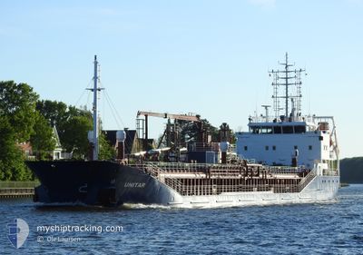
UNITAR
General Cargo
Current Trip
| Time Travelled | 1 day |
|---|---|
| Remaining Time | 19 h, 46 mins |
| Distance Travelled | 326.51 nm |
| Remaining Distance | 171.64 nm |
| AVG Speed | 8 Knots |
| MAX Speed | 14.6 Knots |
| AVG Wind | 7.6 knots |
| MAX Wind | 26 knots |
| MIN Temp | -0.2°C / 31.64°F |
| MAX Temp | 6.8°C / 44.24°F |
| Draught | 5.2 m |
| Position Received | 1 h, 49 m ago |
Current Position
| Longitude | 4.23654° |
|---|---|
| Latitude | 53.10177° |
| Status | Under way using engine |
| Speed | 6.7 Knots |
| Course | 232.1° |
| Area | North Sea |
| Station | T-AIS |
| Position Received | 1 h, 49 m ago |
Info
Information
The current position of UNITAR is in North Sea with coordinates 53.10177° / 4.23654° as reported on 2025-02-04 18:23 by AIS to our vessel tracker app. The vessel's current speed is 6.7 Knots and is heading at the port of DUNKERQUE. The estimated time of arrival as calculated by MyShipTracking vessel tracking app is 2025-02-05 15:59 LT
The vessel UNITAR (IMO: 9505687, MMSI: 257364000) is a General Cargo that was built in 2009 ( 16 years old ). It's sailing under the flag of [NO] Norway.
In this page you can find informations about the vessels current position, last detected port calls, and current voyage information. If the vessels is not in coverage by AIS you will find the latest position.
The current position of UNITAR is detected by our AIS receivers and we are not responsible for the reliability of the data. The last position was recorded while the vessel was in Coverage by the Ais receivers of our vessel tracking app.
The current draught of UNITAR as reported by AIS is 5.2 meters
Weather
| Temperature | 7.7°C / 45.86°F |
|---|---|
| Wind Speed | 24 knots |
| Direction | 211° SSW |
| Pressure | 1022.9 hPa |
| Humidity | 88.8 % |
| Cloud Coverage | 100 % |
Featured Company
Last Port Calls
| Port | Arrival | Departure | Time In Port |
|---|---|---|---|
| 2025-02-02 11:34 | 2025-02-03 02:07 | 14 h | |
| 2025-02-01 07:12 | 2025-02-01 17:53 | 10 h | |
| 2025-01-30 04:57 | 2025-01-31 12:28 | 1 d | |
| 2025-01-27 03:41 | 2025-01-27 04:10 | 29 m | |
| 2025-01-26 02:11 | 2025-01-27 03:38 | 1 d | |
| 2025-01-26 01:21 | 2025-01-26 01:55 | 34 m | |
| 2025-01-23 18:09 | 2025-01-23 18:49 | 40 m | |
| 2025-01-22 19:33 | 2025-01-23 09:12 | 13 h | |
| 2025-01-22 11:52 | 2025-01-22 11:55 | 3 m | |
| 2025-01-18 16:44 | 2025-01-20 06:07 | 1 d |
Last Trips
| Origin | Departure | Destination | Arrival | Distance | |
|---|---|---|---|---|---|
| 2025-02-01 18:53 | 2025-02-02 12:34 | 158.49 nm | |||
| 2025-01-31 13:28 | 2025-02-01 08:12 | 157.46 nm | |||
| 2025-01-27 04:10 | 2025-01-30 05:57 | 636.26 nm | |||
| 2025-01-27 03:38 | 2025-01-27 03:41 | 0.31 nm | |||
| 2025-01-26 01:55 | 2025-01-26 02:11 | 0.34 nm | |||
| 2025-01-23 19:49 | 2025-01-26 01:21 | 429.56 nm | |||
| 2025-01-23 10:12 | 2025-01-23 19:09 | 77.85 nm | |||
| 2025-01-22 12:55 | 2025-01-22 20:33 | 76.06 nm | |||
| 2025-01-20 07:07 | 2025-01-22 12:52 | 434.40 nm | |||
| 2025-01-17 18:26 | 2025-01-18 17:44 | 181.31 nm |
Events
| Time | Event | Details | Position / Dest | Info |
|---|---|---|---|---|
| 2025-02-04 18:26 | Status Changed | Default Under way using engine |
53.09850 / 4.22961
FRDKK
|
Speed: 6.7 kn Course: 232.1° |
| 2025-02-04 18:23 | OUT of Coverage |
53.10177 / 4.23654
North Sea
FRDKK
|
Speed: 6.7 kn Course: 232.1° |
|
| 2025-02-04 18:11 | Status Changed | Under way using engine Default |
53.11536 / 4.26508
FRDKK
|
Speed: 7.1 kn Course: 231° |
| 2025-02-04 18:09 | Status Changed | Default Under way using engine |
53.11749 / 4.26949
FRDKK
|
Speed: 7.2 kn Course: 232.2° |
| 2025-02-04 17:25 | Status Changed | Under way using engine Default |
53.17378 / 4.38925
FRDKK
|
Speed: 8.2 kn Course: 201° |
| 2025-02-04 17:25 | IN Coverage |
53.17378 / 4.38925
North Sea
FRDKK
|
Speed: 7.6 kn Course: 215.2° |
|
| 2025-02-04 14:27 | Status Changed | Default Under way using engine |
53.50446 / 4.77875
FRDKK
|
Speed: 8.9 kn Course: 250° |
| 2025-02-04 14:25 | OUT of Coverage |
53.50595 / 4.78525
North Sea
FRDKK
|
Speed: 8.9 kn Course: 250° |
|
| 2025-02-04 12:34 | Status Changed | Under way using engine Default |
53.60016 / 5.22409
FRDKK
|
Speed: 8.5 kn Course: 253° |
| 2025-02-04 12:33 | Status Changed | Default Under way using engine |
53.60050 / 5.22593
FRDKK
|
Speed: 8.5 kn Course: 252° |