
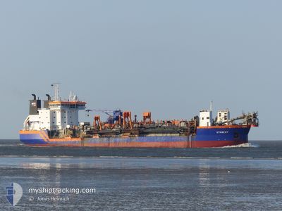
UTRECHT
Trailing Suction Hopper Dredger
Current Trip
| Time Travelled | 3 h, 21 mins |
|---|---|
| Remaining Time | --- |
| Distance Travelled | 16.91 nm |
| Remaining Distance | --- |
| AVG Speed | 11.2 Knots |
| MAX Speed | 13 Knots |
| AVG Wind | 1.9 knots |
| MAX Wind | 6 knots |
| MIN Temp | 24.7°C / 76.46°F |
| MAX Temp | 25.5°C / 77.9°F |
| Draught | 7.3 m |
| Position Received | 3 h, 8 m ago |
Current Position
| Longitude | -46.33740° |
|---|---|
| Latitude | -24.05387° |
| Status | Under way using engine |
| Speed | 11.8 Knots |
| Course | 168° |
| Area | South Atlantic Ocean |
| Station | T-AIS |
| Position Received | 3 h, 8 m ago |
Info
Information
The current position of UTRECHT is in South Atlantic Ocean with coordinates -24.05387° / -46.33740° as reported on 2025-03-12 21:37 by AIS to our vessel tracker app. The vessel's current speed is 11.8 Knots
The vessel UTRECHT (IMO: 9125956, MMSI: 245601000) is a Trailing Suction Hopper Dredger that was built in 1996 ( 29 years old ). It's sailing under the flag of [NL] Netherlands.
In this page you can find informations about the vessels current position, last detected port calls, and current voyage information. If the vessels is not in coverage by AIS you will find the latest position.
The current position of UTRECHT is detected by our AIS receivers and we are not responsible for the reliability of the data. The last position was recorded while the vessel was in Coverage by the Ais receivers of our vessel tracking app.
The current draught of UTRECHT as reported by AIS is 7.3 meters
Weather
| Temperature | 25.3°C / 77.54°F |
|---|---|
| Wind Speed | 7 knots |
| Direction | 53° NE |
| Pressure | 1015.7 hPa |
| Humidity | 90.4 % |
| Cloud Coverage | 89 % |
Featured Company
Last Port Calls
| Port | Arrival | Departure | Time In Port |
|---|---|---|---|
| 2025-03-12 15:30 | 2025-03-12 21:25 | 5 h | |
| 2025-03-12 11:46 | 2025-03-12 14:03 | 2 h | |
| 2025-03-12 07:17 | 2025-03-12 10:25 | 3 h | |
| 2025-03-12 04:51 | 2025-03-12 05:42 | 50 m | |
| 2025-03-12 01:05 | 2025-03-12 01:52 | 47 m | |
| 2025-03-11 22:46 | 2025-03-11 23:33 | 47 m | |
| 2025-03-11 18:20 | 2025-03-11 19:40 | 1 h | |
| 2025-03-11 15:53 | 2025-03-11 16:44 | 51 m | |
| 2025-03-11 12:26 | 2025-03-11 13:16 | 49 m | |
| 2025-03-11 10:15 | 2025-03-11 11:06 | 50 m |
Most Visited Ports (Last year)
| Port | Arrivals | |
|---|---|---|
| 356 | ||
| 35 | ||
| 23 | ||
| 6 | ||
| 1 |
Last Trips
| Origin | Departure | Destination | Arrival | Distance | |
|---|---|---|---|---|---|
| 2025-03-12 11:03 | 2025-03-12 12:30 | 13.26 nm | |||
| 2025-03-12 07:25 | 2025-03-12 08:46 | 13.19 nm | |||
| 2025-03-12 02:42 | 2025-03-12 04:17 | 14.95 nm | |||
| 2025-03-11 22:52 | 2025-03-12 01:51 | 10.12 nm | |||
| 2025-03-11 20:33 | 2025-03-11 22:05 | 15.75 nm | |||
| 2025-03-11 16:40 | 2025-03-11 19:46 | 9.21 nm | |||
| 2025-03-11 13:44 | 2025-03-11 15:20 | 15.79 nm | |||
| 2025-03-11 10:16 | 2025-03-11 12:53 | 9.34 nm | |||
| 2025-03-11 08:06 | 2025-03-11 09:26 | 13.99 nm | |||
| 2025-03-11 04:49 | 2025-03-11 07:15 | 9.47 nm |
Events
| Time | Event | Details | Position / Dest | Info |
|---|---|---|---|---|
| 2025-03-12 23:26 | START Moving | 8.66 nm, South of SANTOS |
-24.11218 / -46.32427
BR SSZ
|
Speed: 3.1 kn Course: 167° |
| 2025-03-12 22:06 | STOP Moving | 8.59 nm, South of SANTOS |
-24.11088 / -46.32817
BR SSZ
|
Speed: 0.2 kn Course: 191° |
| 2025-03-12 21:42 | Status Changed | Default Under way using engine |
-24.06735 / -46.33427
BR SSZ
|
Speed: 11.8 kn Course: 168° |
| 2025-03-12 21:37 | OUT of Coverage |
-24.05387 / -46.33740
South Atlantic Ocean
|
Speed: 11.8 kn Course: 168° |
|
| 2025-03-12 21:25 | PORT DEPARTURE |
|
-24.01537 / -46.34013
BR SSZ
|
Speed: 11.4 kn Course: 220° |
| 2025-03-12 21:16 | Status Changed | Under way using engine Default |
-23.99205 / -46.32178
[BR] SANTOS
|
Speed: 12.1 kn Course: 280° |
| 2025-03-12 21:14 | Status Changed | Default Under way using engine |
-23.99212 / -46.31495
[BR] SANTOS
|
Speed: 9.7 kn Course: 226° |
| 2025-03-12 21:00 | START Moving |
-23.97402 / -46.29260
[BR] SANTOS
|
Speed: 6 kn Course: 134° |
|
| 2025-03-12 18:48 | STOP Moving |
-23.97218 / -46.29413
[BR] SANTOS
|
Speed: 0.3 kn Course: 146° |
|
| 2025-03-12 17:59 | START Moving |
-23.95833 / -46.30177
[BR] SANTOS
|
Speed: 3.6 kn Course: 299° |