
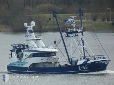
VAN EYCK Z53
Fishing
Current Trip
Unknown
| Time Travelled | 4 days |
|---|---|
| Remaining Time | --- |
| Distance Travelled | 429.15 nm |
| Remaining Distance | --- |
| AVG Speed | 4.6 Knots |
| MAX Speed | 11 Knots |
| AVG Wind | 20.8 knots |
| MAX Wind | 29 knots |
| MIN Temp | 4.5°C / 40.1°F |
| MAX Temp | 8.4°C / 47.12°F |
| Draught | 0 m |
| Position Received | 9 m ago |
Current Position
| Longitude | -0.51861° |
|---|---|
| Latitude | 49.97798° |
| Status | Engaged in Fishing |
| Speed | 4.6 Knots |
| Course | 266° |
| Area | English Channel |
| Station | T-AIS |
| Position Received | 9 m ago |
Info
Information
The current position of VAN EYCK Z53 is in English Channel with coordinates 49.97798° / -0.51861° as reported on 2025-02-11 01:01 by AIS to our vessel tracker app. The vessel's current speed is 4.6 Knots
The vessel VAN EYCK Z53 (IMO: 9982407, MMSI: 205166000) is a Fishing It's sailing under the flag of [BE] Belgium.
In this page you can find informations about the vessels current position, last detected port calls, and current voyage information. If the vessels is not in coverage by AIS you will find the latest position.
The current position of VAN EYCK Z53 is detected by our AIS receivers and we are not responsible for the reliability of the data. The last position was recorded while the vessel was in Coverage by the Ais receivers of our vessel tracking app.
Weather
| Temperature | 5.4°C / 41.72°F |
|---|---|
| Wind Speed | 12 knots |
| Direction | 356° N |
| Pressure | 1019.5 hPa |
| Humidity | 78.3 % |
| Cloud Coverage | 100 % |
Featured Company
Last Port Calls
| Port | Arrival | Departure | Time In Port |
|---|---|---|---|
| 2025-02-05 00:07 | 2025-02-06 15:51 | 1 d | |
| 2025-01-20 06:11 | 2025-02-04 18:01 | 15 d | |
| 2025-01-19 19:07 | 2025-01-20 00:42 | 5 h | |
| 2025-01-14 12:55 | 2025-01-14 22:51 | 9 h | |
| 2025-01-09 14:48 | 2025-01-09 17:36 | 2 h | |
| 2025-01-05 13:24 | 2025-01-06 13:17 | 23 h | |
| 2025-01-02 15:58 | 2025-01-02 17:41 | 1 h | |
| 2024-12-31 09:00 | 2025-01-02 13:53 | 2 d | |
| 2024-12-22 05:41 | 2024-12-28 00:14 | 5 d | |
| 2024-12-19 11:05 | 2024-12-19 16:36 | 5 h |
Last Trips
| Origin | Departure | Destination | Arrival | Distance | |
|---|---|---|---|---|---|
| 2025-02-04 19:01 | 2025-02-05 01:07 | 54.03 nm | |||
| 2025-01-20 01:42 | 2025-01-20 07:11 | 51.94 nm | |||
| 2025-01-14 23:51 | 2025-01-19 20:07 | 464.16 nm | |||
| 2025-01-09 18:36 | 2025-01-14 13:55 | 311.24 nm | |||
| 2025-01-06 14:17 | 2025-01-09 15:48 | 235.63 nm | |||
| 2025-01-02 18:41 | 2025-01-05 14:24 | 235.77 nm | |||
| 2025-01-02 14:53 | 2025-01-02 16:58 | 16.30 nm | |||
| 2024-12-28 01:14 | 2024-12-31 10:00 | 261.94 nm | |||
| 2024-12-19 17:36 | 2024-12-22 06:41 | 197.42 nm | |||
| 2024-12-16 03:38 | 2024-12-19 12:05 | 320.77 nm |
Events
| Time | Event | Details | Position / Dest | Info |
|---|---|---|---|---|
| 2025-02-11 00:23 | IN Coverage |
49.98086 / -.49093
English Channel
|
Speed: 3.8 kn Course: 87° |
|
| 2025-02-10 15:22 | OUT of Coverage |
50.01477 / -.34342
English Channel
|
Speed: 4.7 kn Course: 244.7° |
|
| 2025-02-10 13:49 | IN Coverage |
50.07146 / -.24843
English Channel
|
Speed: 6.3 kn Course: 292.5° |
|
| 2025-02-10 12:32 | OUT of Coverage |
50.07571 / -.23651
English Channel
|
Speed: 4.6 kn Course: 224° |
|
| 2025-02-10 10:58 | Detected in Sea | French part of the English Channel |
50.17542 / -.16584
English Channel
|
Speed: 3.4 kn Course: 220.2° |
| 2025-02-10 08:56 | IN Coverage |
50.29596 / -.04364
English Channel
|
Speed: 4.4 kn Course: 190.5° |
|
| 2025-02-10 07:31 | OUT of Coverage |
50.37636 / -.04950
English Channel
|
Speed: 3.8 kn Course: 160.9° |
|
| 2025-02-09 16:54 | IN Coverage |
50.38483 / -.10220
English Channel
|
Speed: 4.5 kn Course: 358.8° |
|
| 2025-02-09 12:01 | OUT of Coverage |
50.31667 / -.02632
English Channel
|
Speed: 4.5 kn Course: 177.1° |
|
| 2025-02-09 05:25 | START Moving | 20.61 nm, South of BRIGHTON MARINA |
50.46979 / -.17152
|
Speed: 5 kn Course: 179.4° |