
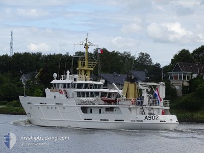
VAN KINSBERGEN
Naval Patrol Vessel
Current Trip
Current Position
| Longitude | 10.14555° |
|---|---|
| Latitude | 54.36084° |
| Status | Moored |
| Speed | |
| Course | 203° |
| Area | Baltic Sea |
| Station | T-AIS |
| Position Received | 2 m ago |
Info
Information
The current position of VAN KINSBERGEN is in Baltic Sea with coordinates 54.36084° / 10.14555° as reported on 2025-02-05 17:26 by AIS to our vessel tracker app. The vessel's current speed is 0 Knots and is currently inside the port of KIEL.
The vessel VAN KINSBERGEN (IMO: 9201578, MMSI: 244736000) is a Naval Patrol Vessel that was built in 1999 ( 26 years old ). It's sailing under the flag of [NL] Netherlands.
In this page you can find informations about the vessels current position, last detected port calls, and current voyage information. If the vessels is not in coverage by AIS you will find the latest position.
The current position of VAN KINSBERGEN is detected by our AIS receivers and we are not responsible for the reliability of the data. The last position was recorded while the vessel was in Coverage by the Ais receivers of our vessel tracking app.
The current draught of VAN KINSBERGEN as reported by AIS is 3.4 meters
Weather
| Temperature | 3.1°C / 37.58°F |
|---|---|
| Wind Speed | 6 knots |
| Direction | 250° WSW |
| Pressure | 1037 hPa |
| Humidity | 95.1 % |
| Cloud Coverage | 53 % |
Featured Company
Most Visited Ports (Last year)
| Port | Arrivals | |
|---|---|---|
| 33 | ||
| 13 | ||
| 6 | ||
| 6 | ||
| 4 | ||
| 3 |
Last Trips
| Origin | Departure | Destination | Arrival | Distance | |
|---|---|---|---|---|---|
| 2025-02-02 10:20 | 2025-02-04 15:54 | 460.68 nm | |||
| 2025-01-30 10:24 | 2025-02-01 09:41 | 351.03 nm | |||
| 2025-01-26 10:28 | 2025-01-28 15:51 | 427.03 nm | |||
| 2025-01-23 19:39 | 2025-01-25 09:53 | 364.65 nm | |||
| 2025-01-22 13:31 | 2025-01-23 19:35 | 264.42 nm |
Events
| Time | Event | Details | Position / Dest | Info |
|---|---|---|---|---|
| 2025-02-05 02:11 | Status Changed | Moored Default |
54.36083 / 10.14555
[DE] KIEL
|
Speed: Course: 203° |
| 2025-02-05 02:08 | Status Changed | Default Moored |
54.36082 / 10.14555
[DE] KIEL
|
Speed: Course: 203° |
| 2025-02-04 15:23 | Status Changed | Moored Under way using engine |
54.36059 / 10.14533
[DE] KIEL
|
Speed: Course: 204° |
| 2025-02-04 15:07 | STOP Moving |
54.35966 / 10.14640
[DE] KIEL
|
Speed: 0.3 kn Course: 192° |
|
| 2025-02-04 14:54 | PORT ARRIVAL |
|
54.36256 / 10.16660
[DE] KIEL
|
Speed: 9.6 kn Course: 208.9° |
| 2025-02-04 12:47 | Change Sea Area | German part of the Baltic Sea Danish part of the Baltic Sea |
54.56670 / 10.55060
Baltic Sea
|
Speed: 8.8 kn Course: 246.1° |
| 2025-02-04 10:56 | Change Sea Area | Danish part of the Baltic Sea Danish part of the Kattegat |
54.74058 / 10.85864
Baltic Sea
|
Speed: 9.3 kn Course: 180.3° |
| 2025-02-04 10:52 | ETA Changed | 2025/04/02 15:00 2025/02/04 04:30 |
54.75169 / 10.85857
DEKEL
|
Speed: 9.3 kn Course: 179.3° |
| 2025-02-03 23:43 | ETA Changed | 2025/02/04 04:30 2025/02/03 09:30 |
55.06532 / 11.26059
SAMSO
|
Speed: 10.1 kn Course: 186.5° |
| 2025-02-03 23:22 | Destination Changed | SAMSO AGERSO SUND |
55.12297 / 11.27397
SAMSO
|
Speed: 9.7 kn Course: 184.6° |