
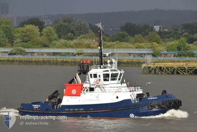
VB BENELUX
Tug
Current Trip
HARB0UR TOWAGE
| Time Travelled | 7 h, 51 mins |
|---|---|
| Remaining Time | --- |
| Distance Travelled | 5.12 nm |
| Remaining Distance | --- |
| AVG Speed | 10.5 Knots |
| MAX Speed | 11 Knots |
| AVG Wind | 7.1 knots |
| MAX Wind | 8.8 knots |
| MIN Temp | 1.5°C / 34.7°F |
| MAX Temp | 3.5°C / 38.3°F |
| Draught | 5.7 m |
| Position Received | Now |
Current Position
| Longitude | 0.42219° |
|---|---|
| Latitude | 51.44710° |
| Status | At anchor |
| Speed | |
| Course | 266° |
| Area | North Sea |
| Station | T-AIS |
| Position Received | Now |
Info
Information
The current position of VB BENELUX is in North Sea with coordinates 51.44710° / 0.42219° as reported on 2025-02-15 10:01 by AIS to our vessel tracker app. The vessel's current speed is 0 Knots
The vessel VB BENELUX (IMO: 9547867, MMSI: 232058017) is a Tug that was built in 2010 ( 15 years old ). It's sailing under the flag of [GB] United Kingdom.
In this page you can find informations about the vessels current position, last detected port calls, and current voyage information. If the vessels is not in coverage by AIS you will find the latest position.
The current position of VB BENELUX is detected by our AIS receivers and we are not responsible for the reliability of the data. The last position was recorded while the vessel was in Coverage by the Ais receivers of our vessel tracking app.
The current draught of VB BENELUX as reported by AIS is 5.7 meters
Weather
| Temperature | 3.7°C / 38.66°F |
|---|---|
| Wind Speed | 9 knots |
| Direction | 155° SSE |
| Pressure | 1021.2 hPa |
| Humidity | 72.3 % |
| Cloud Coverage | 100 % |
Featured Company
Last Port Calls
| Port | Arrival | Departure | Time In Port |
|---|---|---|---|
| 2025-02-15 00:59 | 2025-02-15 02:11 | 1 h | |
| 2025-02-14 15:50 | 2025-02-14 16:21 | 30 m | |
| 2025-02-14 12:47 | 2025-02-14 14:16 | 1 h | |
| 2025-02-14 03:03 | 2025-02-14 03:55 | 52 m | |
| 2025-02-13 21:40 | 2025-02-13 23:10 | 1 h | |
| 2025-02-13 14:17 | 2025-02-13 20:25 | 6 h | |
| 2025-02-13 03:47 | 2025-02-13 14:01 | 10 h | |
| 2025-02-12 21:36 | 2025-02-13 02:56 | 5 h | |
| 2025-02-12 21:01 | 2025-02-12 21:08 | 7 m | |
| 2025-02-12 16:04 | 2025-02-12 20:52 | 4 h |
Most Visited Ports (Last year)
| Port | Arrivals | |
|---|---|---|
| 173 | ||
| 102 | ||
| 51 | ||
| 34 | ||
| 32 | ||
| 18 |
Last Trips
| Origin | Departure | Destination | Arrival | Distance | |
|---|---|---|---|---|---|
| 2025-02-14 16:21 | 2025-02-15 00:59 | 18.10 nm | |||
| 2025-02-14 14:16 | 2025-02-14 15:50 | 9.78 nm | |||
| 2025-02-14 03:55 | 2025-02-14 12:47 | 13.20 nm | |||
| 2025-02-13 23:10 | 2025-02-14 03:03 | 14.87 nm | |||
| 2025-02-13 20:25 | 2025-02-13 21:40 | 6.19 nm | |||
| 2025-02-13 14:01 | 2025-02-13 14:17 | 1.48 nm | |||
| 2025-02-13 02:56 | 2025-02-13 03:47 | 3.59 nm | |||
| 2025-02-12 21:08 | 2025-02-12 21:36 | 1.75 nm | |||
| 2025-02-12 20:52 | 2025-02-12 21:01 | --- | |||
| 2025-02-12 15:28 | 2025-02-12 16:04 | 7.17 nm |
Events
| Time | Event | Details | Position / Dest | Info |
|---|---|---|---|---|
| 2025-02-15 02:50 | Status Changed | At anchor Under way using engine |
51.44700 / .42164
HARB0UR TOWAGE
|
Speed: 0.3 kn Course: 267° |
| 2025-02-15 02:48 | STOP Moving | 1.53 nm, South West of CLIFFE |
51.44703 / .42201
HARB0UR TOWAGE
|
Speed: 0.3 kn Course: 269° |
| 2025-02-15 02:11 | PORT DEPARTURE |
|
51.50465 / .54494
HARB0UR TOWAGE
|
Speed: 11.3 kn Course: 263° |
| 2025-02-15 02:08 | START Moving |
51.50480 / .55963
[GB] CANVEY ISLAND
|
Speed: 11 kn Course: 272° |
|
| 2025-02-15 01:01 | STOP Moving |
51.50464 / .56300
[GB] CANVEY ISLAND
|
Speed: 0.2 kn Course: 278° |
|
| 2025-02-15 00:59 | PORT ARRIVAL |
|
51.50550 / .56235
[GB] CANVEY ISLAND
|
Speed: 0.6 kn Course: 219° |
| 2025-02-14 23:03 | START Moving | 1.45 nm, South West of CLIFFE |
51.44899 / .42207
HARB0UR TOWAGE
|
Speed: 5.9 kn Course: 47.1° |
| 2025-02-14 22:57 | Status Changed | Under way using engine At anchor |
51.44687 / .42173
HARB0UR TOWAGE
|
Speed: Course: 255° |
| 2025-02-14 16:47 | Status Changed | At anchor Under way using engine |
51.44726 / .42306
HARB0UR TOWAGE
|
Speed: 1.5 kn Course: 88° |
| 2025-02-14 16:46 | STOP Moving | 1.5 nm, South West of CLIFFE |
51.44718 / .42263
HARB0UR TOWAGE
|
Speed: 0.3 kn Course: 77° |