
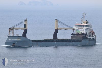
VECTIS PROGRESS
General Cargo
Current Trip
| Trip Time | 6 days |
|---|---|
| Trip Distance | 1130.31 nm |
| AVG Speed | 10 Knots |
| MAX Speed | 12.5 Knots |
| Draught | 5.4 m |
| AVG Wind | 14.4 knots |
| MAX Wind | 20 knots |
| MIN Temp | 22.9°C / 73.22°F |
| MAX Temp | 29°C / 84.2°F |
| Position Received | 17 d ago |
Current Position
| Longitude | -61.13624° |
|---|---|
| Latitude | 13.59937° |
| Status | Under way using engine |
| Speed | 11 Knots |
| Course | 152° |
| Area | Caribbean Sea |
| Station | T-AIS |
| Position Received | 17 d ago |
Info
Information
The current position of VECTIS PROGRESS is in Caribbean Sea with coordinates 13.59937° / -61.13624° as reported on 2025-12-06 17:27 by AIS to our vessel tracker app. The vessel's current speed is 11 Knots and is currently inside the port of ITAQUI.
The vessel VECTIS PROGRESS (IMO: 9626144, MMSI: 235094626) is a General Cargo that was built in 2012 ( 13 years old ). It's sailing under the flag of [GB] United Kingdom.
In this page you can find informations about the vessels current position, last detected port calls, and current voyage information. If the vessels is not in coverage by AIS you will find the latest position.
The current position of VECTIS PROGRESS is detected by our AIS receivers and we are not responsible for the reliability of the data. The last position was recorded while the vessel was in Coverage by the Ais receivers of our vessel tracking app.
The current draught of VECTIS PROGRESS as reported by AIS is 5.4 meters
Weather
| Temperature | 24.3°C / 75.74°F |
|---|---|
| Wind Speed | 3 knots |
| Direction | 59° ENE |
| Pressure | 1011.3 hPa |
| Humidity | 89.6 % |
| Cloud Coverage | 100 % |
Featured Company
Last Port Calls
| Port | Arrival | Departure | Time In Port |
|---|---|---|---|
| 2025-12-20 19:24 | |||
| 2025-12-12 12:38 | 2025-12-13 23:26 | 1 d | |
| 2025-12-04 01:15 | 2025-12-04 19:05 | 17 h | |
| 2025-12-02 13:41 | 2025-12-02 23:07 | 9 h | |
| 2025-12-01 08:51 | 2025-12-01 17:07 | 8 h | |
| 2025-11-14 13:53 | 2025-11-17 12:39 | 2 d | |
| 2025-11-09 08:22 | 2025-11-14 00:50 | 4 d | |
| 2025-11-04 10:59 | 2025-11-07 16:33 | 3 d | |
| 2025-10-19 23:47 | 2025-10-21 18:15 | 1 d | |
| 2025-10-19 12:15 | 2025-10-19 13:46 | 1 h |
Most Visited Ports (Last year)
| Port | Arrivals | |
|---|---|---|
| 8 | ||
| 5 | ||
| 5 | ||
| 4 | ||
| 4 | ||
| 4 |
Last Trips
| Origin | Departure | Destination | Arrival | Distance | |
|---|---|---|---|---|---|
| 2025-12-13 23:26 | 2025-12-20 19:24 | 1130.31 nm | |||
| 2025-12-04 19:05 | 2025-12-12 12:38 | 886.45 nm | |||
| 2025-12-02 23:07 | 2025-12-04 01:15 | 185.98 nm | |||
| 2025-12-01 17:07 | 2025-12-02 13:41 | 229.70 nm | |||
| 2025-11-17 12:39 | 2025-12-01 08:51 | 3806.61 nm | |||
| 2025-11-14 00:50 | 2025-11-14 13:53 | 134.69 nm | |||
| 2025-11-07 16:33 | 2025-11-09 08:22 | 483.25 nm | |||
| 2025-10-21 18:15 | 2025-11-04 10:59 | 3002.53 nm | |||
| 2025-10-19 13:46 | 2025-10-19 23:47 | 130.46 nm | |||
| 2025-10-17 23:19 | 2025-10-19 12:15 | 319.98 nm |
Events
| Time | Event | Details | Position / Dest | Info |
|---|---|---|---|---|
| 2025-12-20 22:24 | STOP Moving |
-2.58500 / -44.36833
[BR] ITAQUI
|
Speed: Course: -1° |
|
| 2025-12-20 22:24 | PORT ARRIVAL |
|
-2.58500 / -44.36833
[BR] ITAQUI
|
Speed: 1.9 kn Course: 138° |
| 2025-12-20 19:42 | START Moving | 7.98 nm, North East of SAO LUIS |
-2.40451 / -44.24453
GY GEO
|
Speed: 7.9 kn Course: 260° |
| 2025-12-18 13:04 | STOP Moving | 8.46 nm, North East of SAO LUIS |
-2.40131 / -44.23449
GY GEO
|
Speed: 0.2 kn Course: 195° |
| 2025-12-14 03:27 | START Moving | 0.94 nm, North of GEORGETOWN |
6.80500 / -58.17333
GY GEO
|
Speed: 7 kn Course: -1° |
| 2025-12-14 03:26 | PORT DEPARTURE |
|
6.80500 / -58.17333
GY GEO
|
Speed: 1 kn Course: -1° |