

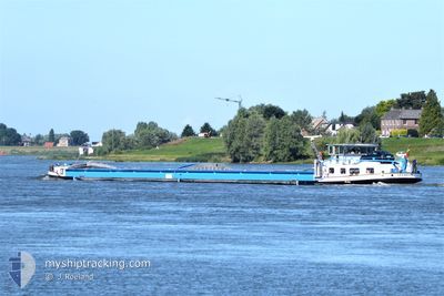
VEERDAM
Cargo

Current Trip
| Trip Time | --- |
|---|---|
| Trip Distance | --- |
| AVG Speed | --- |
| MAX Speed | --- |
| Draught | --- |
| AVG Wind | --- |
| MAX Wind | --- |
| MIN Temp | --- |
| MAX Temp | --- |
| Position Received | 6 h, 38 m ago |
Current Position
| Longitude | 12.50983° |
|---|---|
| Latitude | 52.41879° |
| Status | Moored |
| Speed | |
| Course | --- |
| Area | North Sea |
| Station | T-AIS |
| Position Received | 6 h, 38 m ago |
Information
The current position of VEERDAM is in North Sea with coordinates 52.41879° / 12.50983° as reported on 2025-03-28 05:42 by AIS to our vessel tracker app. The vessel's current speed is 0 Knots and is currently inside the port of BRANDENBURG.
The vessel VEERDAM (MMSI: 205509090) is a Cargo It's sailing under the flag of [BE] Belgium.
In this page you can find informations about the vessels current position, last detected port calls, and current voyage information. If the vessels is not in coverage by AIS you will find the latest position.
The current position of VEERDAM is detected by our AIS receivers and we are not responsible for the reliability of the data. The last position was recorded while the vessel was in Coverage by the Ais receivers of our vessel tracking app.
Weather
| Temperature | 2.7°C / 36.86°F |
|---|---|
| Wind Speed | 5 knots |
| Direction | 151° SSE |
| Pressure | 1016 hPa |
| Humidity | 93.3 % |
| Cloud Coverage | 9 % |


Featured Company
Last Port Calls
| Port | Arrival | Departure | Time In Port |
|---|---|---|---|
| 2025-03-21 01:08 | 2025-03-21 03:14 | 2 h | |
| 2025-03-16 04:58 | 2025-03-16 09:27 | 4 h | |
| 2025-03-15 06:06 | 2025-03-15 07:15 | 1 h | |
| 2025-03-14 05:57 | 2025-03-14 22:50 | 16 h | |
| 2025-03-02 12:33 | 2025-03-02 12:55 | 21 m | |
| 2025-03-02 11:25 | 2025-03-02 12:08 | 42 m | |
| 2025-03-01 18:50 | 2025-03-01 20:40 | 1 h | |
| 2025-02-25 06:48 | 2025-02-25 10:09 | 3 h | |
| 2025-02-24 14:40 | 2025-02-24 15:18 | 37 m | |
| 2025-02-24 14:11 | 2025-02-24 14:17 | 5 m |
Most Visited Ports (Last year)
| Port | Arrivals | |
|---|---|---|
| 31 | ||
| 8 | ||
| 7 | ||
| 6 | ||
| 5 | ||
| 4 |
Last Trips
| Origin | Departure | Destination | Arrival | Distance | |
|---|---|---|---|---|---|
| 2025-03-16 09:27 | 2025-03-21 01:08 | 116.68 nm | |||
| 2025-03-15 07:15 | 2025-03-16 04:58 | 98.50 nm | |||
| 2025-03-14 22:50 | 2025-03-15 06:06 | 23.51 nm | |||
| 2025-03-02 12:55 | 2025-03-14 05:57 | 403.15 nm | |||
| 2025-03-02 12:08 | 2025-03-02 12:33 | 0.88 nm | |||
| 2025-03-01 20:40 | 2025-03-02 11:25 | 94.71 nm | |||
| 2025-02-25 10:09 | 2025-03-01 18:50 | 83.58 nm | |||
| 2025-02-24 15:18 | 2025-02-25 06:48 | 100.12 nm | |||
| 2025-02-24 14:17 | 2025-02-24 14:40 | 2.25 nm | |||
| 2025-02-07 01:31 | 2025-02-24 14:11 | 553.62 nm |
Events
| Time | Event | Details | Position / Dest | Info |
|---|---|---|---|---|
| 2025-03-28 05:42 | OUT of Coverage |
52.41879 / 12.50983
North Sea
[DE] BRANDENBURG
|
Speed: Course: 511° |
|
| 2025-03-28 05:42 | IN Coverage |
52.41879 / 12.50983
North Sea
[DE] BRANDENBURG
|
Speed: Course: 511° |
|
| 2025-03-28 04:30 | OUT of Coverage |
52.41879 / 12.50981
North Sea
[DE] BRANDENBURG
|
Speed: Course: 511° |
|
| 2025-03-28 02:06 | IN Coverage |
52.41884 / 12.50978
North Sea
[DE] BRANDENBURG
|
Speed: Course: 511° |
|
| 2025-03-25 04:30 | OUT of Coverage |
52.33937 / 11.95550
North Sea
|
Speed: 4.7 kn Course: 57.4° |
|
| 2025-03-25 02:37 | IN Coverage |
52.24399 / 11.74512
North Sea
|
Speed: 1.4 kn Course: 40.1° |
|
| 2025-03-24 20:33 | OUT of Coverage |
52.24156 / 11.73961
North Sea
|
Speed: Course: 511° |
|
| 2025-03-24 20:25 | STOP Moving | 7.97 nm, North East of MAGDEBURG |
52.24155 / 11.73962
HAVEN TE MOERDIJK
|
Speed: Course: 511° |
| 2025-03-24 18:16 | IN Coverage |
52.26933 / 11.44618
North Sea
|
Speed: 5.3 kn Course: 117.9° |
|
| 2025-03-24 03:14 | OUT of Coverage |
52.40696 / 9.74220
North Sea
|
Speed: 4.8 kn Course: 115.6° |