
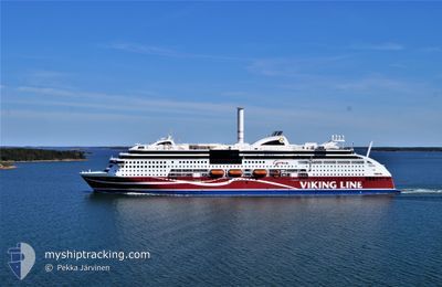
VIKING GRACE
Ro-Ro/Passenger Ship
Current Trip
| Time Travelled | 4 h, 50 mins |
|---|---|
| Remaining Time | 6 mins |
| Distance Travelled | 85.31 nm |
| Remaining Distance | 4.59 nm |
| AVG Speed | 17.6 Knots |
| MAX Speed | 20.6 Knots |
| AVG Wind | 11.5 knots |
| MAX Wind | 12 knots |
| MIN Temp | 0.8°C / 33.44°F |
| MAX Temp | 2°C / 35.6°F |
| Draught | 6.7 m |
| Position Received | 1 m ago |
Current Position
| Longitude | 22.12529° |
|---|---|
| Latitude | 60.40978° |
| Status | Under way using engine |
| Speed | 9.5 Knots |
| Course | 22° |
| Area | Gulf of Bothnia |
| Station | T-AIS |
| Position Received | 1 m ago |
Info
Information
The current position of VIKING GRACE is in Gulf of Bothnia with coordinates 60.40978° / 22.12529° as reported on 2025-03-22 17:19 by AIS to our vessel tracker app. The vessel's current speed is 9.5 Knots and is heading at the port of TURKU. The estimated time of arrival as calculated by MyShipTracking vessel tracking app is 2025-03-22 19:26 LT
The vessel VIKING GRACE (IMO: 9606900, MMSI: 230629000) is a Ro-Ro/Passenger Ship that was built in 2013 ( 12 years old ). It's sailing under the flag of [FI] Finland.
In this page you can find informations about the vessels current position, last detected port calls, and current voyage information. If the vessels is not in coverage by AIS you will find the latest position.
The current position of VIKING GRACE is detected by our AIS receivers and we are not responsible for the reliability of the data. The last position was recorded while the vessel was in Coverage by the Ais receivers of our vessel tracking app.
The current draught of VIKING GRACE as reported by AIS is 6.7 meters
Weather
| Temperature | 1.1°C / 33.98°F |
|---|---|
| Wind Speed | 7 knots |
| Direction | 152° SSE |
| Pressure | 1033.2 hPa |
| Humidity | 62.5 % |
| Cloud Coverage | --- |
Featured Company
Last Port Calls
| Port | Arrival | Departure | Time In Port |
|---|---|---|---|
| 2025-03-22 14:02 | 2025-03-22 14:30 | 28 m | |
| 2025-03-22 06:06 | 2025-03-22 07:50 | 1 h | |
| 2025-03-22 00:58 | 2025-03-22 01:12 | 13 m | |
| 2025-03-21 19:37 | 2025-03-21 20:58 | 1 h | |
| 2025-03-21 14:02 | 2025-03-21 14:27 | 24 m | |
| 2025-03-21 06:09 | 2025-03-21 07:54 | 1 h | |
| 2025-03-21 00:59 | 2025-03-21 01:13 | 14 m | |
| 2025-03-20 19:36 | 2025-03-20 21:00 | 1 h | |
| 2025-03-20 14:01 | 2025-03-20 14:24 | 22 m | |
| 2025-03-20 06:09 | 2025-03-20 07:51 | 1 h |
Last Trips
| Origin | Departure | Destination | Arrival | Distance | |
|---|---|---|---|---|---|
| 2025-03-22 07:50 | 2025-03-22 14:02 | 76.84 nm | |||
| 2025-03-22 01:12 | 2025-03-22 06:06 | 91.79 nm | |||
| 2025-03-21 20:58 | 2025-03-22 00:58 | 66.22 nm | |||
| 2025-03-21 14:27 | 2025-03-21 19:37 | 89.00 nm | |||
| 2025-03-21 07:54 | 2025-03-21 14:02 | 77.06 nm | |||
| 2025-03-21 01:13 | 2025-03-21 06:09 | 91.83 nm | |||
| 2025-03-20 21:00 | 2025-03-21 00:59 | 66.22 nm | |||
| 2025-03-20 14:24 | 2025-03-20 19:36 | 89.53 nm | |||
| 2025-03-20 07:51 | 2025-03-20 14:01 | 76.94 nm | |||
| 2025-03-20 01:14 | 2025-03-20 06:09 | 91.62 nm |
Events
| Time | Event | Details | Position / Dest | Info |
|---|---|---|---|---|
| 2025-03-22 15:49 | Status Changed | Under way using engine Default |
60.17994 / 21.46113
SESTO-FIMHQ-FITKU
|
Speed: 19.8 kn Course: 79° |
| 2025-03-22 15:49 | IN Coverage |
60.17994 / 21.46113
Gulf of Bothnia
SESTO-FIMHQ-FITKU
|
Speed: 15.2 kn Course: 76.6° |
|
| 2025-03-22 14:34 | Status Changed | Default Under way using engine |
60.09529 / 20.72762
SESTO-FIMHQ-FITKU
|
Speed: 19.8 kn Course: 111.7° |
| 2025-03-22 14:27 | OUT of Coverage |
60.09790 / 20.66624
Gulf of Bothnia
SESTO-FIMHQ-FITKU
|
Speed: 19.8 kn Course: 111.7° |
|
| 2025-03-22 14:18 | Status Changed | Under way using engine Default |
60.12481 / 20.59054
SESTO-FIMHQ-FITKU
|
Speed: 18.6 kn Course: 88° |
| 2025-03-22 14:18 | Status Changed | Default Under way using engine |
60.12492 / 20.58417
SESTO-FIMHQ-FITKU
|
Speed: 17.7 kn Course: 88° |
| 2025-03-22 12:30 | PORT DEPARTURE |
|
60.08596 / 19.92879
SESTO-FIMHQ-FITKU
|
Speed: 7.1 kn Course: 188° |
| 2025-03-22 12:30 | START Moving |
60.08655 / 19.92903
[FI] MARIEHAMN
|
Speed: 6.6 kn Course: 186° |
|
| 2025-03-22 12:09 | STOP Moving |
60.08837 / 19.92979
[FI] MARIEHAMN
|
Speed: 0.3 kn Course: 178° |
|
| 2025-03-22 12:02 | PORT ARRIVAL |
|
60.08744 / 19.92789
[FI] MARIEHAMN
|
Speed: 5.7 kn Course: 334.6° |