
VILNIUS
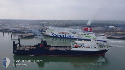
Ro-Ro/Passenger Ship
Current Trip
| Time Travelled | 13 h, 11 mins |
|---|---|
| Remaining Time | --- |
| Distance Travelled | 133.62 nm |
| Remaining Distance | --- |
| AVG Speed | 10.2 Knots |
| MAX Speed | 10.8 Knots |
| AVG Wind | 6.4 knots |
| MAX Wind | 9.8 knots |
| MIN Temp | 8.7°C / 47.66°F |
| MAX Temp | 10.7°C / 51.26°F |
| Draught | 5.5 m |
| Position Received | 13 h, 1 m ago |
Current Position
| Longitude | 41.61782° |
|---|---|
| Latitude | 41.69317° |
| Status | Under way using engine |
| Speed | 16.2 Knots |
| Course | 325.4° |
| Area | Black Sea |
| Station | T-AIS |
| Position Received | 13 h, 1 m ago |
Info
Information
The current position of VILNIUS is in Black Sea with coordinates 41.69317° / 41.61782° as reported on 2025-01-31 16:55 by AIS to our vessel tracker app. The vessel's current speed is 16.2 Knots and is heading at the port of VARNA. The estimated time of arrival as calculated by MyShipTracking vessel tracking app is 2025-02-03 08:00 LT
The vessel VILNIUS (IMO: 8311900, MMSI: 370515000) is a Ro-Ro/Passenger Ship that was built in 1987 ( 38 years old ). It's sailing under the flag of [PA] Panama.
In this page you can find informations about the vessels current position, last detected port calls, and current voyage information. If the vessels is not in coverage by AIS you will find the latest position.
The current position of VILNIUS is detected by our AIS receivers and we are not responsible for the reliability of the data. The last position was recorded while the vessel was in Coverage by the Ais receivers of our vessel tracking app.
The current draught of VILNIUS as reported by AIS is 5.5 meters
Weather
| Temperature | 10.1°C / 50.18°F |
|---|---|
| Wind Speed | 7 knots |
| Direction | 244° WSW |
| Pressure | 1024.9 hPa |
| Humidity | 74.6 % |
| Cloud Coverage | 100 % |
Featured Company
Last Port Calls
| Port | Arrival | Departure | Time In Port |
|---|---|---|---|
| 2025-01-31 06:09 | 2025-01-31 16:46 | 10 h | |
| 2025-01-27 06:01 | 2025-01-28 15:05 | 1 d | |
| 2025-01-24 05:11 | 2025-01-24 17:17 | 12 h | |
| 2025-01-20 05:49 | 2025-01-21 14:49 | 1 d | |
| 2025-01-17 12:12 | 2025-01-17 20:54 | 8 h | |
| 2025-01-08 05:53 | 2025-01-14 15:17 | 6 d | |
| 2024-12-30 13:38 | 2024-12-31 18:53 | 1 d | |
| 2024-12-21 16:15 | 2024-12-22 03:41 | 11 h |
Last Trips
| Origin | Departure | Destination | Arrival | Distance | |
|---|---|---|---|---|---|
| 2025-01-28 17:05 | 2025-01-31 10:09 | 617.02 nm | |||
| 2025-01-24 21:17 | 2025-01-27 08:01 | 619.19 nm | |||
| 2025-01-21 16:49 | 2025-01-24 09:11 | 618.69 nm | |||
| 2025-01-18 00:54 | 2025-01-20 07:49 | 618.97 nm | |||
| 2025-01-14 17:17 | 2025-01-17 16:12 | 623.19 nm | |||
| 2024-12-31 20:53 | 2025-01-08 07:53 | 1141.01 nm | |||
| 2024-12-22 04:41 | 2024-12-30 15:38 | 1453.02 nm | |||
| 2024-11-22 13:17 | 2024-12-21 17:15 | 1785.12 nm |
Events
| Time | Event | Details | Position / Dest | Info |
|---|---|---|---|---|
| 2025-01-31 17:01 | Status Changed | Default Under way using engine |
41.70306 / 41.59342
BG VAR
|
Speed: 16.2 kn Course: 325.4° |
| 2025-01-31 16:55 | OUT of Coverage |
41.69317 / 41.61782
Black Sea
BG VAR
|
Speed: 16.2 kn Course: 325.4° |
|
| 2025-01-31 16:46 | PORT DEPARTURE |
|
41.65993 / 41.64449
BG VAR
|
Speed: 9.9 kn Course: 341° |
| 2025-01-31 16:33 | START Moving |
41.64814 / 41.65264
[GE] BATUMI
|
Speed: 3.1 kn Course: 278° |
|
| 2025-01-31 16:32 | Status Changed | Under way using engine Moored |
41.64795 / 41.65385
[GE] BATUMI
|
Speed: Course: 259° |
| 2025-01-31 16:27 | Status Changed | Moored Default |
41.64701 / 41.65537
[GE] BATUMI
|
Speed: Course: 259° |
| 2025-01-31 16:21 | Status Changed | Default Moored |
41.64702 / 41.65537
[GE] BATUMI
|
Speed: Course: 259° |
| 2025-01-31 16:12 | Status Changed | Moored Default |
41.64702 / 41.65537
[GE] BATUMI
|
Speed: Course: 259° |
| 2025-01-31 16:09 | Status Changed | Default Moored |
41.64702 / 41.65537
[GE] BATUMI
|
Speed: Course: 259° |
| 2025-01-31 15:39 | Status Changed | Moored Default |
41.64702 / 41.65537
[GE] BATUMI
|
Speed: Course: 259° |