

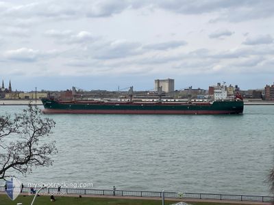
WIGEON
Bulk Carrier

Current Trip
| Time Travelled | 12 days |
|---|---|
| Remaining Time | --- |
| Distance Travelled | 1793.27 nm |
| Remaining Distance | --- |
| AVG Speed | 12.3 Knots |
| MAX Speed | 16.5 Knots |
| AVG Wind | 10.4 knots |
| MAX Wind | 21 knots |
| MIN Temp | 11.9°C / 53.42°F |
| MAX Temp | 19.7°C / 67.46°F |
| Draught | 6.1 m |
| Position Received | 3 d ago |
Current Position
| Longitude | -16.33296° |
|---|---|
| Latitude | 27.97148° |
| Status | Under way using engine |
| Speed | 13.3 Knots |
| Course | 200.2° |
| Area | North Atlantic Ocean |
| Station | T-AIS |
| Position Received | 3 d ago |
Information
The current position of WIGEON is in North Atlantic Ocean with coordinates 27.97148° / -16.33296° as reported on 2025-05-19 02:29 by AIS to our vessel tracker app. The vessel's current speed is 13.3 Knots and is heading at the port of RICHARDS BAY. The estimated time of arrival as calculated by MyShipTracking vessel tracking app is 2025-06-08 08:00 LT
The vessel WIGEON (IMO: 9358395, MMSI: 538011204) is a Bulk Carrier that was built in 2007 ( 18 years old ). It's sailing under the flag of [MH] Marshall Is.
In this page you can find informations about the vessels current position, last detected port calls, and current voyage information. If the vessels is not in coverage by AIS you will find the latest position.
The current position of WIGEON is detected by our AIS receivers and we are not responsible for the reliability of the data. The last position was recorded while the vessel was in Coverage by the Ais receivers of our vessel tracking app.
The current draught of WIGEON as reported by AIS is 6.1 meters
Weather
| Temperature | 19.6°C / 67.28°F |
|---|---|
| Wind Speed | 21 knots |
| Direction | 35° NE |
| Pressure | 1018.6 hPa |
| Humidity | 79.2 % |
| Cloud Coverage | 3 % |


Featured Company
Last Port Calls
| Port | Arrival | Departure | Time In Port |
|---|---|---|---|
| 2025-05-05 12:37 | 2025-05-10 20:30 | 5 d | |
| 2025-04-22 05:11 | 2025-04-22 21:17 | 16 h | |
| 2025-04-20 20:07 | 2025-04-20 20:49 | 42 m | |
| 2025-04-15 21:01 | 2025-04-17 00:35 | 1 d | |
| 2025-04-13 13:28 | 2025-04-13 17:36 | 4 h | |
| 2025-04-12 08:53 | 2025-04-12 09:19 | 26 m | |
| 2025-04-09 11:22 | 2025-04-10 20:07 | 1 d |
Most Visited Ports (Last year)
| Port | Arrivals | |
|---|---|---|
| 2 | ||
| 2 | ||
| 2 | ||
| 2 | ||
| 1 | ||
| 1 |
Last Trips
| Origin | Departure | Destination | Arrival | Distance | |
|---|---|---|---|---|---|
| 2025-04-22 21:17 | 2025-05-05 12:37 | 3099.22 nm | |||
| 2025-04-20 20:49 | 2025-04-22 05:11 | 289.81 nm | |||
| 2025-04-17 00:35 | 2025-04-20 20:07 | 729.82 nm | |||
| 2025-04-13 17:36 | 2025-04-15 21:01 | 505.24 nm | |||
| 2025-04-12 09:19 | 2025-04-13 13:28 | 234.72 nm | |||
| 2025-04-10 20:07 | 2025-04-12 08:53 | 292.90 nm |
Events
| Time | Event | Details | Position / Dest | Info |
|---|---|---|---|---|
| 2025-05-19 02:29 | OUT of Coverage |
27.97148 / -16.33296
North Atlantic Ocean
ZA RCB
|
Speed: 13.3 kn Course: 200.2° |
|
| 2025-05-18 20:54 | Detected in Sea | Spanish (Canary Islands) part of the North Atlantic Ocean |
29.02402 / -15.61672
North Atlantic Ocean
ZA RCB
|
Speed: 13.2 kn Course: 199.3° |
| 2025-05-18 20:53 | IN Coverage |
29.02402 / -15.61672
North Atlantic Ocean
ZA RCB
|
Speed: 13.2 kn Course: 199.3° |
|
| 2025-05-17 14:14 | OUT of Coverage |
35.37232 / -13.21110
North Atlantic Ocean
ZA RCB
|
Speed: 12.5 kn Course: 200.2° |
|
| 2025-05-17 14:06 | Detected in Sea | High seas of the North Atlantic Ocean |
35.39874 / -13.20037
North Atlantic Ocean
ZA RCB
|
Speed: 12.8 kn Course: 198.8° |
| 2025-05-17 14:06 | IN Coverage |
35.39874 / -13.20037
North Atlantic Ocean
ZA RCB
|
Speed: 12.8 kn Course: 198.8° |
|
| 2025-05-17 05:45 | OUT of Coverage |
37.11601 / -12.52804
North Atlantic Ocean
ZA RCB
|
Speed: 12.9 kn Course: 196.8° |
|
| 2025-05-17 03:21 | IN Coverage |
37.59894 / -12.32713
North Atlantic Ocean
ZA RCB
|
Speed: 12.5 kn Course: 192.2° |
|
| 2025-05-17 02:20 | OUT of Coverage |
37.80526 / -12.24504
North Atlantic Ocean
ZA RCB
|
Speed: 12.3 kn Course: 195.1° |
|
| 2025-05-17 01:47 | IN Coverage |
37.91895 / -12.20159
North Atlantic Ocean
ZA RCB
|
Speed: 13.2 kn Course: 196.5° |