
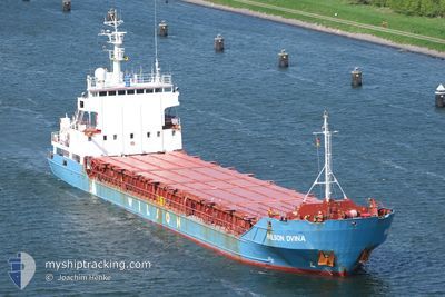
WILSON DVINA
General Cargo
Current Trip
| Time Travelled | 2 days |
|---|---|
| Remaining Time | 56 mins |
| Distance Travelled | 511.46 nm |
| Remaining Distance | 11.65 nm |
| AVG Speed | 9.8 Knots |
| MAX Speed | 12.3 Knots |
| AVG Wind | 15.1 knots |
| MAX Wind | 20.9 knots |
| MIN Temp | -1.6°C / 29.12°F |
| MAX Temp | 1.8°C / 35.24°F |
| Draught | 5 m |
| Position Received | 1 m ago |
Current Position
| Longitude | 8.25247° |
|---|---|
| Latitude | 58.05738° |
| Status | Under way using engine |
| Speed | 9.4 Knots |
| Course | 262.1° |
| Area | Skaggerak |
| Station | T-AIS |
| Position Received | 1 m ago |
Info
Information
The current position of WILSON DVINA is in Skaggerak with coordinates 58.05738° / 8.25247° as reported on 2025-02-13 21:56 by AIS to our vessel tracker app. The vessel's current speed is 9.4 Knots and is heading at the port of KRISTIANSAND. The estimated time of arrival as calculated by MyShipTracking vessel tracking app is 2025-02-13 22:54 LT
The vessel WILSON DVINA (IMO: 9005742, MMSI: 314220000) is a General Cargo that was built in 1992 ( 33 years old ). It's sailing under the flag of [BB] Barbados.
In this page you can find informations about the vessels current position, last detected port calls, and current voyage information. If the vessels is not in coverage by AIS you will find the latest position.
The current position of WILSON DVINA is detected by our AIS receivers and we are not responsible for the reliability of the data. The last position was recorded while the vessel was in Coverage by the Ais receivers of our vessel tracking app.
The current draught of WILSON DVINA as reported by AIS is 5 meters
Weather
| Temperature | 1.3°C / 34.34°F |
|---|---|
| Wind Speed | 18 knots |
| Direction | 53° NE |
| Pressure | 1029.1 hPa |
| Humidity | 65 % |
| Cloud Coverage | 58 % |
Featured Company
Last Port Calls
| Port | Arrival | Departure | Time In Port |
|---|---|---|---|
| 2025-02-10 18:15 | 2025-02-11 18:00 | 23 h | |
| 2025-02-08 08:54 | 2025-02-08 21:28 | 12 h | |
| 2025-02-05 07:01 | 2025-02-05 18:27 | 11 h | |
| 2025-02-03 13:38 | 2025-02-04 09:52 | 20 h | |
| 2025-01-29 06:10 | 2025-01-29 20:02 | 13 h | |
| 2025-01-25 17:58 | 2025-01-27 18:10 | 2 d | |
| 2025-01-07 12:27 | 2025-01-17 22:59 | 10 d | |
| 2024-12-19 20:23 | |||
| 2024-12-12 16:41 | 2024-12-13 19:24 | 1 d | |
| 2024-12-03 02:50 | 2024-12-03 08:33 | 5 h |
Last Trips
| Origin | Departure | Destination | Arrival | Distance | |
|---|---|---|---|---|---|
| 2025-02-08 22:28 | 2025-02-10 19:15 | 194.14 nm | |||
| 2025-02-05 19:27 | 2025-02-08 09:54 | 512.43 nm | |||
| 2025-02-04 10:52 | 2025-02-05 08:01 | 93.30 nm | |||
| 2025-01-29 21:02 | 2025-02-03 14:38 | 872.20 nm | |||
| 2025-01-27 19:10 | 2025-01-29 07:10 | 309.67 nm | |||
| 2025-01-17 23:59 | 2025-01-25 18:58 | 1738.27 nm | |||
| 2024-12-19 22:23 | 2025-01-07 13:27 | 2675.28 nm | |||
| 2024-12-03 09:33 | 2024-12-12 19:41 | 2077.52 nm | |||
| 2024-11-28 22:21 | 2024-12-03 03:50 | 842.07 nm |
Events
| Time | Event | Details | Position / Dest | Info |
|---|---|---|---|---|
| 2025-02-13 17:52 | Detected in Sea | Norwegian part of the Skaggerak |
58.02605 / 9.45628
Skaggerak
NOKRS
|
Speed: 9.2 kn Course: 283.8° |
| 2025-02-13 12:40 | Change Sea Area | Danish part of the Skaggerak Danish part of the Kattegat |
57.81077 / 10.95355
Skaggerak
NOKRS
|
Speed: 10.9 kn Course: 320.2° |
| 2025-02-13 11:34 | Detected in Sea | Danish part of the Kattegat |
57.65861 / 11.19533
Kattegat
NOKRS
|
Speed: 10.7 kn Course: 319.2° |
| 2025-02-13 07:32 | ETA Changed | 2025/02/14 01:00 2025/02/14 02:00 |
57.05660 / 11.71741
NOKRS
|
Speed: 9.6 kn Course: 343.6° |
| 2025-02-13 07:25 | Detected in Sea | Swedish part of the Kattegat |
57.04041 / 11.72625
Kattegat
NOKRS
|
Speed: 9.6 kn Course: 341.7° |
| 2025-02-13 07:25 | ETA Changed | 2025/02/14 02:00 2025/02/14 20:00 |
57.03918 / 11.72701
NOKRS
|
Speed: 9.6 kn Course: 341.5° |
| 2025-02-13 05:07 | Change Sea Area | Danish part of the Kattegat Swedish part of the Kattegat |
56.69191 / 11.99872
Kattegat
NOKRS
|
Speed: 10.3 kn Course: 323.8° |
| 2025-02-12 23:08 | Change Sea Area | Swedish part of the Kattegat Danish part of the Kattegat |
55.81977 / 12.72733
Kattegat
NOKRS
|
Speed: 9.6 kn Course: 11.6° |
| 2025-02-12 21:05 | Change Sea Area | Danish part of the Kattegat Swedish part of the Kattegat |
55.49013 / 12.71337
Kattegat
NOKRS
|
Speed: 9.6 kn Course: 4.7° |
| 2025-02-12 20:05 | Change Sea Area | Swedish part of the Kattegat Swedish part of the Baltic Sea |
55.34125 / 12.67614
Kattegat
NOKRS
|
Speed: 9.5 kn Course: 356.4° |